Tags Posts tagged with "Water"

Water

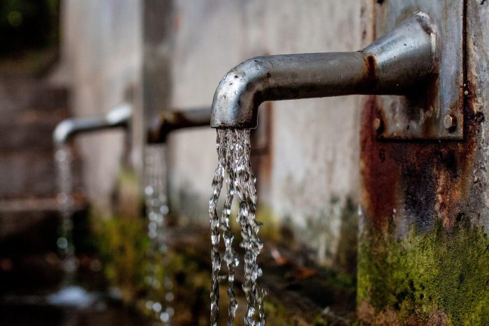
Pixabay photo

By John L. Turner

This is the first in a two-part series on Long Island’s water supply.

When thinking about Long Island’s groundwater supply — its drinking water aquifers — it is helpful to visualize a food you might eat while drinking water — say, a three-tiered, open-faced turkey sandwich — a slice of cheese on top, a juicy, thick tomato disk in the middle, a slice of turkey on the bottom, all resting on a piece of hard, crusty bread. 

Well, substitute the Upper Glacial Aquifer for the cheese, the thicker Magothy Aquifer for the tomato, the Lloyd Aquifer for the turkey, and a “basement of bedrock” for the bread and you’ve got Long Island’s tiered groundwater system. It is this collection of groundwater aquifers — these sections of the sandwich — that are the sole source of water for all the uses Long Islanders use water for. Hydrologists estimate there’s about 90 trillion gallons of water contained in Long Island’s groundwater supply.

Our sandwich model described above is not fully accurate in that there is another layer called the Raritan Clay formation separating the Magothy and Lloyd Aquifers. This clay layer, about 200 feet thick, retards water movement (for a number of reasons water moves painfully slow through clay) and is referred to as an aquitard. So, in our sandwich model let’s make the thin but impactive clay formation a layer of mustard or mayonnaise. With the exception of this clay-confining layer, Long Island is essentially a million-acre sandpile whose geology is generally distinguished by subtle changes in the composition, texture, and porosity of its geological materials — varying mixtures of silt, clay, sand, gravel and cobbles which affects rates of water transmissivity or movement.

The basement of bedrock (the bread in our sandwich) that underlies all of Long Island is metamorphic rock estimated to be about 400 million years old. It slants from the northwest to the southeast dipping at about 50 feet to the mile. So, while the thickness of the freshwater aquifers in northwest Queens is only a few hundred feet, it is approximately 2,000 feet thick in western Southampton.

On the North and South Forks and the south shore barrier islands, freshwater doesn’t extend all the way to bedrock as it does in Nassau County and much of western and central Suffolk County. It is shallowest on the barrier islands, the freshwater lens extending down only several dozen feet. 

On the North Fork it goes a little deeper before the water becomes salty and it is deepest on the wide South Fork where the freshwater lens extends downward about 550-600 feet. The depth of the aquifer is influenced by how many feet above sea level the water table is. There’s a hydrological formula, called the Ghyben-Herzberg principle, that states for every foot of water above sea level there’s 40 feet of freshwater beneath.

The water in the groundwater aquifers isn’t stored in large subterranean pools or caverns, as it is in some other places in the country with markedly different geology, Rather, the water is situated between the tiny, interstitial spaces existing between the countless sand particles that collectively make up Long Island. Given this, it is not surprising that groundwater flows (under the influence of gravity) slowly downward and sideways (depending where in the aquifer the water is located) moving on the order of just a few feet a day at most but typically in the ballpark of about one foot per day. 

It takes dozens to hundreds to thousands of years for water to move through the system, all depending where it first landed on the island’s surface. Water pumped from the seaward edge of the lowest aquifer — the Lloyd Aquifer — may have fallen as rain many years before the beginning of the ancient Greek Empire.

In the late 1970’s several governmental studies helped us to better understand some of the basics as to how the groundwater system works. One of the important takeaways from this research was that it is the middle half to two-thirds of the island that is most important for recharge — this segment is known as the “deep-flow recharge area” because a raindrop that lands here will move vertically downward recharging the vast groundwater supply. 

The middle of this area is knows as the “groundwater divide”; a water drop that lands to the south of the divide will move downward and then laterally in a southern direction discharging into one of the south shore bays or the salty groundwater underneath the Atlantic Ocean while a drop to the north will move eventually into Long Island Sound or the sandy sediments beneath it.

Hydrologists have determined that for every square mile of land (640 acres) an average of about two million gallons of rain water lands on the surface with about one million gallons recharging the groundwater supply on a daily basis. What happens to the other one million gallons? It evaporates, runs off into streams and other wetlands, or is taken up by trees and other plants that need it to sustain life processes such as transpiration (a large oak tree needs about 110 gallons of water daily to survive). 

In contrast, raindrops that land in locations nearer to the coasts such as in Setauket, northern Smithtown, southern Brookhaven, Babylon, or other places along the north and south shores don’t become part of the vast groundwater reservoir; instead, after percolating into the ground the water moves horizontally, discharging either into a stream that flows to salty water or into the salty groundwater that surrounds Long Island. These landscape segments are referred to as “shallow-flow recharge areas.”

The higher elevations along the Ronkonkoma Moraine (the central spine of Long Island created by glacial action about 40,000 years ago) are also the highest points in the water table although the water table elevation contours are a dampened expression of the land surface. So, in the West Hills region of Huntington where Jayne’s Hill is located, the highest point on Long Island topping out at a little more than 400 feet, the elevation of the water table is about 80 feet above sea level. 

Below the water table is the saturated zone and above it the unsaturated zone where air, instead of water, exists in the tiny spaces between the sand particles (in the Jayne’s Hill case the unsaturated zone runs about 320 feet). It is the water (more precisely its weight) in the higher regions of the saturated zones that pushes on the water beneath it, driving water in the lower portions to move at first sideways or laterally and then to upwell into the salty groundwater under the ocean. Due to the weight of the water the freshwater-saltwater interface is actually offshore on both coasts, meaning you could drill from a platform a mile off Jones Beach and tap into freshwater if you were to drill several hundred feet down.

A wetland forms where the land surface and water table intersect. It may be Lake Ronkonkoma, the Nissequogue or Peconic River, or any of the more than one hundred streams that drain the aquifer discharging into bays and harbors around Long Island. So when you’re gazing at the surface of Lake Ronkonkoma you’re looking at the water table — the top of the Long Island groundwater system. Since the water table elevations can change due to varying amounts of rain and snow and pumping by water suppliers these wetlands can be affected; in wet years they may enlarge and discharge more water while in droughts wetlands can largely dry up which happened on Long Island in the 1960’s.

It is clear, given the isolated nature of our water supply — our freshwater bubble surrounded by hostile salt water — that we are captains of our own fate. Our groundwater supply is the only source of water to meet all of our collective needs and wants. There are no magical underground freshwater connections to Connecticut, mainland New York, or New Jersey. We are not tied into, nor is it likely we will ever be able to tap into, New York City’s water supply, provided by the Delaware River and several upstate reservoirs. As the federal Environmental Protection Agency has declared — Long Island is a “sole source aquifer.” To paraphrase the late Senator Daniel Patrick Moyhihan: “Long Islanders all drink from the same well.” Indeed we do.

The next article will detail the quality and quantity problems facing our groundwater supply.

A resident of Setauket, John Turner is conservation chair of the Four Harbors Audubon Society, author of “Exploring the Other Island: A Seasonal Nature Guide to Long Island” and president of Alula Birding & Natural History Tours.

Dr. Paolo Boffetta

By Daniel Dunaief

Dr. Paolo Boffetta, who joined Stony Brook University as Associate Director for Population Sciences in the Cancer Center in the midst of the pandemic last April, asks the kinds of questions doctors, scientists and non-scientists also raise when they look at illnesses among groups of people.

An epidemiologist who worked for 20 years at the World Health Organization and at Mt. Sinai Hospital in New York City for 10 years, Boffetta joined Stony Brook because he saw an opportunity to replicate the kind of success he and others had at Mt. Sinai, where he helped the institution earn a National Cancer Institute designation. Cancer centers can apply for NCI designation when they have a well-established portfolio of research.

Dr. Paolo Boffetta

“The idea to try to get the Cancer Center” at Stony Brook “to the NCI level was very appealing,” Boffetta said. Stony Brook was looking to build out its population sciences work.

In addition to the big picture goal of helping Cancer Center Director Yusuf Hannun and other researchers earn that designation, Boffetta has partnered with several scientists at Stony Brook and elsewhere to address questions related to various illnesses.

Boffetta has applied for $12 million in funds over six years from the National Cancer Institute for a new water project.

The research will recruit people who are over 50 years old across several towns, primarily in Suffolk County to explore the link between the potential exposure these residents had to different chemicals in drinking water and types of cancers.

“The main idea is that people may be exposed to carcinogens through drinking water according to where they have been living,” Boffetta said.

The scientists will follow these residents over time to determine the health impact of their town of residency. “If this is funded, this will be a major project that will involve many institutions,” he added.

The chemicals they will study include nitrates, chlorinated solvents, 1,4-dioxane, and perfluoroalkyl substances.

While he awaits word on potential funding for the water effort, Boffetta and others are looking at another project to explore the link between various environmental factors and bladder cancer. This is not limited to drinking water contamination. The group plans to analyze tumor samples to see whether they can detect fingerprint mutations.

World Trade Center Studies

Boffetta also plans to continue and expand on work he’s done at Mt. Sinai with responders of the World Trade Center attacks, a group that has received considerable attention from numerous scientists at Stony Brook.

He has been “doing a number of quite detailed analyses on cancer, including survival of workers and responders to developing cancer,” he said. The WTC survivors are enrolled in a medical monitoring treatment program, sponsored by the Centers for Disease Control, which means they “should be getting good cancer care.”

Boffetta has been comparing their survival to the population at large in New York, analyzing how the risk of cancer evolved over the almost 20 years since the attacks.

Boffetta has started to look at one particular new project, in which he studies the prevalence of clonal hematopoiesis of indeterminate potential (or CHIP), which is an asymptomatic condition that increases the likelihood of leukemia and cardiovascular disease. He is studying 350 healthy World Trade Center responders and a group of historical controls from the literature.

He plans to use the results of his study to develop strategies to prevent these diseases in WTC responders.

In some of his WTC studies, Boffetta is working with Ben Luft, Director of the Stony Brook WTC Wellness Program at the Renaissance School of Medicine at SBU, who has been involved in providing extensive research and clinical support for WTC responders.

Boffetta is an “internationally renowned cancer epidemiologist” who contributed his “vast experience on the impact of environmental and occupational exposures [that were] seminal in our understanding of how the disaster of 9/11 would eventually lead to increased numbers of cancer cases among responders,” Luft wrote in an email.

Boffetta’s contribution and understanding will “transcend the events of 9/11 and its impact on the responder community to a general understanding of the increased incidence of cancer on Long Island,” said Luft.

While Boffetta has several academic affiliations with institutions including Harvard University, where he teaches a class for a week each year, and Vanderbilt University, his primary focus involves the work he conducts at Stony Brook and at the University of Bologna.

Boffetta plans to keep his research team considerably smaller than the 80 to 100 people who worked with him at the World Health Organization. Indeed, he said he mainly focuses on working with collaborators. He plans to hire his first post doctoral researchers soon.

As for teaching, Boffetta has been working with the program directors of the Masters of Public Health to develop a tract in epidemiology. He plans to start teaching next year.

Boffetta, who spoke with Times Beacon Record News Media through WhatsApp from Italy, said he often works double shifts to remain in contact with his colleagues in the United States and Europe. When he’s in the United States, meetings can start at 6 in the morning to connect with his European counterparts in the middle of their day. When he’s in Italy, his last meetings sometimes end at 11 p.m. or midnight.

Boffetta, however, said he has “a normal life,” which, prior to the pandemic, included trips to the opera and museums. He also enjoys skiing and hiking.

Married to Antonella Greco, who used to teach Italian, Boffetta lives in New York City. He has three daughters, who live in Brooklyn, Italy and Uruguay. He has been vaccinated against COVID-19 and is looking forward to the opportunity to interact with his colleagues in person once restrictions caused by the pandemic ease.

The Suffolk County Water Authority is urging customers to turn off their taps.

SCWA has asked residents to take measures to reduce their water use after it hit an all-time high water pumping figure amid a heat wave in the area. This month, a water pumping figure of 545,726 gallons-per-minute across the authority’s service territory broke a previous record of 542,610 gallons-per-minute set in July of 2016. 

SCWA, which services approximately 1.2 million Suffolk County residents, has sent emails and recorded phone messages to customers in recent weeks in an effort to make sure there is sufficient water supply for emergencies. The authority says customers should adjust their irrigation controllers to water no more than every other day and avoid setting controllers to operate between peak pumping hours of 3 a.m. to 7 a.m.

During the summer months, water usage increases as customers refill pools, water lawns and gardens. 

“We need cooperation from our customers to make sure that firefighters have sufficient water pressure to battle fires and that hospitals have sufficient water pressure to take care of patients,” said SCWA Chief Executive Officer Jeffrey Szabo. “We need people to get this message loud and clear — change your watering habits today and help to ensure there is a sufficient water supply for everyone.”

The Long Island Water Conference, which is made up of water providers, has recommended that residents shorten irrigation system watering time by five minutes, check their irrigation system for leaks and consider replacing a standard irrigation with a smart irrigation controller.

For more ideas about how to conserve water, customers are urged to go to ourwaterourlives.com. 

A map showing where the SCWA expects to put the treatment systems, should they be approved. Images from SCWA

In an effort to eliminate 1,4-dioxane in county drinking water, Suffolk County Water Authority has proposed installing additional treatment systems at sites throughout the county, though costs could be high if plans see the light of day.  

An image of the proposed treatment system. Image from SCWA

In a presentation to Suffolk County legislators, SWCA proposed installing 31 new advanced treatment systems at a number of sites where the levels of 1,4-dioxane are higher than the New York State proposed limit, which is 1 part per billion.

Jeffrey Szabo, SCWA chief executive officer, said the authority is continuing to develop technology that will eliminate toxic chemicals such as 1,4-dioxane. 

“We have been working with the health department on our AOP (advanced oxidation process) systems and the results have been successful,” Szabo said. 

A concern of 1,4-dioxane is that it can’t be removed through conventional treatment methods and involves a complex process of mixing the contaminated water with hydrogen peroxide, treated with ultraviolet light, which then gets sent to tanks filled with carbon where the rest of contaminants are filtered out. The hamlet of Central Islip currently has the sole advanced oxidation process system capable of removing 1,4-dioxane on Long Island. 

The authority says that its systems can destroy 1,4-dioxane molecules to virtually undetectable levels. Szabo said there are close to 100 wells in Suffolk County that need to be treated for the toxin. 

The proposed plan could take five to six years to install all 31 treatment systems, according to the authority’s chief executive officer and it would cost between $1.5 and $6 million in capital costs alone for each system. 

“We are trying to get this done as quickly as possible, there are things still up in the air,” Szabo said. 

The authority is waiting on the state Department of Health to adopt an official maximum contaminant level (MCL) standard. According to officials, they expect to get confirmation sometime in early 2020. 

Szabo stressed that the authority and other water providers will need time to adjust to the new standards as well as to implement the new systems. 

“This will take time, each system has to get approved by the department of health before it can be installed,” Szabo said. 

In the case of the AOP pilot system in Central Islip, officials said it took over two years to get approval from the Department of Health. 

“We want to reassure the public that we are doing everything we can,” Szabo said. 

1,4-Dioxane has been designated by the U.S. Environmental Protection Agency as a likely carcinogen associated with liver and kidney damage after a lifetime of exposure to contaminated drinking water. The chemical has been found in industrial solvents, detergents, shampoos and other products. 

In July, the state health department began the process of adopting the MCL of 1 part per billion. The department would become the first in the country to set a limit on 1,4-dioxane. Similarly, Gov. Andrew Cuomo (D) has planned to offer $350 million in grants for treatment. 

At a forum in February, the Long Island Water Conference estimated the cost of treatment systems for close to 200 water wells contaminated by 1,4-dioxane to be at $840 million. 

The authority said it is hopeful it can begin to implement the plan sometime in 2020. In addition, two additional AOP systems are currently in development for pump stations in East Farmingdale and Huntington.

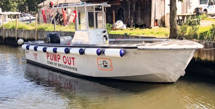
Brookhaven’s current pump-out boats are showing signs of wear and will be replaced. Photo by Kyle Barr

If you’ve ever seen a boat with a built-in toilet, the next question is inevitable: Where does that waste inevitably go?

Either the waste goes straight into the Long Island Sound or surrounding harbors or boaters call the Town of Brookhaven’s pump-out boats, a service provided by the town for free, to suck out the waste, according to Karl Guyer, a senior bay constable for Brookhaven.

At Brookhaven town’s Sept. 13 meeting the board voted unanimously to purchase two new pump-out boats — one for Mount Sinai Harbor and one for Port Jefferson Harbor. The total cost for both boats is $92,500 with $60,000 of that amount coming from state aid in grant funding from the New York State Environmental Facilities Corporation. The town is supplying $32,500 in matching funds from serial bonds, according to town Councilwoman Jane Bonner (C-Rocky Point).

The town operates four pump-out boats, including two on the South Shore and two on the North Shore, which are located in Port Jeff and Mount Sinai harbors. All these boats were purchased in 2006, and Guyer said it was time all of them were replaced. The two on the South Shore were replaced this year, and the North Shore boats will be replaced early in 2019, according to Guyer.

“They’ve been in service for quite a number of years and they’re at the end of their life span,” Guyer said.

The pump-out boat in Port Jeff Harbor is showing signs of long use. The paint on the boat’s deck has been worn down by years of work, and there are cracks showing in some of the plastic hatches around the boat. William Demorest, the bay constable for Port Jeff Harbor, said the new boats will be made from aluminum, which should give them a longer life span.

The pump-out boat service is widely used by the boaters in both harbors, and on a busy day town employees operating the boats can service hundreds of boats in a single day. People can call for a pump out by radioing the constable’s office on channel 73.

There is a manual boat waste pump in a barge inside Port Jeff Harbor, though the constable said 75 percent of the over 700 boats that come to port on summer weekends use the pump-out boat service. After the pump-out boats are docked for the winter, all North Shore boaters are required to manually pump out their own waste.

Bonner said these boats do a major service in cleaning out the tanks of many boaters, because dumping the waste into the coastal waters only adds to the islands growing water pollution problem.

“Not only would there be waste in the water but the nitrogen load would be crazy,” Bonner said. “It would take several tides to flush that out.”

All the water from Conscience Bay through Port Jefferson Harbor as well as the entire Long Island Sound is within mandated U.S. Environmental Protection Agency No-Discharge Zones, meaning it is illegal to dump any boat waste into the surrounding waters.

While Demorest said he hasn’t seen people dumping their waste into the water himself, he has heard reports of it being done. He said he believed the vast majority use the free pump-out service.

“If we don’t see it, there’s nothing we can do about it,” he said.

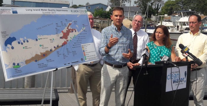
Many areas of the North Shore are experiencing waves of hypoxia, an increase of nitrogen in the water that deprives sea life, both plants and animals, of oxygen. During a press conference Sept. 25, co-director of the Center for Clean Water Technology Christopher Gobler and other researchers from the Long Island Clean Water Partnership concluded there were cases of harmful algae blooms in harbors from Mount Sinai all the way to Huntington, another symptom of excess nitrogen in the water. Most of that nitrogen has come from cesspools and septic tanks from people’s homes slowly leaking into the surrounding waters.

The boats usually operate Friday, Saturday and Sunday mostly by high school and college-aged summer employees, according to Guyer. The pump-out boat service ends on Columbus Day, Oct. 8.

by -
0 2368
This skiff belonging to Wen Zhong Wang, 37, of Ronkonkoma, was found empty in the Long Island Sound. Photo from SCPD

A man spent 45 minutes treading water in the Long Island Sound Sept. 4 after being knocked off his small boat by a wake, according to Suffolk County police. The man was rescued from the water after his unoccupied skiff was spotted floating in the Sound.

Marine Bureau officers Cory Kim and Gregory Stroh responded aboard Marine Delta after a fisherman reported finding an unoccupied skiff floating in the Long Island Sound at about 12 p.m. Tuesday, police said. While officers were responding to that call, a 911 caller reported a person yelling for help in the water off Old Field Road in Setauket.

Officers Kim and Stroh located the man, Wen Zhong Wang, 37, of Ronkonkoma, approximately 1/10 of a mile from shore. Wang, who was not wearing a life jacket, had been in the water approximately 45 minutes after he was knocked off his 9-foot skiff when it was hit by wake from a passing boat. Wang was transported to the Port Jefferson boat ramp where he was evaluated by Port Jefferson Ambulance personnel and released.

The fisherman towed the boat to shore where it was secured by the Port Jefferson Harbormaster.

Port Jefferson Harbor. File photo by Alex Petroski

Port Jefferson Harbor is currently undergoing an alarming phenomenon that an expert called “uncharted territory” locally.

The harbor is currently experiencing a rust tide, or an algal bloom, caused by a single-celled phytoplankton. Rust tides don’t pose any harm to humans but can be lethal to marine life.

Christopher Gobler, endowed chair of Coastal Ecology and Conservation at the Stony Brook University School of Marine and Atmospheric Sciences, said rust tides are spurred by hot air, water temperatures and excessive nutrients in the water, especially nitrogen. The Gobler Laboratory at SBU, named for the chairman, is monitoring the situation, performing research into its specific causes, and is looking for solutions to reduce nitrogen loading and thus the intensity of events like these, according to Gobler. He said he has been studying the phenomenon on the East End of Long Island for about 12 years, but this is only the second time it has occurred in Port Jefferson Harbor.

“We never had these blooms even on the East End before 2004,” Gobler said. “Now, they occur pretty much every year since 2004 or so.”

Blooming rust tides typically start in late August and last into mid-September.  However, as water and global temperatures continue to rise, Gobler said there are a lot of unknowns. He said this is one of the hottest summers he has ever witnessed regarding the temperature of the Long Island Sound, adding that temperatures in the local body of water have increased at a rate significantly faster than global averages.

“The big issue is temperature, so these blooms tend to track very well with warmer temperatures,” Gobler said.

George Hoffman, a co-founder of Setauket Harbor Task Force, a nonprofit group which monitors and advocates for the health of the harbor, said his organization saw some early evidence of a rust tide in Little Bay while conducting biweekly water testing Aug. 24. Little Bay is located within Setauket Harbor, and within the larger Port Jefferson Harbor complex. Hoffman said the task force’s readings suggested salinity levels and water temperature were within the parameters needed for the growth of a rust tide.

Rust tide is caused by cochlodinium polykrikoides, according to a fact sheet compiled by the Rhode Island Department of Environmental Management. The single-cell phytoplankton may harm fish and shellfish because it produces a hydrogen peroxide-like compound that can damage their gill tissue. Fish can avoid these dangerous blooms by simply swimming away. Fish and shellfish harvested in areas experiencing rust tides are still safe for human consumption.

Gobler said the installation of septic systems capable of removing more nitrogen in homes, especially that fall within watershed areas, would go a long way toward reducing hazardous algal blooms. Suffolk County has taken steps in recent months to increase grant money available to homeowners interested in installing septic systems with up-to-date technology capable of reducing the amount of nitrogen discharged into local waters. In addition, members of the New York State-funded Center for Clean Water Technology at SBU unveiled their nitrogen-reducing biofilter April 26 at a Suffolk County-owned home in Shirley.

Stony Brook University professor Christopher Gobler discusses the quality of local bodies of water at a press conference Sept. 12. Photo by Kyle Barr

By Kyle Barr

There’s still something in the water — and it’s not a good kind of something.

Scientists from the Stony Brook University School of Marine and Atmospheric Sciences released an annual report highlighting the concern over the prolonged existence of toxic algae blooms, and a deficiency of oxygen in Long Island waters caused high levels of nitrogen.

Stony Brook Professor Christopher Gobler and several members of the advocacy collective Long Island Clean Water Partnership, a conglomerate of several Long Island environmental groups, revealed the findings of a study done from May to August.

The Roth Pond, a Stony Brook University body of water that plays host to the annual Roth Regatta, is affected by blue-green algae. File photo from Stony Brook University

“In order to make Long Island sustainable and livable, clean water needs to be established,” said Adrienne Esposito, the executive director of Citizens Campaign for the Environment. “The challenge has been very great over the last decade … though the problem, unfortunately, is getting a bit worse. Algae blooms and the degradation of water quality across Long Island are serious threats to Long Island’s health.”

On the North Shore, there are several severe cases of hypoxia, or a depletion of dissolved oxygen in water, which is necessary for sea life to survive. Cases were found in Stony Brook Harbor, Northport Bay, Oyster Bay and Hempstead Bay. Measured on a milligram per liter of water scale,any case of hypoxia below two milligrams per liter can be harmful to fish, and almost anything else living on the bottom of the bays.

There were also periodic outbreaks of blue-green algae in Lake Ronkonkoma and Stony Brook University’s Roth Pond. This algae releases a poison harmful to humans and animals, but Gobler said students at the university shouldn’t worry, because he and other scientists at Stony Brook are constantly monitoring the water, especially before the annual Roth Regatta.

“[If nothing is done] the areas could expand — it could get more intense,” Gobler said. “We use a cutoff of three milligrams per liter, which is bad, but of course you can go to zero. An area like Hempstead Harbor went to zero, [Northport and Oyster Bays] went to zero at some points in time. There’s a usual day-night cycle, so it’s at night that the levels get very, very low.”

“We have the problem growing worse, and it is going to get worse before it gets better.”

—Dick Amper

As a result of the possibility of hypoxia expanding, Gobler said he and other scientists have also been monitoring Port Jefferson Harbor and Setauket Harbor.

Though Setauket Harbor is not currently experiencing any problems with hypoxia or algae, the harbor has experienced periods of pathogens, like E. coli, some of which were born from runoff into the harbor, but others might have come from leakage of antiquated cesspools in the area, according to George Hoffman, a trustee of the Setauket Harbor Task Force, which is also a member of the Clean Water Partnership.

Next May the task force hopes to start monitoring directly inside Setauket Harbor. Runoff from lawn fertilizers can also increase the nitrogen levels in the harbor.

“If our problem isn’t hypoxia, we have a problem with pathogens,” Hoffman said in a phone interview. “Prevention is really [Dr. Gobbler’s] goal — to know what is happening and to start taking steps. I think people’s information levels [on the topic] are high in the surface waters that they live by.”

In addition to hypoxia and blue-green algae, some of the water quality problems found in the assessment were brown tides on the South Shore, rust tide in the Peconic bays and paralytic shellfish poisoning on the East End — all of which are also nitrogen level issues that can be  traced back to cesspool sewage and fertilizers.

Port Jefferson Harbor is being monitored due to the speading of hypoxia across local bodies of water. File photo by Alex Petroski

“Make no mistake about it, this is so big that even … still, we have the problem growing worse, and it is going to get worse before it gets better,” said Dick Amper, the director of The Long Island Pine Barrens Society. “What’s the solution to this problem? We have to do more.”

There have been several efforts to help curb water degradation on Long Island. New York Gov. Andrew Cuomo (D) signed legislation in April that put $2.5 billion toward clean water protection, improving water infrastructure and building new sewer systems in Smithtown and Kings Park, and adding a rebate program for those upgrading outdated septic systems.

Despite doing more, the repairs will take some time.

“This is going to be a long, long marathon,” said Kevin McDonald, the conservation project director at The Nature Conservancy said.

There is also worry that the U.S. Army Corps of Engineers — announcing the dumping of dredged materials into Long Island Sound — could compound the problem.

“We have more political funding and will try to implement solutions,” Esposito said. “The problems are getting worse, but the solutions are becoming clearer.”

Dog owners like Kevin Harrigan and Taylor Gittin who are watching their dogs Cassie and Ruby play can look forward to using fresh water stations at Selden Dog Park thanks to a grant secured by Town of Brookhaven Councilman Kevin LaValle. Photo by Kyle Barr

By Kyle Barr

Dog owners in Brookhaven have something new to bark about, as the Town of Brookhaven received a grant to make improvements to the Selden Dog Park.

Last week, Councilman Kevin LaValle (R-Selden) announced the town was one of just 25 local municipalities out of 215 from across the country to receive pet supply manufacturer PetSafe’s annual Bark for Your Park grant — a $10,000 prize. Most of the funds will be used to install new water stations and water fountains inside the dog park, and the rest will go toward minor improvements.

Taylor Gittin and his dog Cassie play at Selden Dog Park. Photo by Kyle Barr

“We have a lot of dog owners that want a place where they can bring their dog who can run around with other dogs who live in the area,” LaValle said. “That’s where this all started — a lot of dog lovers out there who needed a place to go.”

Selden resident Taylor Gittin has already visited the park several times with his 1.5-year-old dog Cassie since recently moving to the area from Chicago.

“There were some parks in the neighborhood, but they were concrete, so its nice that there are trees and she can run on [the sand],” Gittin said of his old park compared to the one in Selden. “A few times coming here I forgot water bottles from home because I’m used to other dog parks having [fountains], so that’s the biggest thing for me [the town could improve on].”

Not including villages and private property, the town currently supports two off-leash dog parks — in Selden and Middle Island. The Selden Dog Park will receive sprinklers, and new plants will help beautify the entrance. Slats will be added to the entrance gate so excited dogs don’t crowd the entrance as new owners enter.

“We’re always looking to save taxpayers money, and going out and getting these grants, whether it’s for infrastructure or parks, is something we really focus in the town because it offsets our costs,” LaValle said. “It’s these little extras that the residents want and the residents need that helps keep the tax bills down. We beat out municipalities from all over the country, so this was a great thing.”

“A few times coming here I forgot water bottles from home because I’m used to other dog parks having [fountains], so that’s the biggest thing for me [the town could improve on].”

—Taylor Gittin

The Bark for Your Park grant began in 2011 as a social media contest that would earn just over 40 applicants PetSafe Brand Marketing Specialist Justin Young said in an email. In 2016, the contest was transformed into a grant-giving campaign. There are 25 grants available in different funding levels — communities building a new park can apply for a $25,000 grant, communities performing maintenance on existing parks can receive $10,000 and communities that desire new equipment can get $5,000 worth of park accessories through park furnishing company Ultrasite, a partner of PetSafe.

“The program is all about finding enthusiastic, pet-loving communities that support green spaces, with civic leaders and community organizations who want to improve their communities and encourage responsible pet ownership,” Young said in the email.

Centereach resident Kevin Harrigan is a regular to the park and takes his three dogs Ruby, Max and Jasper for a walk around Selden almost every day.

“This dog park is a God send,” Harrigan said. “From my perspective, there’s a lot of people like me — I’m in my 60s, I’ve been living in this community for 20 years and I pay my taxes every year. I have three dogs. I can’t bring them in the parks, can’t bring them in school areas. I pay the taxes to pay for all these things and I can’t enjoy any of them. [A good amount] of the population are out here without kids, so for a lot of us, dogs are our kids.”

The corner of King and Oxalis road flooded as garbage cans floated to the center of the dip at the intersection following severe rainfall Aug. 18. Photo from Sara Wainwright

By Desirée Keegan

Rocky Point residents are flooded with emotion over the rise in water level during recent storms.

As rain fell on King and Oxalis roads during the heavy rainfall Aug. 18, residents reached out to Brookhaven Town’s highway department in search of answers as to why their questions of concern have not been answered.

“I know we sound like a broken record regarding the flooding conditions at King and Oxalis, but I am writing to continue to follow up on this situation,” Rocky Point resident Sara Wainwright wrote in a letter to the highway department. “We’ve been complaining for years about the flooding, which used to be occasional, and now occurs nearly every time it rains.”

Flooding runs down an almost mile-length on King Road in Rocky Point. Photo from Sara Wainwright

She said, and the highway department confirmed, that additional drains were added, but Wainwright claims they’re in places where they do not help to relieve the flooding, and said the town has to send out manpower and equipment to pump the drains almost every big storm.

“My husband, Frank, had a lengthy conversation with Kevin from the highway department, and members walked the property,” said Wainwright, who lives on King Road right across from the Oxalis intersection. “We suggested and Kevin agreed to look into installing additional drains on our property in front of our trees. We have heard nothing else on this since, and the conditions have continued to deteriorate with every storm.”

Brookhaven Town Highway Superintendent Dan Losquadro (R) said that 12 drainage structures have been installed in the specific area of Rocky Point over the last year to alleviate flooding conditions. He said the cost of the systems was more than $70,000.

But Wainwright and her neighbors say the streets are still dangerous during heavy rain.

“This is the worst we have seen from rain alone — the water is nearly up to my neighbor’s front walkway,” she said Aug. 18. “Highway department workers did drive by and they did mention there are other flooding conditions today, however this is an ongoing issue that I have been requesting help with for several years. Please do not try to pacify me with ‘we had lots of flooding everywhere today.’ Even the fire department sent out warnings to responders that the road is closed due to flooding here.”

Losquadro responded that “flooding everywhere” is part of the problem, but said recent studies have shown that there is still a drainage issue in the vicinity.

“When we have significant rain events like this morning — when nearly four inches of rain fell within a few hours — most drainage structures will struggle to dissipate the runoff quickly enough to maintain a water-free surface,” he said. “I am well aware of the conditions experienced this morning both in Rocky Point and across central and northern Brookhaven Town and immediately dispatched crews to these areas to pump out existing drainage structures to alleviate flooded road conditions.”

Wainwright said that cars still speed down the road as flooding persists, and said this summer a man was trapped in his car when it died as he passed through.

Flooding on King and Oxalis roads. Photo from Sara Wainwright

“Please let me know how the town plans to proceed to resolve this issue as opposed to using our tax dollars to send out, and put at risk, employees and equipment,” Wainwright wrote in the letter. “Cars travel very fast down this road and have no regard for your workers, unfortunately. Another time, a police car became stuck, and multiple others of cars travel so fast they send a wake over my treetops. I think you get my point.”

Brookhaven Town Councilwoman Jane Bonner (C-Rocky Point), who has lived in Rocky Point for the last 30 years, has witnessed the issue firsthand, and receives concerned calls and emails regarding the matter.

“Residents send me photos and ask for my help,” she said. “The highway department and Dan Losquadro have been doing a great job paving roads, repairing drains and putting out massive storm water infrastructure. As a resident of Rocky Point I know some flood spots are better than others, and I’m thankful I live at the top of a hill, but I have seen when the rain stops, it does drain pretty quickly. It’s a matter of massive pileup over a short period of time.”

Wainwright said at the very least, she feels there should be street signs indicating the risk of flood conditions, and a warning to signal drivers to slow down as they move through the at-risk streets.

“I’m concerned as the season progresses that we will see more rain and possibly tropical storm and hurricane conditions,” Wainwright said in her letter. “My neighbors and I should not need to worry about flooding at elevation — you must understand that is ridiculous. We are all taxpayers. Please communicate to us as to how you plan to use the money that we have all been paying to remedy this safety issue.”

Losquadro said his engineering division recently completed a drainage study in and around the area of King and Oxalis roads, and came to the conclusion that there is still some concern.

“I will be moving forward with additional drainage infrastructure to handle more volume than what had been designed for in the past,” he said, “thereby preventing this condition from happening again.”