After the record-breaking flood of last August, an heirloom of our community fell to ruins and has yet to reconnect with the scenic roads that we are so lucky to take every day. In light of the destruction of the beautiful and historic Mill Pond in Stony Brook and Stump Pond in Smithtown, members of the community have shared an outpouring of public support and togetherness in rebuilding our local history in the past week. At the Mill Pond, residents describe feeling stranded by administrative gridlock; but perhaps it does not have to be disheartening.
As the weather finally warms, we are looking to fill the mill-shaped gaps in our hearts, which we can do by visiting and honoring our island’s other beautiful parks. We can celebrate our rich Native American and colonial history at equally evocative and inspiring sites duringthese sun-kissed summer days.
Containing the only remaining wooden cottage part of the beach, West Meadow Beach Path offers a 2.3-mile paved stroll through the wetlands reserve, complete with local wildlife infographics, a scenic overlook at still-standing 1876 Gamecock Cottage, and a historic building constructed for storage of oars and row boats. West Meadow Beach Path eases us from the nostalgia of the wooded, breezy salt marsh at dusk to the citrus sunsets met by the water, with terrapins, herons and bunnies searching for food or calling to each other between the reeds. At dusk, we may even spot deer up close in the brush.
At the Rocky Point Pine Barrens, archaeological evidence point to a minimum 12,000 year-long history of Native American presence in the area. The land that provided resources for hunting, gathering, and shelter now offers miles of hiking and biking trails and horseback riding. Visitors should keep an eye out for historical signage, landmarks and vegetation unique to the undeveloped land, enabling us to appreciate and respect our island’s pre-colonial history. Verdant and sprawling, the Rocky Point Pine Barrens is stimulating and invigorating as much as it is calming. A visit to the pine barrens connects us with those who called this place home long before we arrived.
Further west, Heckscher Park is the site of a former 19th-century estate bought by New York State. Within walking distance of Huntington Village, the park features the Heckscher Museum of Art, pond, walking paths, playground, tennis courts, ball field, public art and memorials in addition to the “Chapin Rainbow Stage” performing arts amphitheater, home of the Huntington Summer Music Festival. Heckscher Park bustles with joy and laughter; an “All-American” gem, a mine for summer-night nostalgia alongside new memories we can enjoy on picnic blankets.
Tracking our unique lineage and culture throughout the island is as important as fighting for what we’ve lost. We can create new memories and revel in small joys at other local treasures as wewait for the Mill Pond and Stump Pond to recover.
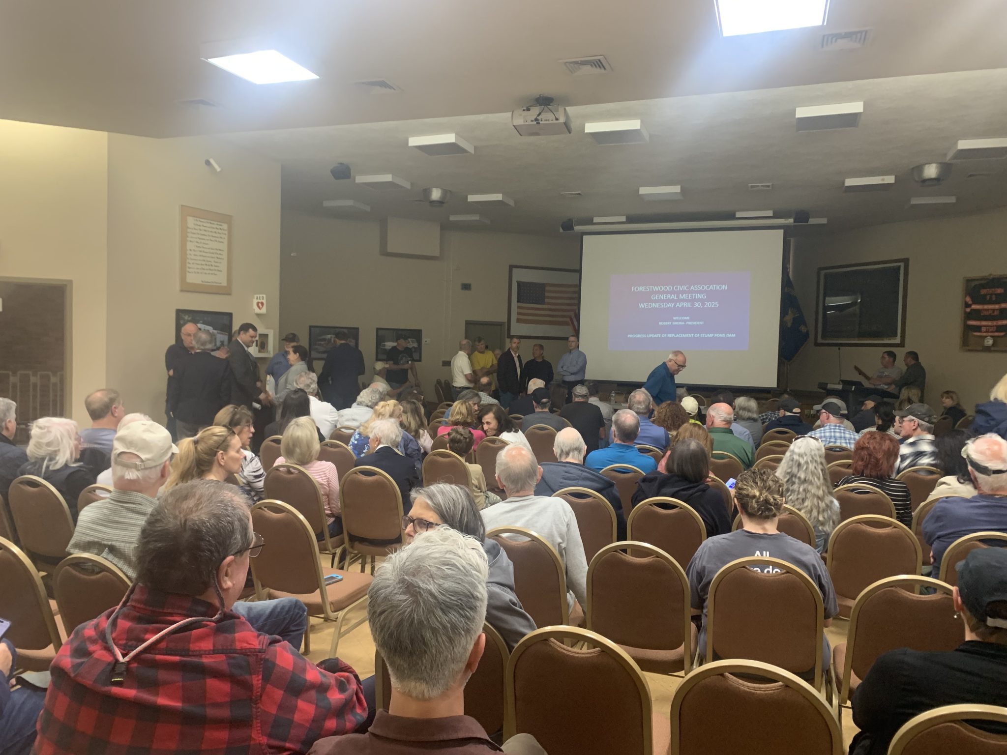
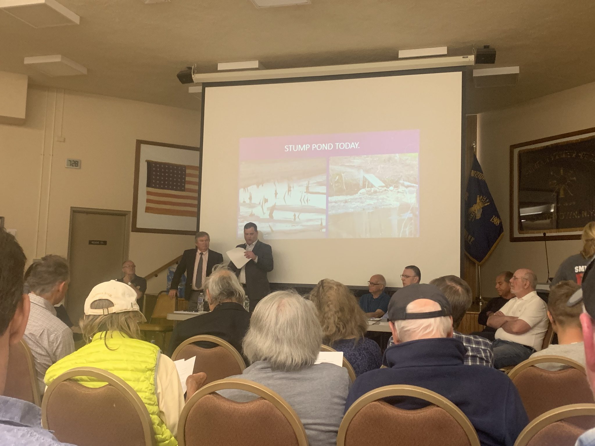
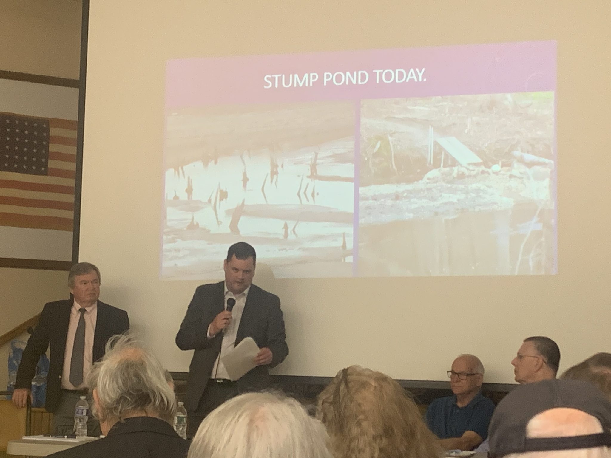
The Forestwood Civic Association meeting on April 30. Photo by Sabrina Artusa
The Forestwood Civic Association meeting on April 30. Photo by Sabrina Artusa
The Forestwood Civic Association meeting on April 30. Photo by Sabrina Artusa
By Sabrina Artusa
Residents of Forestwood continue to monitor changes to Blydenburgh County Park, which sits in the heart of their community. At a Forestwood Civic Association meeting, Suffolk County Chief Engineer Alexander Prego fielded questions regarding the design and timeline for a new dam, an essential step in the process of refilling Stump Pond.
The timeline for the lake, a signature characteristic of this national historic site and a major draw for hikers, fishers and kayakers, has been uncertain as county officials navigate permitting and funding.
“Our goal is to build it back better,” Prego said. “That failure that occurred last fall — we need to make sure that we build it for more than that.” The failed dam was classified as Class A, or a low-hazard dam, where failure could result in damage to roads and undeveloped land with an unlikely risk of “substantial economic loss or substantial environmental damage.” The new dam will likely be Class B, or intermediate hazard, reflecting the reality of August’s storm and its potential for “downstream damage,” according to Suffolk County Department of Public Works Commissioner Charlie Bartha. The more “substantial” dam will require more periodic inspections from the New York State Department of Environmental Conservation.
Blydenburgh is on a watershed, meaning the water from over 12,000 acres of land accumulated at the park. “We need to estimate how much water of that 12,000 will be coming in during a 25- or 100-year storm,“ Prego said. The new dam and spillway will be able to handle 225% of a 100-year storm. They installed five stream gauges to record rainfall and tide data. “We need to measure everything coming in here,” he said.
In April, Suffolk County Executive Ed Romaine (R) released a document detailing the steps to be completed, which include permitting and inspections from several different departments such as the DEC and the New York State Historic Preservation Office. Prego said the county aims to have permitting and plans completed by the end of this year.
Of the $6.6 million of county money dedicated to rebuilding, the mapping, engineering planning and other analyses used $500,000.
In addition, they plan to add a fish ladder to promote the migration of the American eel, brook trout and river otters.
Forestwood residents expressed concern for trail accessibility for horses as well as the safety hazard posed by the soft, muddy surface of the empty lake. “What are you going to do to protect the pond area and at the same time protect the kids in our neighborhood?” one resident asked.
The swamp-like crater was described as looking like “a breeding ground for mosquitoes” by one resident, who then asked how it is being treated. The county can use larvicide to eliminate mosquitoes before they hatch, said Suffolk County Council on Environmental Quality Vice Chair Michael Kaufman.
Members of the Suffolk County Department of Parks were invited but were not present for the meeting. Forestwood civic President Robert Sikora called their absence “very disappointing.”
“They should’ve been here,” he said. “This is a park discussion.” Indeed, several residents had questions about trail maintenance that did not fall into the purview of the public works department.
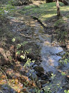
Above, what Blydenburgh County Park could look like if the dam isn't put back ... this is West Brook in Bayard Cutting Arboretum several years after the dam failed and a beautiful stream valley with great biodiversity has emerged. Photo from John Turner
By John L. Turner
Due to the extensive development of Long Island, starting with European colonization nearly 400 years ago, virtually no species, natural area, or landscape has been untouched. Some of these “touches” have been minor, others moderate, while still others have been drastic or complete, like the virtual destruction of the Hempstead Plains, a once 40,000 square mile tallgrass prairie located in the middle of Nassau County. True too, for the timber wolf which was eradicated early in the Island’s settlement driven by a bounty paid during the 17th century for each dead wolf.
There are few places where these impacts have been more extensive than with the more than 100 streams and rivers flowing outward from the center of Long Island to the salty waters that surround it. For centuries these streams were viewed as only having commercial value; modified by dams the streams became artificial ponds to supply water for cranberry bogs and for the harvest of ice.
Mills were constructed in many places, taking advantage of the water funneled over constructed dams, to grind corn, saw wood or for fulling clothing fiber. Today, there are very few unobstructed streams on Long Island. (One of the few is Alewife Creek in Southampton which drains Big Fresh Pond, emptying into North Sea Harbor).
The ‘brook’ in Stony Brook. Photo from John Turner
Obstruction is the reality at “Cutsgunsuck,” the Setalcott Indigenous Nation’s name for a “brook laden with stones,” a brook that we know today as Stony Brook. This “stone laden” brook, fed by freshwater oozing out of the Upper Glacial aquifer on its northward flow to the harbor, was drastically altered about 275 years ago, with the construction of the dam to funnel water for the Stony Brook Grist Mill so only a limited section of the original brook remains. Predictably, as with all dams, the water backed up behind the newly constructed dam, creating a pond in the process and drowning much of the stream and streamside environment — and its interwoven array of plants and animals— that had evolved in place over many thousands of years. Same was the case with the dam in Blydenburgh County Park creating Stump Pond.
Victims of these dams were the migratory fish, American Eel and Alewife, a species of river herring, that undoubtedly used Stony Brook and the upper reaches of the Nissequogue River centuries ago to spawn and develop. These fish, known as diadromous species,live in two worlds — in the case of American eels spawning in the ocean (the Sargasso Sea), migrating inland to freshwater streams, rivers, lakes, and ponds to spend more than a decade growing and maturing before returning to the ocean. Alewife behave in the opposite fashion — coming inland to spawn with the adults and young leaving to develop in the ocean.
Eels and river herring are important components of the coastal food chain, nourishing cormorants, wading birds, eagles, and ospreys while back in the sea, a host of predatory fish such as striped bass, bluefish, and tuna. Mammals that prey on these species include river otters, making a slow comeback on Long Island, and seals. The dams created insurmountable obstacles to the completion of their life cycle so for these fish and the other species that feed upon them two ecological threads were severed.
The Northern Dusky Salamander found in the Stony Brook Mill Pond. Photo from John Turner
Other animals that prosper in cold and clear streams lost out too, seeing their habitat lost or substantially diminished.Remarkably, one of them is a species hanging on in the truncated stream segment south of the now drained portion of the Stony Brook Mill Pond — the Northern Dusky Salamander, an amphibian discovered by someone helping wildlife in the pond after the dam failure; a species which has not been seen on Long Island in nearly a century and was presumed extirpated here!
The northern dusky is one of nine native salamander species that call Long Island home and some naturalists wonder if this population constitutes a new species since it’s been reproductively isolated from other populations of the species, the nearest being in Westchester county, for some 12,000 to 15,000 years.DNA work is proposed to sort the genetics out.
The same adverse ecological impacts occurred when the dam was constructed to operate a grist mill at Stump Pond within Blydenburgh County Park in Hauppauge (which had its dam blow out due to the same storm event in August) but on an even larger scale. The two streams feeding Stump Pond, that is two headwater sections of the Nissequogue River, one beginning in the Hauppauge Springs area near the Suffolk County Center on State Route 454, the other emanating further afield in the Village of the Branch, disappeared with the construction of the dam that created Stump Pond, flooding many dozens of acres of riparian habitat including the killing of dozens of Atlantic White Cedar, a rare wetland tree species.
What if the dams at Stony Brook Mill Pond and Stump Pond are not reconstructed? What would this mean for the environmental setting there? Almost immediately wetland dependent plant species and wildlife would repopulate the stream and the adjacent low-lying floodplain and the wetland at West Brook in the Bayard Cutting Arboretum can provide insight. Here, the dam failed in 2019 draining an area about the size of the Stony Brook Mill Pond and naturalists have been studying the result ever since.
Migratory fish now have unimpeded access to the full length of the West Brook watershed. Plants have flourished, emerging from the seed bank that has laid dormant for many decades, awaiting just the right conditions to germinate. Within two years 108 native species of wetland-loving wildflowers began to fill in the mud banks on both sides of West Brook, including an extensive stand of cattails. These plants now support numerous insects including a number of pollinators.
Underappreciated concerns from dams and dam failures are property damage and loss of human life. These concerns are very likely to grow as the frequency and severity of storm events increases due to climate disruption.
For example, the National Centers for Environmental Information, part of the National Oceanographic and Atmospheric Administration (NOAA), keeps tallies of storms and for New York noted seven weather related disasters in the 1980’s causing $1 billion worth of property damage. By the 1990’s the total doubled to 14, the same number for the period of 2000 to 2009.
For the 2010’s? Twenty-nine such events. And in 2023 alone there were seven, the same number you’ll remember for all of the 1980’s. With slightly different circumstances it is not difficult to envision several houses and the occupants within them, living downstream from the failed dams at both the Stony Brook Mill Pond and Blydenburgh County Park, being destroyed and killed, respectively.
Then there’s the cost of maintaining dams and impoundments. The impoundments behind dams collect sediment which eventually have to be dredged, at considerable expense, or the pond becomes increasingly shallow and eventually disappears from the sediment load. And the warm, still waters in the impoundments are conducive to plant growth, especially by invasive species which often proliferate, eventually covering the entire water surface, compromising other recreational uses like boating and fishing.
For example, the Town of Brookhaven spent more than $4 million of taxpayer funds to combat Cabomba, a species of fanwort that’s a noxious weed, growing in the Upper Lake of the Carmans River (it wasn’t successful in eliminating the weed).
Suffolk County spent several million dollars more to dredge the sediments from Canaan Lake in Patchogue and Nassau County officials have committed significant staff and equipment in an effort to eradicate Water Chestnut from Mary’s Lake in Massapequa.
One last example is the state’s more-than-a-decade fight to control Ludwigia, also known as floating primrose-willow, an invasive species that’s proliferated an impoundment in the Peconic River. Multiply these fiscal impacts out to the more than 90 dams and impoundments on Long Island and pretty soon we’re talking real money. Fiscal conservatives like free-flowing conditions.
For these aforementioned ecological, public safety, and fiscal reasons, the dam at Blydenburgh County Park should not be repaired. A channel, forking from the stream currently,can be deepened to supply water to the mill wheel if the county ever makes the grist mill functioning again; it has laid dormant for nearly half-a-century.
The good news is that an alternative vision to repairing the dam at Blydenburgh County Park has emerged that would, some believe, enhance a visitor’s experience: construct a bridge over the stream where the dam gave way so hikers can once again walk around the park and the former pond and add two pedestrian footbridges over the two streams that flow through the park, providing scenic and panoramic views of the stream valleys and diverse wetland meadows that will form.
A slightly different vision can be advanced for the Stony Brook Mill Pond. Here, the Town of Brookhaven, other levels of government, and the Ward Melville Heritage Organization are moving to restore the dam, an understandable response to what the Mill Pond has meant to the local Three Village community — a landscape that’s loved and cherished.
The challenge, then, is to determine if there is a way to rebuild the dam and restore the pond but create a richer ecological setting. Can this be done? A good first step would be to incorporate a fish ladder and eel passage that effectively allows for migratory fish to access the pond; the natural-looking rock ramp fish ladder in Grangebel Park in Riverhead and the eel passage further upstream on the Peconic River serve as useful models. Also, establishing a lower pond level through a lower elevation dam would increase stream and streamside habitat for the betterment of the rare salamander and other stream dwelling species.
Two other actions that could improve conditions at the Mill Pond: 1) Soften the boundary along the eastern edge of the pond by removing the bulkheading encompassing much of the shoreline here, planting this transition area with native wetland plants and wildflowers, and 2) Better control road runoffinto the pond from Main Street.
A recent conversation I had with someone who assisted in the effort to free stranded wildlife said she noticed an oil sheen on the surface of the remaining pooled water in the southeastern section of the pond where a drainage pipe empties into the pond from Main Street; a number of ducks were swimming around in this water.On a recent visit, I noticed a few ducks preening and wondered if they weren’t ingesting toxic oil into their bodies in the process.
If we embrace the alternative described above, a better experience can be had at Blydenburgh County Park and if we make these modifications, a better, more environmentally sound Stony Brook Mill Pond can emerge from the ruins, to once again be enjoyed and valued by the local community. Here, these elements would create enhanced wetland habitat for the betterment of many of our wildlife neighbors — fish, birds, and salamanders alike. And in no small measure, it wouldallow for the landscape feature that gave the community its name —Stony Brook — to be enhanced and better protected. Indeed, we’d be putting a bit of the “brook” back in Stony Brook.
A resident of Setauket, author John L. Turner is a naturalist, conservation co-chair of the Four Harbors Audubon Society, and Conservation Policy Advocate for the Seatuck Environmental Association.
Storm damage at Blydenburgh County Park. Photo courtesy Sebastian Artusa
8-month process to redesign Stump Pond spillway and dam underway
Suffolk County Executive Ed Romaine today announced that the Suffolk County Department of Public Works (DPW) has sent out a request for proposal (RFP) for the redesign of the Stump Pond dam and spillway that were destroyed by record rainfalls caused by a historic August storm that caused up to 11-inches of rain to fall in some areas.
“After the destruction of historic Stump Pond, our engineering team began working on a pathway forward for this area,” said Romaine. “It was decided immediately to rebuild this culturally and environmentally important pond for the residents of this county.”
The new proposal is for a reinforced earthen dam that will contain a culver and spillway in the same location as that was lost during the storm. Given the circumstances, it is anticipated that the dam’s classification will be upgraded by the State to Class B from Class A – Class B requiring more frequent inspections and higher standards of durability.
In addition to an increase in safety standards, vendors are also asked to design an alternative with a fish ladder.
Proposals from consultants must conform to a myriad of local, state and federal guidelines regarding the safety, hydrology and ecology of the project.
The deadline for proposals is Monday, November 25.
A tentative schedule of the design phase is as follows:
Complete project scoping within two months after contract award.
Complete preliminary design three months after scoping documents are approved.
Complete final design three months after approval of preliminary plans.
The dam washed away along with a portion of the trail and a clearing that was a popular picnicking and fishing spot for visitors. Photo courtesy Sebastian Artusa
Storm damage at Blydenburgh County Park. Photo courtesy Sebastian Artusa
The dam washed away along with a portion of the trail and a clearing that was a popular picnicking and fishing spot for visitors. Photo courtesy Sebastian Artusa
Storm damage at Blydenburgh County Park. Photo courtesy Sebastian Artusa
Storm damage at Blydenburgh County Park. Photo courtesy Sebastian Artusa
Storm damage at Blydenburgh County Park. Photo courtesy Sebastian Artusa
Storm damage at Blydenburgh County Park. Photo courtesy Sebastian Artusa
Storm damage at Blydenburgh County Park. Photo courtesy Sebastian Artusa
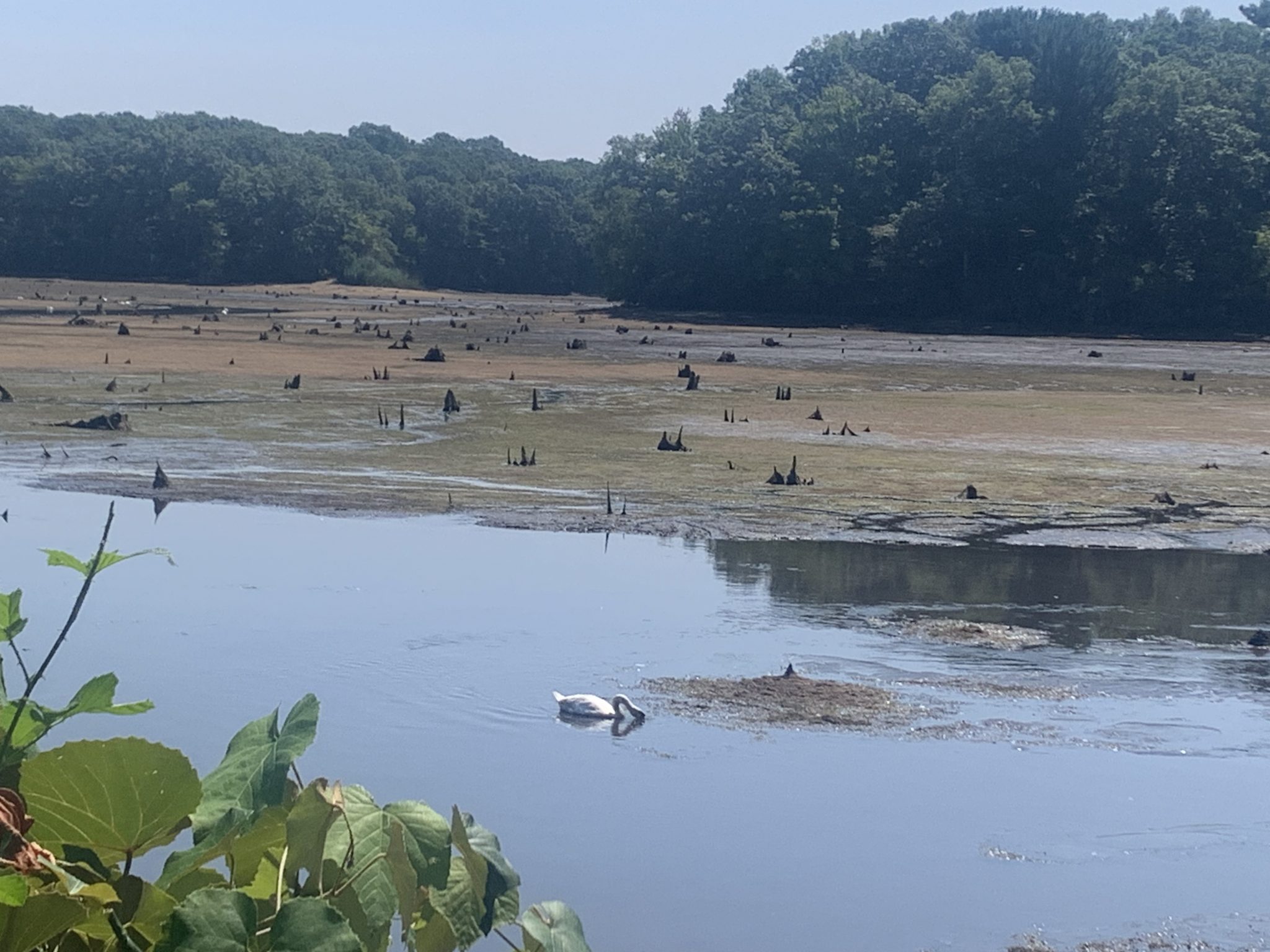
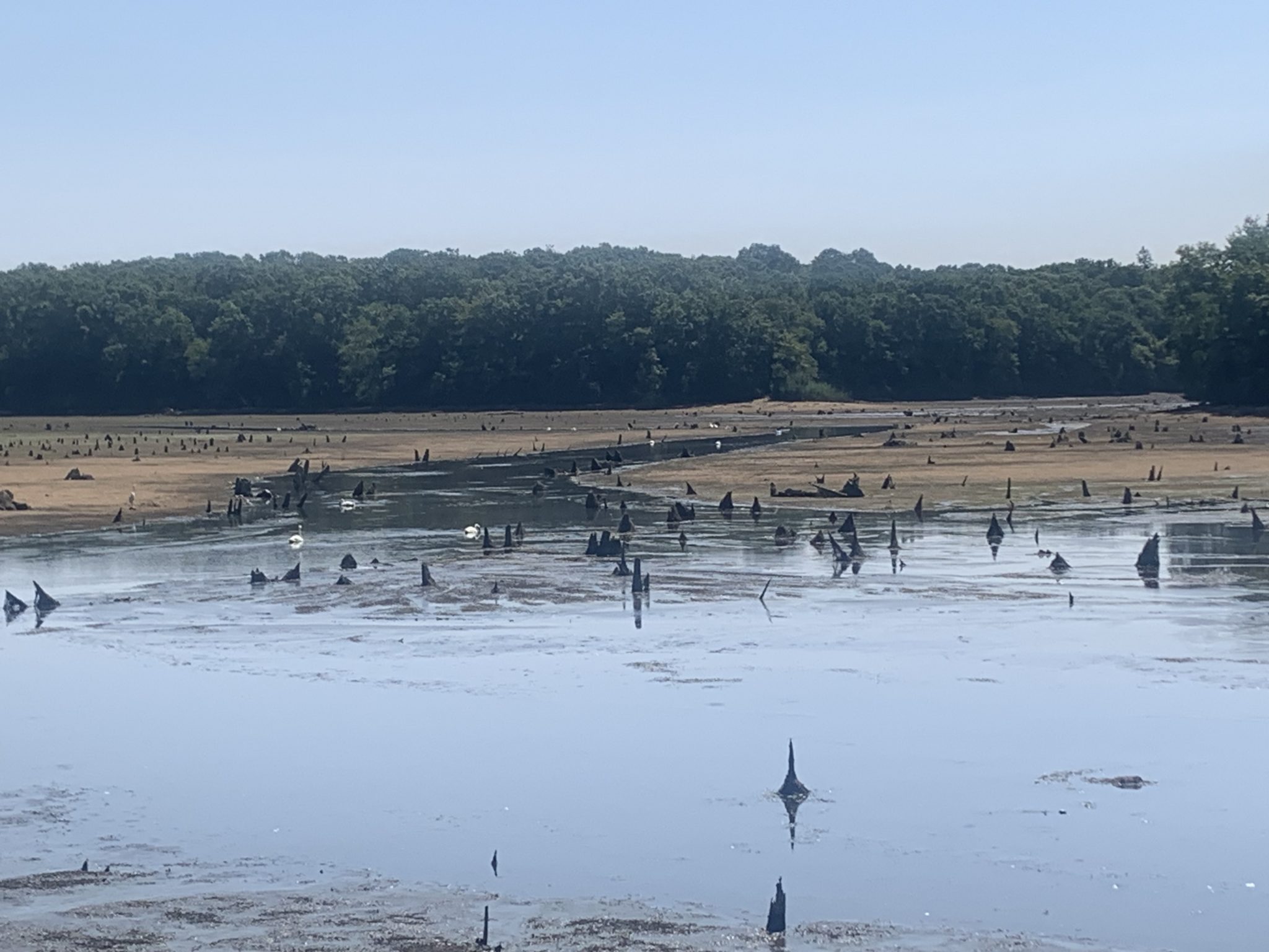
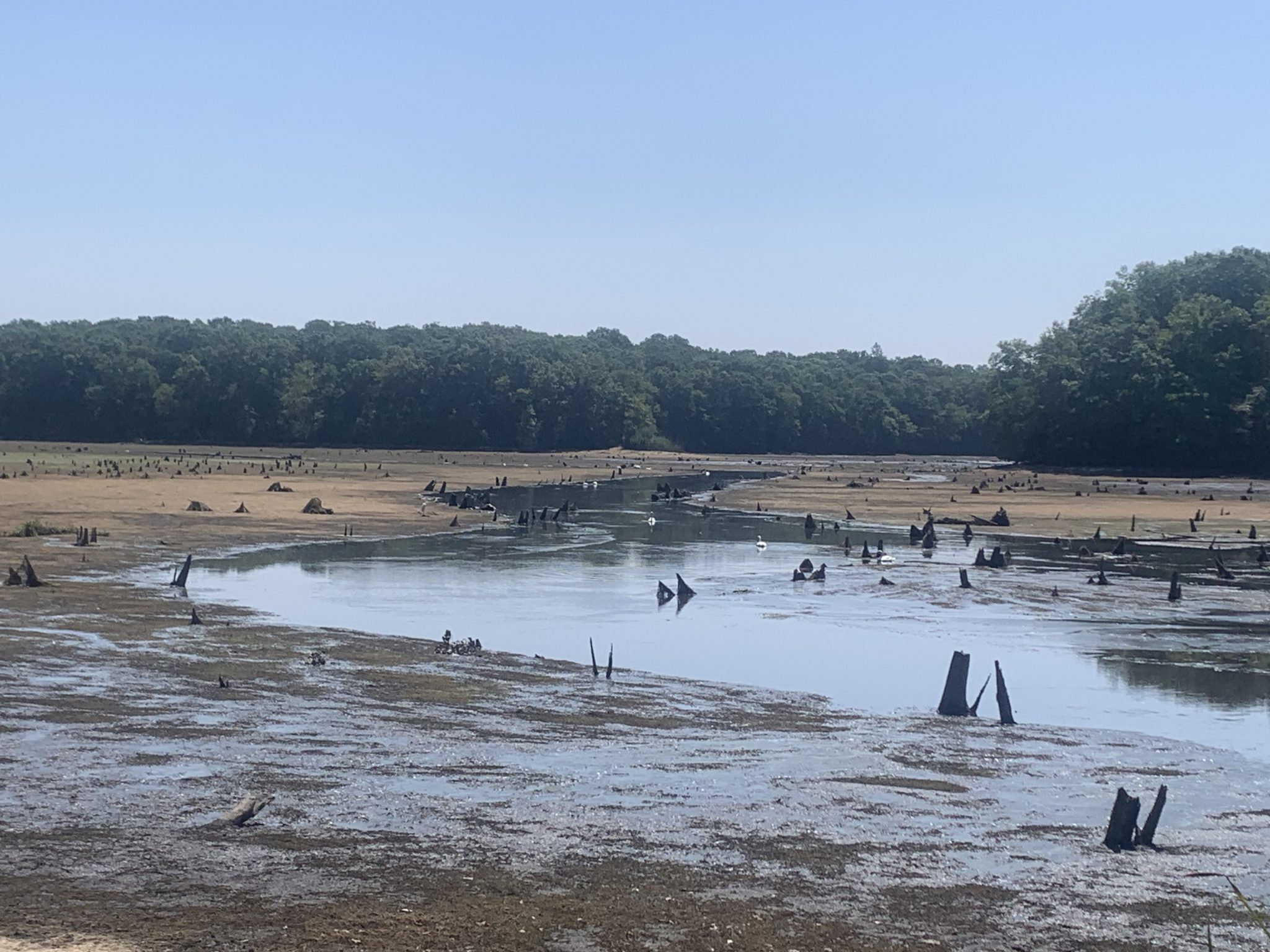
The land that once held an expanse of water at Blydenburgh Park is now reduced to mud and shallow puddles. The signature stumps that gave the pond its name can be seen poking up from the ground. Photo courtesy Sebastian Artusa
By Sabrina Artusa
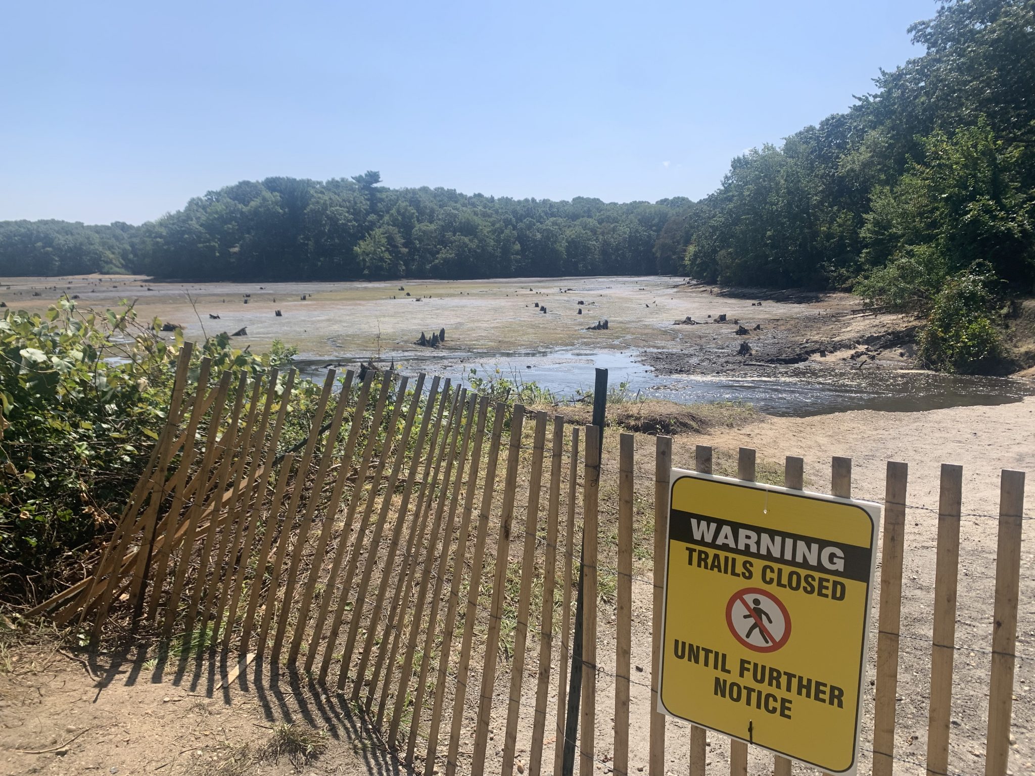
Walking past the dead, dried grass littered with sharp stumps and intercepted by a slight meandering stream of water, longtime visitors of the beloved Blydenburgh County Park in Smithtown can hardly believe the hundreds of acres of mud and dead vegetation, yellowing in the sun, was once an 8-foot deep lake.
The lake, also known as Stump Pond or Weld’s Pond, was fed by the headwaters of Nissequogue river and maintained by a dam, which breached after the Aug. 18-19 storm produced over 9 inches of rain.
The section of land between the dam, which was approximately 50 feet wide, and the lake was completely washed away, leaving a large chasm.
As one of the least developed ponds on Long Island, it was enjoyed by kayakers, anglers, hikers, dog walkers, Boy and Girl Scout troops and horseback riders. Throughout its two centuries of existence, the pond has boasted large amounts of bass.
Fishing and boating are impossible now, and parts of the trail are closed. Two brothers, Tom and Frank, paid a visit to the lake that was the setting for many cherished memories.
“I caught my first fish here,” Tom said. The pair came to assess the damage and to see if there could be any fishing. Frank had been fishing at the pond since 1966. The only evidence of fish now was a small colony trapped in a shallow section of residual water.
“We don’t usually see devastation like this,” Frank said. Indeed, the pond was constructed in 1798 to service the Grist Mill and in the 200 years since, the dam has been breached only once before. But it was not a spillway breach and therefore not as extreme.
An employee of the Long Island Greenbelt Trail Conference said plans are in the works to restore the dam and refill the pond. The type of spillway that will be used in the new dam has yet to be determined.
The employee, who prefers to be anonymous, said that he is optimistic for the future of the pond. He cautioned against venturing too far along the trail. The thick mud is dangerously and decievingly deep. Suffolk County Executive Ed Romaine (R), who has lamented the destruction of several valued natural and historical sites, has spoken of his plans to get the area restored. The employee said that Romaine’s appreciation for the history of the area makes him hopeful that action will be taken swiftly and effectively.
“What we have seen in the last day is an ecological, environmental and economic disaster for parts of northern Suffolk County,” Romaine said at a press conference held at the pond.
“We have to take a look at our infrastructure, catalog it, not only to repair the damage that was done, but to plan ahead so we don’t have a worse disaster in the next storm,” Romaine said. He added that, in collaboration with others, he intends to analyze dams across the county.
On Sunday, President Joe Biden (D) issued a federal emergency declaration for Suffolk County. This is a crucial step in securing federal aid for relief and restoration and is in response to the over-2,000 reports of damage across the county.
A similar dam-breaching tragedy occurred at Stony Brook Mill Pond.
According to a representative for Gov. Kathy Hochul (D), the Department of Homeland Security is working with the county on a plan for relieving homeowners whose properties suffered damage.
At Blydenburgh Park, there was no damage to the Miller’s House, constructed between 1801 and 1803 and overlooking the pond; the Grist Mill, only around 50 yards from the destroyed dam; or Blydenburgh-Weld House.
While this history was preserved at Blydenburgh, it was a small victory among larger devastation. In the Smithtown Library, a special collection dating back centuries was damaged by water when the storm caused flooding to the building’s first floor, bypassing the library’s protective measures. The building is now coping with damage to the floor as well to the archive.
New York State Sen. Mario Mattera (R-St. James) called the storm “devastating” and expressed his desire for FEMA funds.
Assemblyman Mike Fitzpatrick (R-Smithtown) said, “I used to fish here as a kid. I used to ride my bike. It is one of the most beautiful spots in New York state. … We are going to rebuild this. We are going to restore this park to the glory we expect.”