Tags Posts tagged with "Hurricane Ida"

Hurricane Ida

The Thompson House sustained flooding in East Setauket. Photo from WMHO

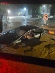
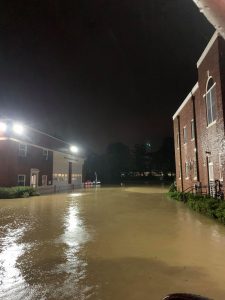
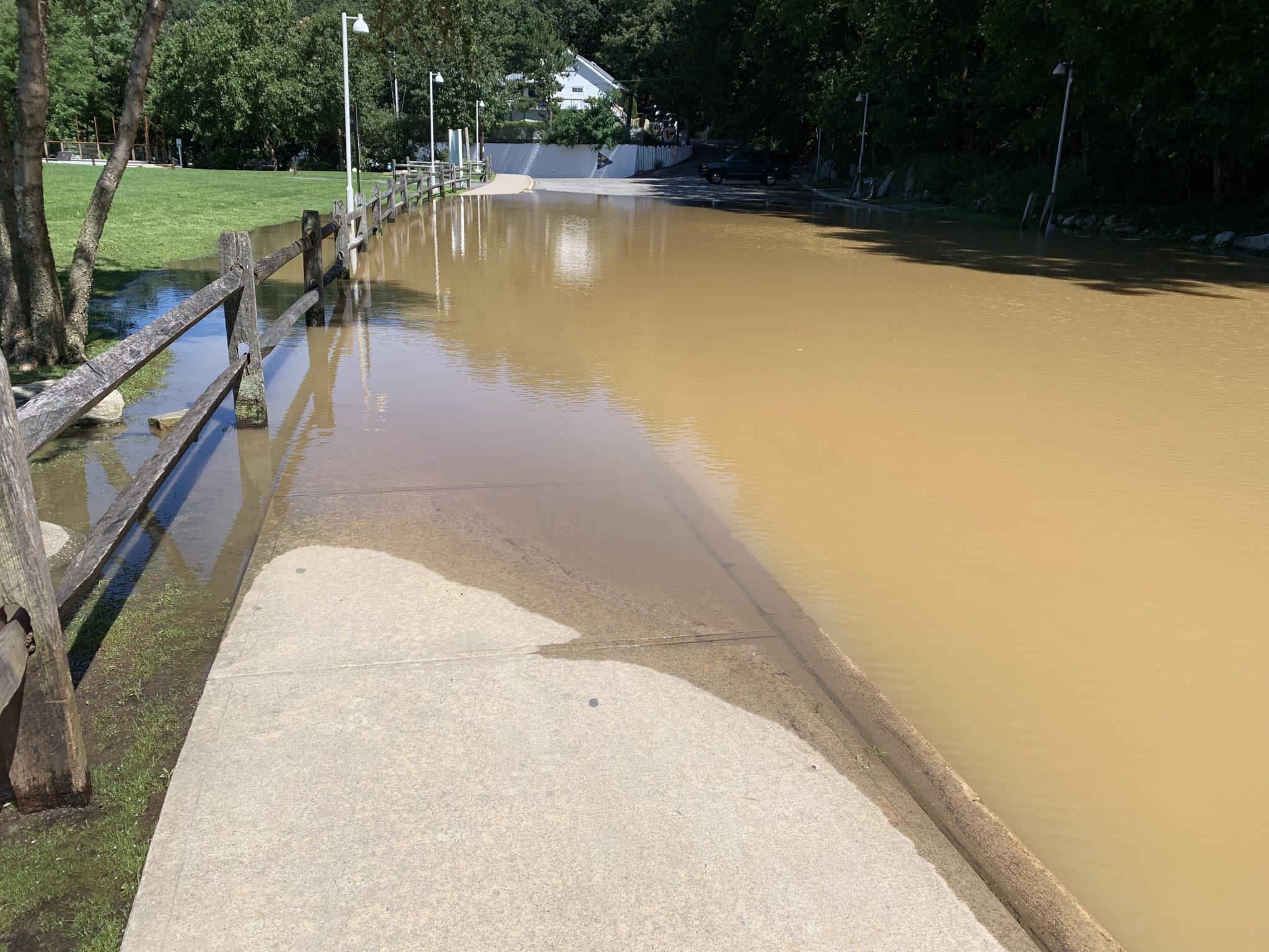
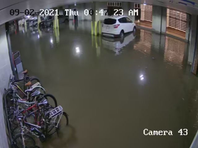
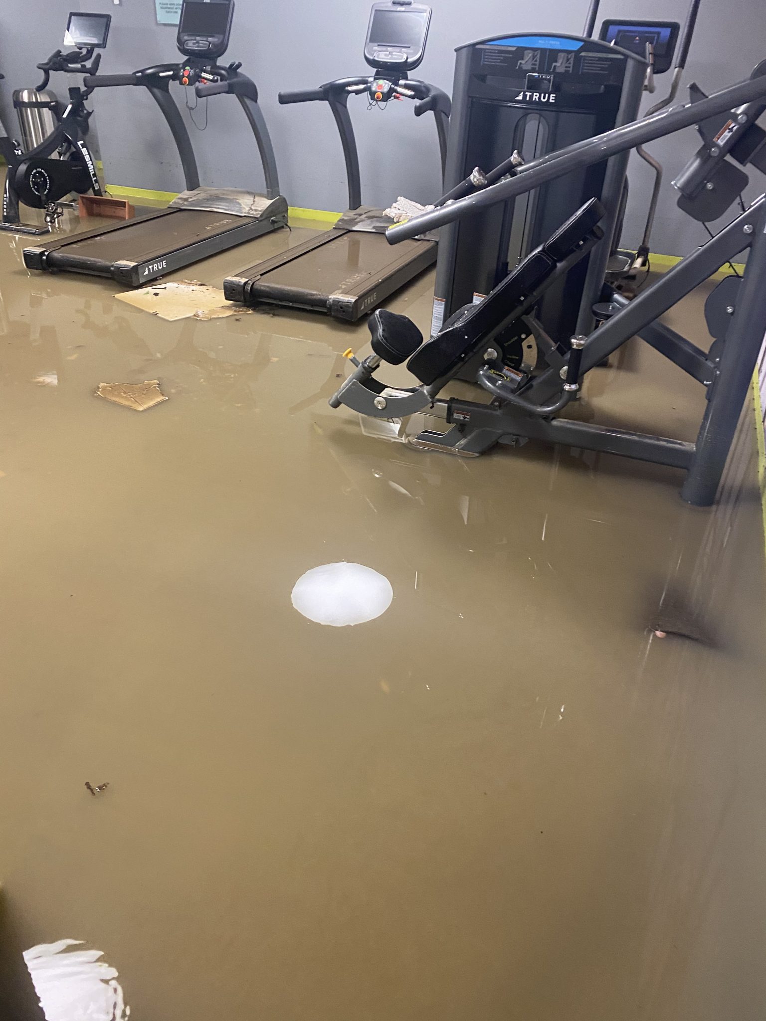
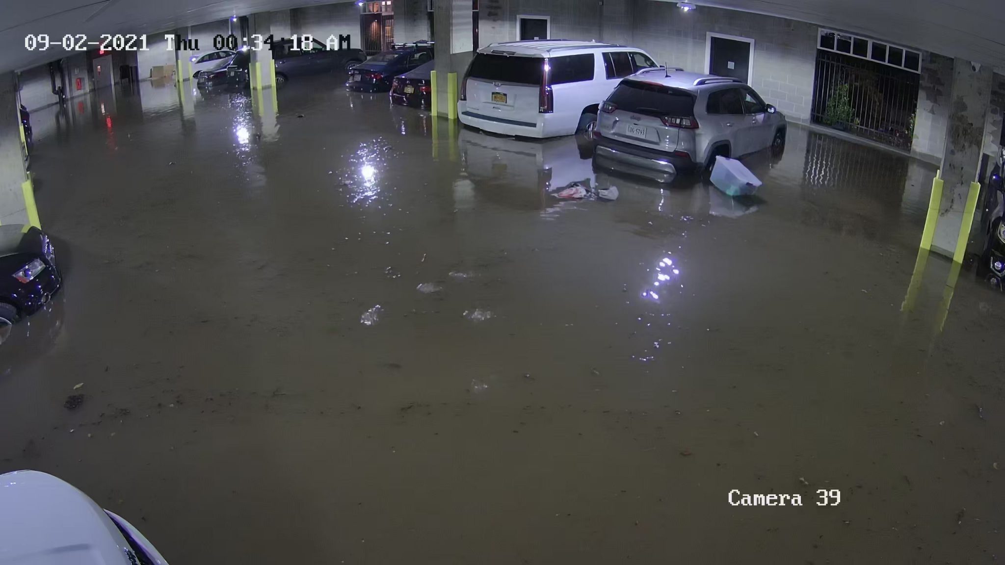
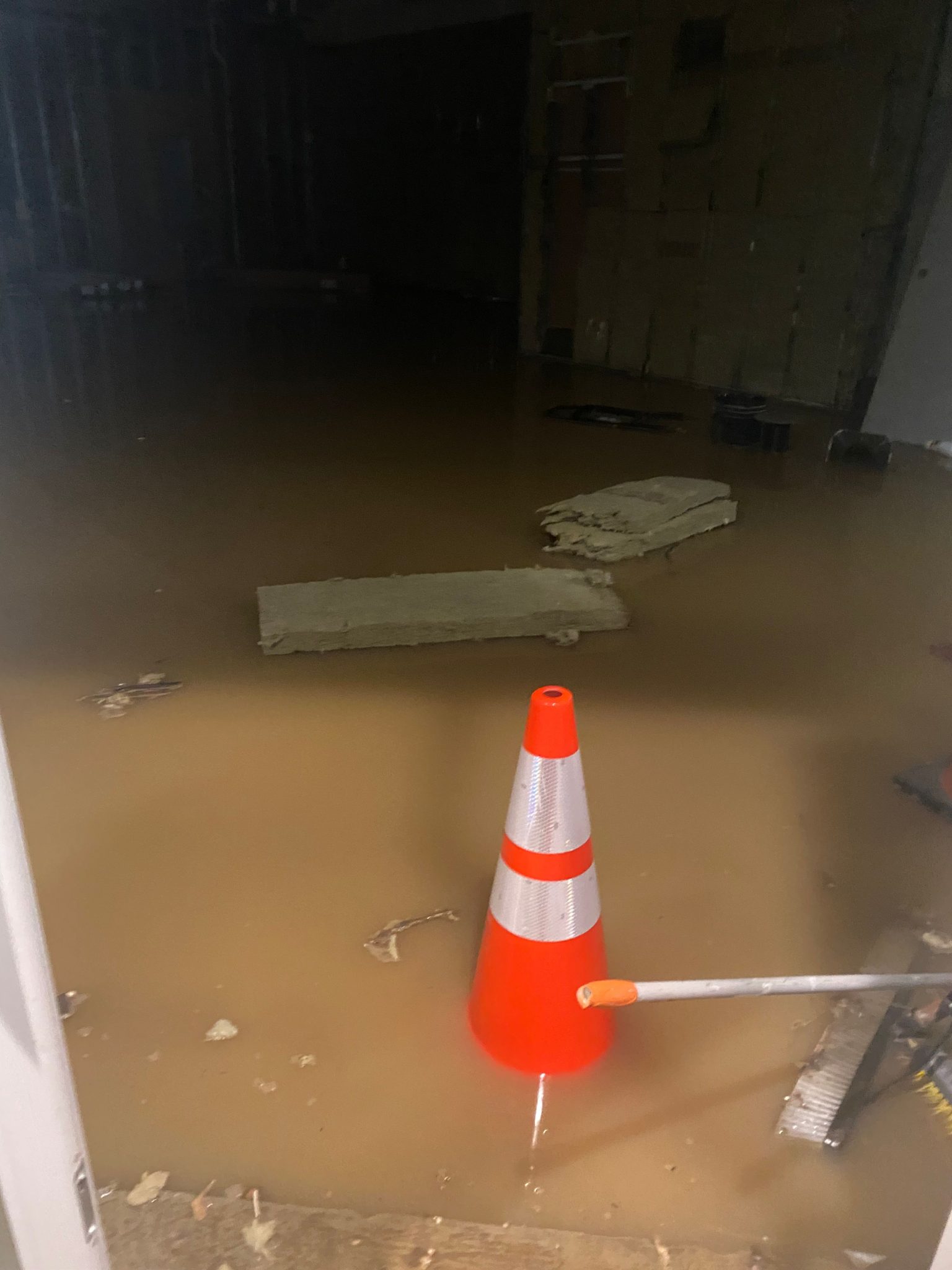
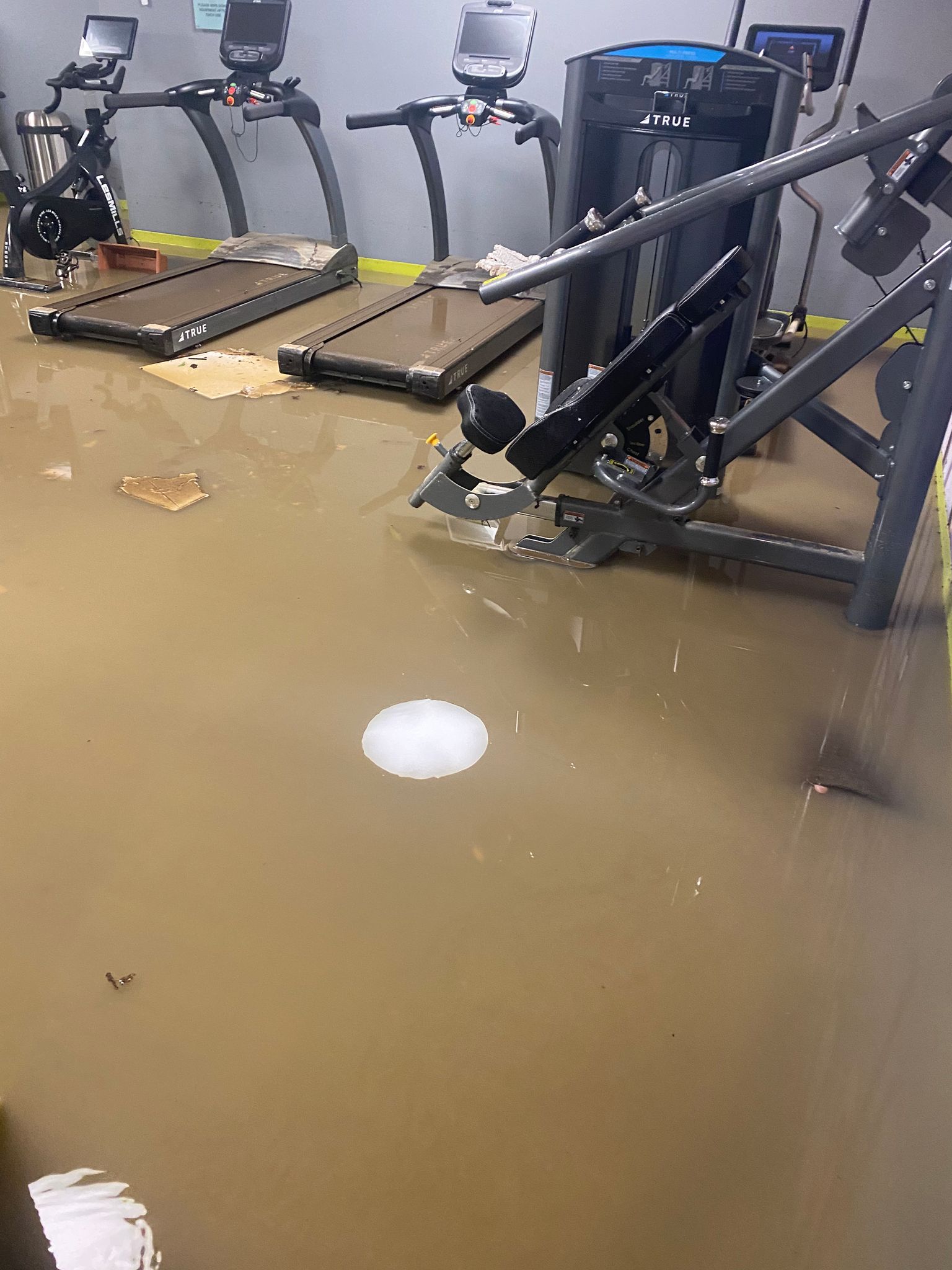
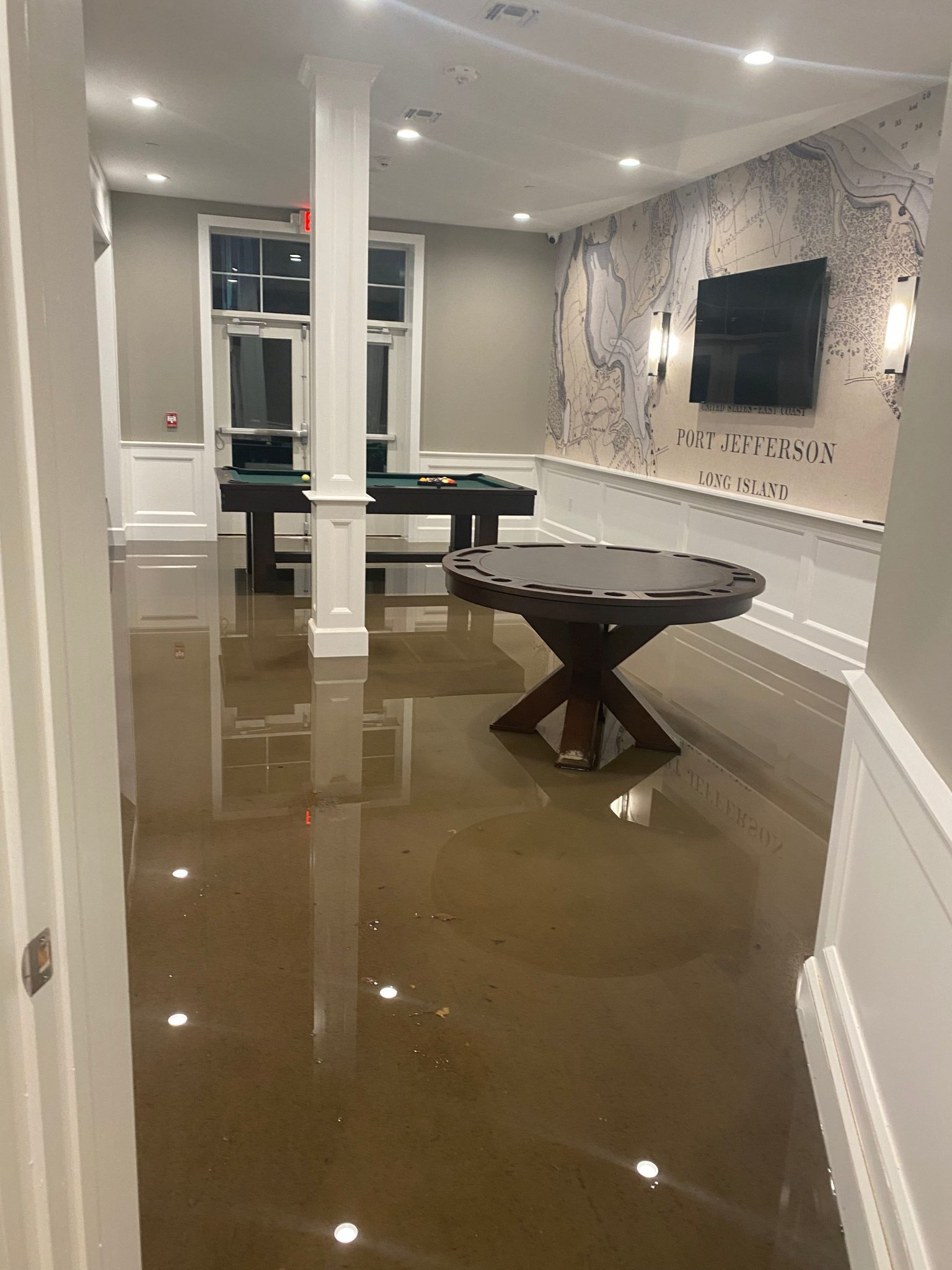
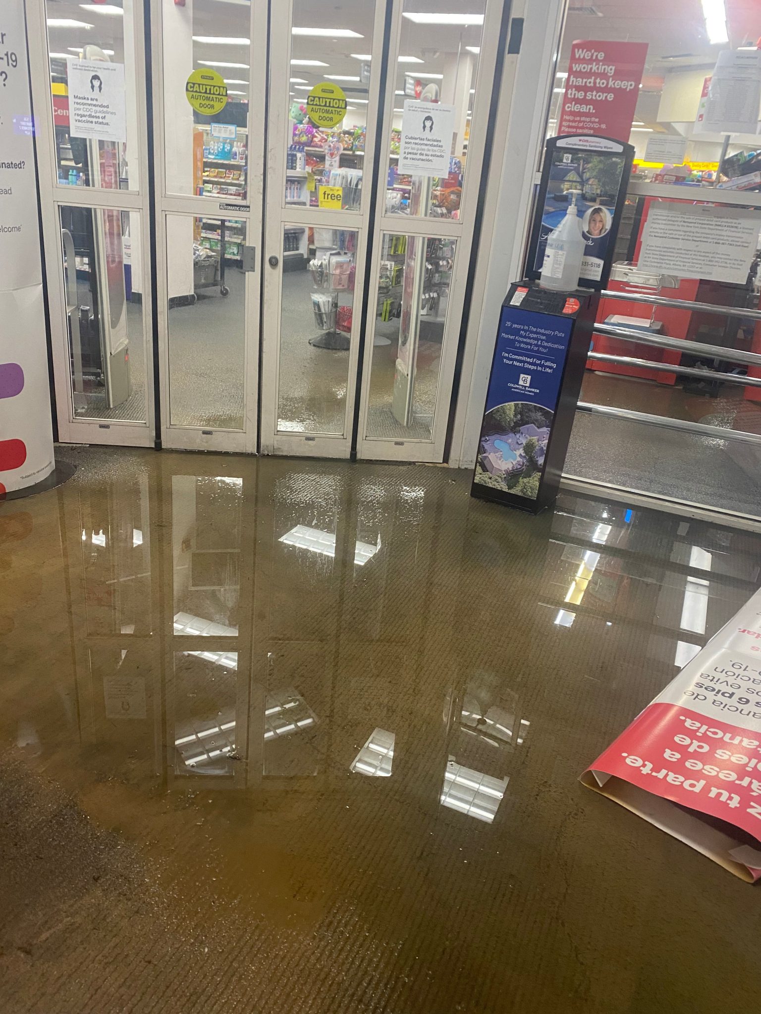
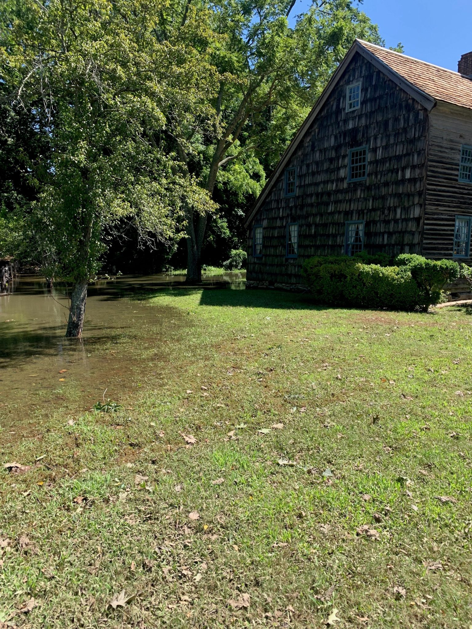
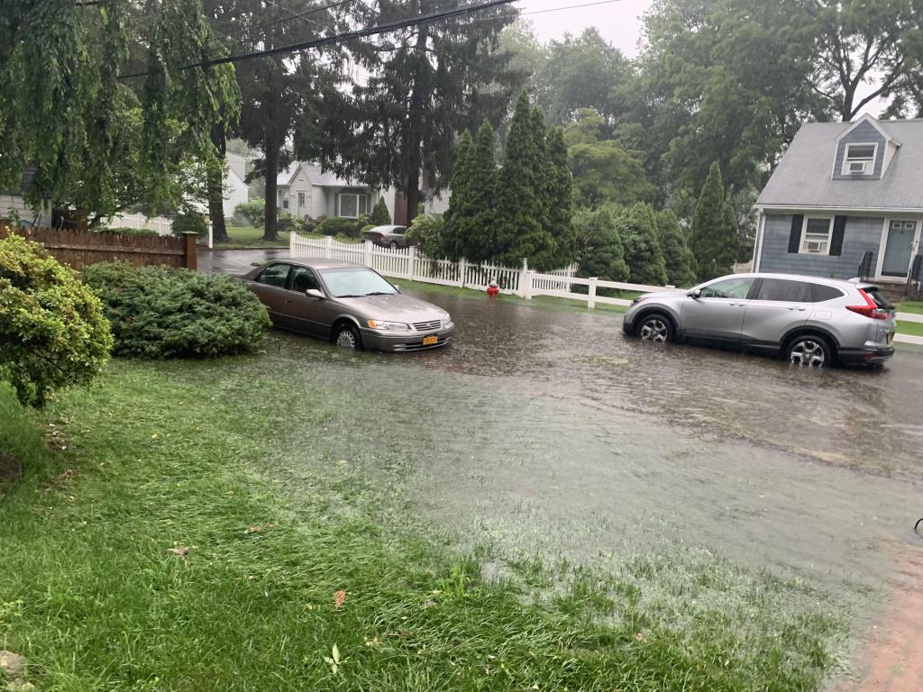
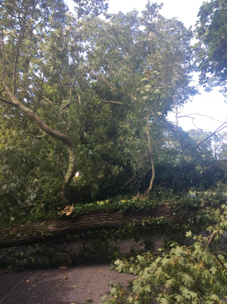
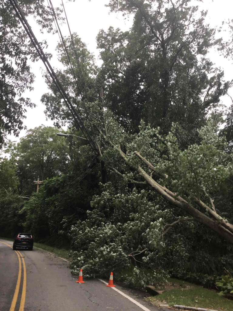
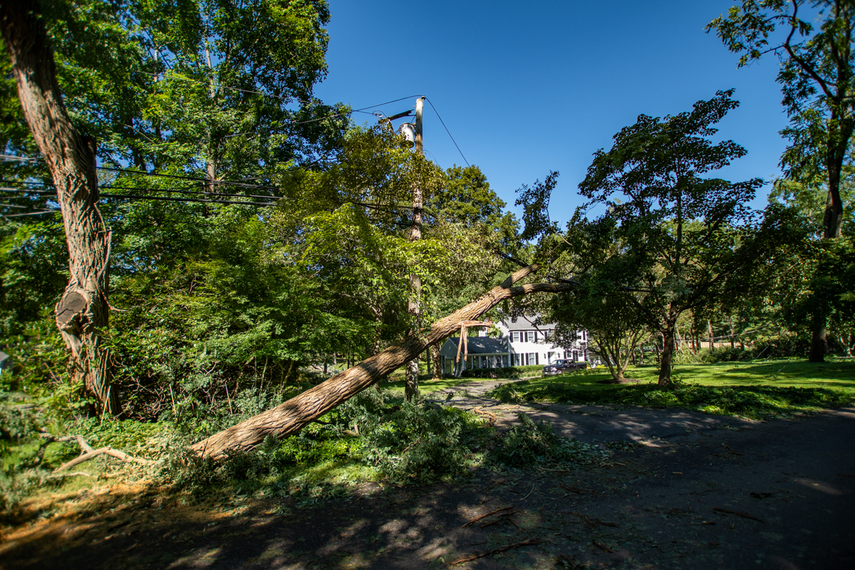
With Hurricane Ida taking lives and causing destruction from Louisiana to New York, New Jersey and Connecticut, some scientists see longer term patterns reflected in the power and destruction of this storm.

Kevin Reed, associate professor at the School of Marine and Atmospheric Sciences at Stony Brook University, said a group of experts on the topic are working on research related to the climate impacts on Ida. No specific timeline is set for such an analysis, which would be similar to what the World Weather Attribution initiative is doing.

“It’s more and more clear that there’s some connection” between a warmer climate and more severe storms,” Reed said. The sooner scientists can make that link, the “more impactful and useful” any such statements or determinations could be.

While Reed hasn’t done any formal research yet on Ida, he has considered some of the specific aspects of this storm.

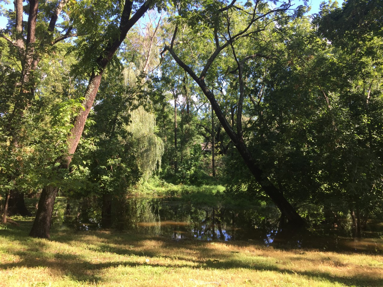
Rainfall rates of over 3 inches per hour, which set a record in Central Park, are “what you would expect in terms of climate impact.”

Previous modeling work indicates that increasing global temperatures raise the likelihood of extreme rainfall.

Reed hopes researchers can build methodologies and refine their approaches to apply what they know about climate to severe weather events like Ida, which command attention as they approach, once they make landfall and, in their aftermath, as cities and states rebuild.

What’s clear from some of the work he’s done is that “climate change is not a long-off problem, it’s already changing storms” in terms of the amount and intensity of rainfall.

The recent Intergovernmental Panel on Climate Change report emphasized that climate change is increasing the rainfall from storms.

Reed suggested it would help in terms of prevention and planning to develop ways to refine the understanding of the link between climate change and storms.

Researchers should “produce this type of information, almost at the same frequency as weather forecasts.”

Larger storms have become a topic on people’s minds in part because disruptive weather events like hurricanes Ida (2021), Laura (2020), Dorian (2019), Florence (2018), Harvey (2017) and Matthew (2016) seem to happen so much more frequently.

Scientists are continuing to try to “quantify the impact” of how the characteristics of an event might have changed because of a warmer climate, Reed said.

Research has been evolving to address society’s most pressing and urgent questions.

Indeed, climate change can and likely has contributed to heavier snowfall events, despite the broader trend towards warmer temperatures.

Some scientists have linked the melting of Arctic ice to the weakening of the polar vortex, enabling colder air to come south toward the continental United States and, in particular, the Eastern Seaboard.

The impacts from climate change are “going to get larger and more significant,” Reed said. “We have an opportunity to mitigate that. If we reduce our emissions the world will warm by half a degree to a degree. That still is offsetting potentially disastrous impacts of going beyond that.”

Recognizing the impact of climate change is a necessary step in reducing the likelihood of future extreme and variable weather events.

The kind of changes necessary for a sustainable future “takes leadership at the national and international level,” Reed said.

Cars try to navigate through flooding on Reynolds Street in Huntington Station. Photo from Town of Huntington

When the remnants of Hurricane Ida made her way last Wednesday to the North Shore of Long Island, residents weren’t prepared for what was coming. 

Two weeks ago, meteorologists got everyone ready for Henri. Gas stations were empty, the supermarket lines went out the door and stores in villages on the water boarded up their windows. 

But nothing happened. It was ultimately a light rain. 

So, when Ida made her way up the coast, we all thought nothing of it. Boy, we were wrong. 

There was flooding all across the North Shore, and people didn’t think to prepare the same way they were going to be for the previous storm.

Port Jefferson village was a muddy mess. Northport was practically under water. Stony Brook University had students sleeping inside the Student Activities Center because dorms became pools. 

According to the United Nations’ latest climate report published recently in The Washington Post, warming from fossil fuels is most likely behind the increase in the number of high intensity hurricanes over the last 40 years. 

Long Island has seen quite a few of those storms, including Sandy, Irene and Isaias. According to the Post, five more tropical systems are currently sweeping over the Atlantic so the hurricane season has only just begun. Will they be just as bad?

What will happen if we keep making poor choices when it comes to the environment? If burning fossil fuels is one of the biggest influencers in climate change, then what can we do to alleviate that stress? We need to collectively do better to eliminate waste and save energy. Consider an eco-friendly vehicle, energy-saving lightbulbs and using more sustainable household products.

But it isn’t just the increases in sustainable living that are important. 

Long Islanders need to ask their elected officials for help. For communities across the North Shore, we need to invest in ways to prevent damage to homes and businesses that sit by the water.

We need to ask PSEG Long Island to consider and create ways to move power lines underground, so when high winds attack we won’t lose power for days.

These are tall orders, but while the rest of us work toward doing better on a smaller level, we hope that Ida showed us all that we need to treat Mother Earth the way she should be treated — if we don’t, the flooding on Main Street will be the new normal.

by -
0 1170
Photo from Port Jefferson Fire Department

While members of the Port Jefferson Fire Department were out helping residents during Hurricane Ida, they had their own issues back at the village’s firehouse. 

According to the Port Jefferson Fire Department, water from the storm made its way into the firehouse, flooding the inside and submerging its antique Engine 3 in three feet of water. 

The 1946 American LaFrance’s engine crank filled with water and might have been completely ruined if it weren’t for the help of a fellow fireman.   

Danny Gruosso, a volunteer with the Terryville Fire Department and resident of Port Jefferson Station, said that this isn’t the first time he’s worked on the vintage truck known as, “The Frog.”

Photo from Port Jefferson Fire Department

Being a member of the adjacent department and a heavy equipment diesel mechanic by trade, Gruosso was asked before the COVID-19 pandemic to check the vehicle out since it was having some issues.  

“Then I get a phone call on Friday after the storm that the truck was underwater,” he said. “They called me in a panic, and I said, ‘Don’t touch it, leave it alone. Leave it in the parking lot and I’ll be down there soon.’”

Gruosso headed down to the firehouse and pulled the engine’s filters out. He drained the oil and refilled it, flushed it and cleaned it. After a three-day-long process, he was able to save the motor. 

“I was thankful that the storm was low tide because if that would have been saltwater, it would have been bad,” he said. “I still have a couple more things to just look over, but for the most part, she’s ready to rock and roll.”

A tedious project, he was happy to help out. 

“Between the two departments we’re like a family,” he said. “We always look out for each other, and we have a lot of respect for each other. It’s a good thing.”

While the antique engine survived this storm, Gruosso said he’s ready to help again if Port Jefferson sees more flooding during the rest of this season.

“I told them, if we’re going to get another storm, I’m coming down. I’ll take the day off and personally drive down here and drive it back to my house,” he said. “It won’t fit in my garage, but I live up the hill and I’ll put it in the driveway with my other trailers.”

Photo by Julianne Mosher

The North Shore of Long Island was hit hard when the aftermath of Tropical Depression Ida swept along the East Coast.

While the storm pummeled the Island Wednesday night, the National Weather Service issued a tornado warning for Suffolk County. Severe flooding headed down Main Street, E Broadway and the side streets of Port Jefferson, causing damage to local stores, the Port Jefferson Fire Department and Theatre Three.

Photo from PJFD

On Wednesday night the fire department responded to numerous water rescue emergencies, and multiple victims were rescued from their vehicles by its High Water unit. They were joined by the Terryville Fire Department and Mount Sinai Fire Department.

According to the PJFD, in some cases, civilians were found on the roof of their vehicles, or trapped within a floating vehicle. Additionally, a landslide took place on Dark Hallow Road, which left the road essentially impassable with nearly 4-feet of mud and debris.

As a result of the landslide, eight families were evacuated from their apartment building due to unstable conditions of the land.

While fire department volunteers made their ways out to help others, they, too, were victims of the storm. The firehouse on Maple Avenue suffered extensive flood damage.

“Our firefighters did an excellent job coordinating multiple rescues,” said Chief of Department Todd Stumpf. “We have a lot of cleanup ahead, but we are fully in service and able to respond to all emergencies.”

Photo from PJFD

He added that fortunately no injuries were reported during the storm.

Down the street, Theatre Three said they had more than three-and-a-half feet of water inside as of Wednesday morning.

Executive artistic director Jeffrey Sanzel said that the theatre has had its fair share of floods throughout the years, and even though they were more prepared for Ida than others in the past, it was still a hard hit.

“This will be two or three days of cleaning,” he said, “But we’ll get it done and you won’t know what happened.”

Water record-setting levels heading too close for comfort to the stage downstairs. Sanzel said water knocked over and carried one of the dumpsters outside, as well as damaged dozens of costumes, furniture and a beautiful, donated upright piano that is now ruined.

Other businesses like Ruvo and Lavender Fields had flood damage and are currently in the midst of cleaning up.

“Port Jeff was hit again with a flash flood of over 7’’ of torrential rainfall,” said Mayor Margot Garant. “While it hit hard, we remain resilient and continue our work with the state emergency office and state agencies on our flood remediation efforts.”

Many North Shore residents spent their Thursday cleaning up after remnants of Tropical Depression Ida pummeled the Island Wednesday night. In addition to the storm, the National Weather Service issued a tornado warning for the North Shore of Suffolk County.

According to PSEG Long Island, the hardest-hit areas on the Island include Northport, Ridge, Lloyd Harbor and Huntington.

Huntington

In the Town of Huntington, flooding outside of the Huntington Sewage Treatment Plant on Creek Road left several motorists stranded, according to a press release from the town. STP staff accessed the facility via payloader late in the evening on Sept.1. During the peak of high tide, STP staff were unable to access the plant from the main entrance on Creek Road or from the rear entrance near the Mill Dam gates.

 “We actually had to take a payloader out to the Creek Road entrance to bring one of our employees into the plant last night,” said John Clark, the town’s director of Environmental Waste Management. “Several cars, including a police vehicle, were stuck on Creek Road and New York Avenue — at least one driver (a police officer) had to be removed via boat by the Huntington Fire Department.”  

Steve Jappell, a wastewater treatment plant operator at the STP facility, operated the payloader and assisted fellow employee Joe Lombardo and the police officer, who was ultimately transported from the scene by the Huntington Fire Department in a rescue boat. 

“Thank you to the Huntington Fire Department, as well as Centerport, Halesite and Northport fire departments, who also arrived to assist other stranded motorists on Creek Road, and to our quick-thinking staff at the plant,” said town Supervisor Chad Lupinacci (R).

According to the press release, the area received its largest rain event in nearly 20 years between 7 p.m. and 1:30 a.m. The town reported that 6.29 inches fell during the 6 ½ hours.

While the STP usually processes around 1.8 million gallons per day, between 6 a.m. Sept. 1 and 6 a.m. Sept. 2 it processed more than 3.8 million gallons. According to the town, the plane “will continue to experience above average flow rates over the next two days as groundwater intrusion and sump pump activity contribute to the increased volumes.” 

Town officials also said there were 26 reports of flooding mostly in Huntington; 29 reports of downed trees and branches; 16 reports of large pieces, sections and layers of asphalt ripped away, five manhole covers washed aside and one possible sinkhole was reported in Northport as asphalt washed away on Oleander Drive.

As for town facilities both golf courses had some flooding and were closed Sept. 2, and Town Hall had about ½ inch of flooding in the basement.

Smithtown

According to Smithtown Public Information Officer Nicole Gargiulo, there was flooding in the Smithtown Town Hall basement; however, there was no other damage to equipment or facilities in the town.

During the peak of the storm, the town received calls about flooded roads, but the streets were cleared as of the morning of Sept. 2. 

Callahan’s Beach sustained damage, according to Gargiulo. The beach had already been closed due to damage after a storm in the early morning hours of Aug. 27. 

Stony Brook University

Students in the Mendelsohn Community of Stony Brook University, which is located on the North end of campus off of Stadium Drive, were the SBU students most affected by the storm. According to communications sent out by the university, while other areas of the campus experienced flooding conditions, Mendelsohn was the most affected and students needed to be relocated.

Also affected by the storm was the Student Brook Union, and the building is closed for damage assessment and cleanup. The university held a ribbon cutting ceremony for the newly renovated student union building last week. Employees who work in the building were asked to work remotely Sept. 2.

In an email from Rick Gatteau, vice president for Students Affairs, and Catherine-Mary Rivera, assistant vice president for Campus Residences, “the Mendelsohn buildings have no power due to 4-6 feet of water in the basement, resulting in a power failure to the building.  At this time, it is unsafe to be in the building while our teams pump out the water, assess the damage, and determine the timeline for repairs.”

Mendelsohn residents were not required to attend class on Sept. 2.

Three Village 

During the storm, the historic Thompson House in East Setauket took in 33 inches of water in its basement. Some of the water rose up to the first floor of the 1709 structure.

The building, which belongs to the Ward Melville Heritage Organization, will need to have the water pumped out, according to WMHO President Gloria Rocchio. After the water is pumped out, a cleanup company will have more work ahead of them to prevent any more damage.

According to the National Weather Service, 6.86 inches of rain fell in Setauket. The NWS reported that it was the highest rainfall total on Long Island.

Additional reporting by Daniel Dunaief.

Pixabay photo

By Daniel Dunaief

Daniel Dunaief

Last Friday around 10:30 am, our son, who just arrived at his freshman dorm 12 days earlier, asked how quickly I could get him on a flight back home.

I dropped what I was doing and searched for flights out of New Orleans. We knew he was in the path of Hurricane Ida and had been hoping, as Long Island had done the week before with Hurricane Henri, that he and the city would somehow avoid the worst of the storm.

His college had provided regular updates, indicating that the forecasts called for the storm to hit 90 miles to their west. That would mean they’d get heavy rain and some wind, but that the storm, strong as it might become, might not cause the same kind of devastation as Hurricane Katrina had exactly 16 years earlier.

By Friday, two days before its arrival, my son, many of his friends, and his friends’ parents were scrambling to get away from the Crescent City amid reports that the storm was turning more to the east.

Fortunately, we were able to book a mid-day flight the next day. An hour later, he texted me and said he might want to stay on campus during the storm, the way a few of his other friends were doing. I ignored the message.

Two hours later, he asked if he still had the plane reservation and said he was happy he’d be leaving.

Later that Friday, another classmate tried unsuccessfully to book a flight, as the scramble to leave the city increased.

My wife and I became increasingly concerned about his ride to the airport, which, on a normal day, would take about 30 minutes. We kept pushing the time back for him to leave, especially when we saw images of crowded roadways.

He scheduled an Uber for 9:30. On Saturday morning at 6 a.m. his time, he texted and asked if he should go with a friend who was leaving at 9 and had room in his car. Clearly, he wasn’t sleeping too much, either.

I urged him to take the earlier car, which would give him more time in case traffic was crawling. He got to the airport well before his flight and waited for close to two hours to get through a packed security line.

When his plane was finally in the air, my wife and I breathed a sigh of relief. We both jumped out of the car at the airport to hug him and welcome him home, even though we had given him good luck hugs only two weeks earlier at the start of college.

After sharing his relief at being far from the storm, he told us how hungry he was. The New Orleans airport had run low on food amid the sudden surge of people fleeing the city. After he greeted our pets, who were thrilled to see him, he fell into a salad, sharing stream-of-consciousness stories.

The next day, he received numerous short videos from friends who stayed during the storm. While we’d experienced hurricanes before, the images of a transformer sparking and then exploding, videos of rooms filling with water from shattered windows, and images of water cascading through ceilings near light fixtures were still shocking.

He will be home for at least six weeks, as the city and the school work to repair and rebuild infrastructure. During that time, he will return to the familiar world of online learning, where he and new friends from around the country and world will work to advance their education amid yet another disruption from a routine already derailed by COVID-19.

We know how fortunate he was to get out of harm’s way and how challenging the rebuilding process will be for those who live in New Orleans. When he returns to campus, whenever that may be, we know he will not only study for his classes, but that he and his classmates will also contribute to efforts to help the community and city recover from the storm.