Tags Posts tagged with "Kevin Reed"

Kevin Reed

Photo courtesy of SBU

By Daniel Dunaief

Predicting extreme heat events is at least as important as tracking the strength and duration of approaching hurricanes.

Ping Liu

Extreme heat waves, which have become increasingly common and prevalent in the western continental United States and in Europe, can have devastating impacts through wildfires, crop failures and human casualties.

Indeed, in 2003, extreme heat in Europe caused over 70,000 deaths, which was the largest number of deaths from heat in recent years.

Recently, a trio of scientists at Stony Brook University’s School of Marine and Atmospheric Sciences (SoMAS) received $500,000 from the National Oceanographic and Atmospheric Administration to study heat events by using and analyzing NOAA’s Seamless System for Prediction and EArth System Research, or SPEAR, to understand heat waves and predict future such events.

The first objective is to evaluate simulations in the SPEAR model, by looking at how effectively this program predicts the frequency and duration of heat events from previous decades, said Ping Liu, who is the Principal Investigator on the project and is an Associate Professor at SoMAS.

Liu was particularly pleased to receive this funding because of the “urgent need” for this research, he explained in an email.

The team will explore the impact of three scenarios for increases in overall average temperature from pre-Industrial Revolution levels, including increases of 1.5 degrees Celsius, 2 degrees Celsius and four degrees Celsius, which are the increases the IPCC Assessment Reports has adopted.

Answering questions related to predicting future heat waves requires high-resolution modeling products, preferably in a large ensemble of simulations from multiple models, for robustness and the estimation of uncertainties, the researchers explained in their proposal.

“Our evaluations and research will provide recommendations for improving the SPEAR to simulate the Earth system, supporting NOAA’s mission of ‘Science, Service and Stewardship,’” they explained.

Kevin Reed, Professor, and Levi Silvers, research scientist, are joining Liu in this effort.

Liu and Reed recently published a paper in the Journal of Climate and have conducted unfunded research on two other projects. Liu brought Silvers into the group after Reed recommended Silvers for his background in climate modeling and dynamics.

Reed, who is Interim Director of Academic, Research and Commercialization Programs for The New York Climate Exchange, suggested that the research the heat wave team does will help understand the limitations of the SPEAR system “so that we can better interpret how the modeling system will project [how] blocking events and heat will be impacted by climate change.”

An expert in hurricanes, Reed added that blocking events, which can cause high pressure systems to stall and lead to prolonged heat waves, can also lead to unique hurricane tracks, such as Hurricane Sandy in 2012.

“A longer term goal of many of my colleagues at Stony Brook University is to better understand these connections,” said Reed, who is Associate Provost for Climate and Sustainability Programming and was also recently appointed to the National Academies’ Board on Atmospheric Sciences and Climate.

Liu will use some of the NOAA funds to recruit and train a graduate student, who will work in his lab and will collaborate with Reed and Silvers.In the bigger picture, the Stony Brook researchers secured the NOAA backing in the same year that the university won the bidding to develop a climate solutions center on Governors Island.

Reed suggested that the “results of the work can be shared with our partners and can help to inform future societally relevant climate research projects.”

Focus on two regions

The systems that have caused an increase in heat waves in the United States and Europe are part of a trend that will continue amid an uneven distribution of extreme weather, Liu added.

Heat waves are becoming more frequent and severe, though the magnitude and impact area vary by year, Liu explained.

The high pressure systems look like ridges on weather maps, which travel from west to east.

Any slowing of the system, which can also occur over Long Island, can cause sustained and uncomfortable conditions.

Over the past several years, Liu developed computer algorithms to detect high pressure systems when they become stationary. He published those algorithms in two journal papers, which he will use in this project.

Personal history

Born and raised in Sichuan, China, Liu moved to Stony Brook from Hawaii, where he was a scientific computer programmer, in November of 2009.

He and his wife Suqiong Li live in East Setauket with their 16-year old daughter Mia, who is a student at Ward Melville High School and  a pianist who has received classical training at the Manhattan School of Music. Mia has been trained by award-winning teacher Miyoko Lotto.

Outside of the lab, Liu, who is five-feet, seven-inches tall, enjoys playing basketball on Thursday nights with a senior basketball team.

Growing up in China, Liu was always interested in weather phenomenon. When he was earning his PhD in China at the Institute for Atmospheric Physics at the Chinese Academy of Sciences in Beijing, he had limited computer resources, working in groups with IBM and, at times, Dell computer. He built several servers out of PC parts.

With air trapped inside the basin surrounded by tall mountains, Sichuan is particularly hot in the summer, which motivated him to pursue the study of heat waves.

Liu appreciated how Stony Brook and Brookhaven National Laboratory had created BlueGene, which he used when he arrived.

As for the future of his work, Liu believes predicting extreme heat waves is increasingly important “to help planners from local to federal levels cope with a climate that is changing rapidly and fostering more frequent and more severe heat events,” he explained.

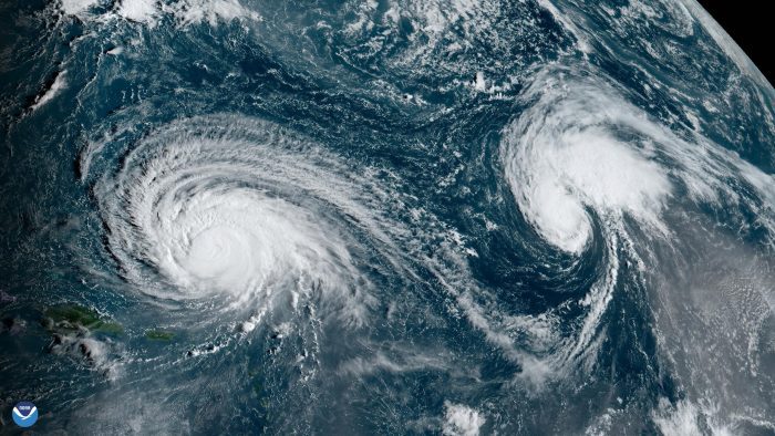
Hurricane Lee, left, and Hurricane Margot churn over the Atlantic. Satellite photo from NOAA

City planners all along the eastern seaboard, meteorologists and people living in flood plains are all hoping the current projections for Hurricane Lee prove correct.

As of earlier this week, the hurricane, which became the fastest system to transition from a tropical storm into a Category 5 hurricane, was not expected to make direct landfall.

That, however, may only be a temporary reprieve, as the conditions that made such a rapid intensification of this monster storm, which, at one point, had wind speeds of 165 miles per hour, continue to exist during the rest of this hurricane season and will likely continue in future years.

Earlier this summer, a sensor off the coast of Florida recorded an ocean temperature of 101.1 degrees Fahrenheit, the highest ever recorded. That creates conditions that threaten marine life and provides the energy that fuels the growth and intensity of hurricanes.

“We know that the warmer the sea surface temperatures are that a storm interacts with, the increased likelihood that a storm will undergo rapid intensification,” said Kevin Reed, associate professor at the School of Marine and Atmospheric Sciences at Stony Brook University. As the Earth continues to warm, Reed added, he expects those conditions to persist.

The exact timing of when a storm will intensify “remains a significant challenge to the weather community,” Reed added. “These types of events continually remind us that we have some way to go in forecasting the intensity of storms, even over a couple of days’ time scale.”

While most of the models predict the storm will head north before tracking toward a potentially dangerous landfall, Reed added that “there remains a possibility that the storm could take a track that interacts with New York or New England” and that the hurricane is still multiple days away from the region.

At this point, Reed believes such a landfall is not impossible but is unlikely.

Even without a landfall nearby, forecasters warn that the storm could produce dangerous rip currents and rough waters around the middle Atlantic states toward the latter part of this week.

NOAA forecast

One of the first things Reed does each morning and the last thing he does in the evening is check the National Hurricane Center site, among others.

A month ago, the hurricane season, which runs from June 1 through Nov. 30, was relatively quiet.

At that point, the National Oceanic and Atmospheric Association updated its seasonal projection to suggest that the hurricane season would be above normal.

“Here we are, in the thick of things,” with multiple storms out there and high activity levels, Reed said. “It’s important to keep an eye on those storms. All it takes is one to make landfall in our region to have a lasting impact.”

Hurricane Lee is the fourth hurricane of the season and the 14th named storm, six ahead as of Sept. 9 of the average over the last 30 years, according to the National Hurricane Center data.

A Category 1 storm, Hurricane Margot, is moving northward in the Atlantic, where it is not expected to make landfall. Another two disturbances may also combine and form a tropical storm. If they do, the disturbance would be named Nigel.

Reed is currently working on a few projects in which he hopes to use climate information to help inform potential impacts of future storms in the local area and coastal regions.

He is looking back retrospectively at various storms to determine how those hurricanes might differ in a warmer world. Those projects, he said, are still in the early stages.

Well aware of the potential for strong storms to hit the area, Reed has looked at a flood map around his house to know where flood waters would go amid different conditions.

He has also talked with his family about what they would do during a storm and where they would get information in the event of an evacuation from New York.

“I try to practice what I preach,” Reed said.

Kevin Reed. Photo courtesy of Stony Brook University

By Daniel Dunaief

Rain, rain go away, come again some other day.

The days of wishing rain away have long since passed, amid the reality of a wetter world, particularly during hurricanes in the North Atlantic.

In a recent study published in the journal Nature Communications, Kevin Reed, Associate Professor and Associate Dean of Research at the School of Marine and Atmospheric Sciences at Stony Brook University, compared how wet the hurricanes that tore through the North Atlantic in 2020 would have been prior to the Industrial Revolution and global warming.

Reed determined that these storms had 10 percent more rain than they would have if they occurred in 1850, before the release of fossil fuels and greenhouse gases that have increased the average temperature on the planet by one degree Celsius.

The study is a “wake up call to the fact that hurricane seasons have changed and will continue to change,” said Reed. More warming means more rainfall. That, he added, is important when planners consider making improvements to infrastructure and providing natural barriers to flooding.

While 10 percent may not seem like an enormous amount of rain on a day of light drizzle and small puddles, it represents significant rain amid torrential downpours. That much additional rain can be half an inch or more of rain, said Reed. Much of the year, Long Island may not get half an inch a day, on top of an already extreme event, he added.

“It could be the difference between certain infrastructure failing, a basement flooding” and other water-generated problems, he said. The range of increased rain during hurricanes in 2020 due to global warming were as low as 5 percent and as high as 15 percent.

While policy makers have been urging countries to reach the Paris Climate Accord’s goal of limiting global warming to 2 degrees Celsius above the temperature from 1850, the pre-Industrial Revolution, studies like this suggest that the world such as it is today has already experienced the effects of warming.

“This is another data point for understanding that climate change is a not only a challenge for the future,” Reed said. It’s not this “end of the century problem that we have time to figure out. The Earth has already warmed by over 1 degrees” which is changing the hurricane season and is also impacting other severe weather events, like the heatwave in the Pacific Northwest in 2021. That heatwave killed over 100 people in the state of Washington.

Even being successful in limiting the increase to 2 degrees will create further increases in rainfall from hurricanes, Reed added. As with any global warming research, this study may also get pushback from groups skeptical of the impact of fossil fuel use and more carbon dioxide in the atmosphere.

Reed contends that this research is one of numerous studies that have come to similar conclusions about the impact of climate change on weather patterns, including hurricanes.

“Researchers from around the world are finding similar signals,” Reed said. “This is one example that is consistent with dozens of other work that has found similar results.”

Amid more warming, hurricane seasons have already changed, which is a trend that will continue, he predicted.

Even on a shorter-term scale, Hurricane Sandy, which devastated the Northeast with heavy rain, wind and flooding, would likely have had more rainfall if the same conditions existed just eight years later, Reed added.

Reed was pleased that Nature Communications shared the paper with its diverse scientific and public policy audience.

“The general community feels like this type of research is important enough to a broad set of [society]” to appear in a high-profile journal, he said. “This shows, to some extent, the fact that the community and society at large [appreciates] that trying to understand the impact of climate change on our weather is important well beyond the domain of scientists like myself, who focus on hurricanes.”

Indeed, this kind of analysis and modeling could and should inform public policy that affects planning for the growth and resilience of infrastructure.

Study origins

The researchers involved in this study decided to compare how the 2020 season would have looked during cooler temperatures fairly quickly after the season ended.

The 2020 season was the most active on record, with 30 named storms generating heavy rains, storm surges and winds. The total damage from those storms was estimated at about $40 billion.

While the global surface temperature has increased 1 degree Celsius since 1850, sea surface temperatures in the North Atlantic basin have risen 0.4 to 0.9 degrees Celsius during the 2020 season.

Reed and his co-authors took some time to discuss the best analysis to use. It took them about four months to put the data together and run over 2,500 model simulations.

“This is a much more computationally intensive project than previous work,” Reed said. The most important variables that the scientists altered were temperature and moisture.

As for the next steps, Reed said he would continue to refine the methodology to explore other impacts of climate change on the intensity of storms, their trajectory, and their speed.

Reed suggested considering the 10 percent increase in rain caused by global warming during hurricanes through another perspective. “If you walked into your boss’s office tomorrow and your boss said, ‘I want to give you a 10 percent raise,’ you’d be ecstatic,” he said. “That’s a significant amount.”

Ecstatic, however, isn’t how commuters, homeowners, and business leaders feel when more even more rain comes amid a soaking storm.

Kevin A. Reed. Photo from Stony Brook University
As climate events continue to cause substantial widespread loss, damage, and financial costs that fall heavier on developing nations, a new commentary in the inaugural issue of PLOS Climate by two researchers, including Stony Brook University’s Professor Kevin A. Reed, calls for developed nations to direct resources toward operationalizing extreme weather events and impact attribution. While this kind of attribution technology is commonplace in the research community, if used by governments it could play a vital role in improving the global response to climate change by making that response more equitable and effective.

Authors Reed and Michael F. Wehner at Lawrence Berkeley National Laboratory, point out the costs of extreme weather over the past 50 years are unevenly distributed across the world. Generally, the most financially expensive weather events have been hurricanes in the U.S., but the deadliest events are droughts and floods in developing nations.
“Our idea is to help guide and push operational centers and governments to use attribution technology to better quantify losses and damage due to climate change, so that the developed world can be better responsive to losses and damages in the developing world,” says Reed, Associate Professor and Associate Dean of Research at the School of Marine and Atmospheric Sciences (SoMAS).

The authors urge that extreme weather event attribution – science that quantifies the influence of anthropogenic climate change on specific individual events – can indeed play a significant role in quantifying loss and damage. They cite two examples in Hurricane Harvey in 2017 and a series of global heat waves over more than 25 years.

“While there has been much discussion about operationalizing extreme weather event attribution, none such exists today,” they write. “Rather attribution statements are performed by a myriad of academic-minded groups, mostly as research projects.”

They add that the credibility of extreme weather event attribution statements has been demonstrated for a wide variety of impactful events, and that observational, computational and statistical tools are readily available.

“Thus, we call on the funding agencies of developed nations to direct resources to their weather forecast services to begin to operationalize extreme weather event and impact attribution.”

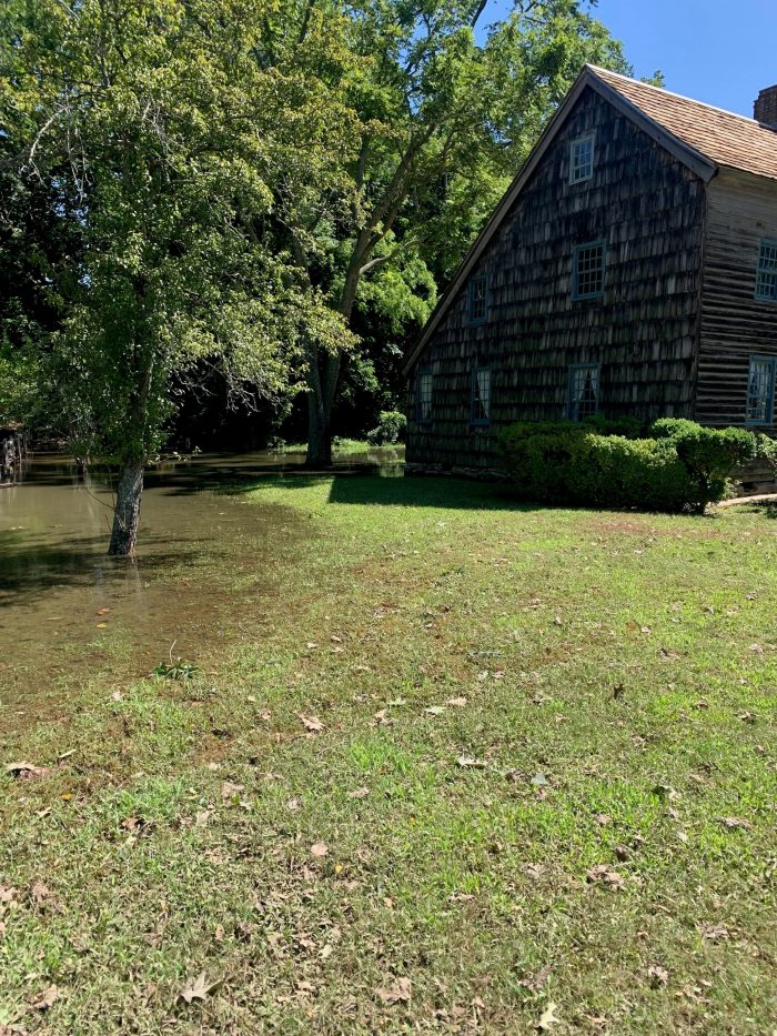
The Thompson House sustained flooding in East Setauket. Photo from WMHO

With Hurricane Ida taking lives and causing destruction from Louisiana to New York, New Jersey and Connecticut, some scientists see longer term patterns reflected in the power and destruction of this storm.

Kevin Reed, associate professor at the School of Marine and Atmospheric Sciences at Stony Brook University, said a group of experts on the topic are working on research related to the climate impacts on Ida. No specific timeline is set for such an analysis, which would be similar to what the World Weather Attribution initiative is doing.

“It’s more and more clear that there’s some connection” between a warmer climate and more severe storms,” Reed said. The sooner scientists can make that link, the “more impactful and useful” any such statements or determinations could be.

While Reed hasn’t done any formal research yet on Ida, he has considered some of the specific aspects of this storm.

Rainfall rates of over 3 inches per hour, which set a record in Central Park, are “what you would expect in terms of climate impact.”

Previous modeling work indicates that increasing global temperatures raise the likelihood of extreme rainfall.

Reed hopes researchers can build methodologies and refine their approaches to apply what they know about climate to severe weather events like Ida, which command attention as they approach, once they make landfall and, in their aftermath, as cities and states rebuild.

What’s clear from some of the work he’s done is that “climate change is not a long-off problem, it’s already changing storms” in terms of the amount and intensity of rainfall.

The recent Intergovernmental Panel on Climate Change report emphasized that climate change is increasing the rainfall from storms.

Reed suggested it would help in terms of prevention and planning to develop ways to refine the understanding of the link between climate change and storms.

Researchers should “produce this type of information, almost at the same frequency as weather forecasts.”

Larger storms have become a topic on people’s minds in part because disruptive weather events like hurricanes Ida (2021), Laura (2020), Dorian (2019), Florence (2018), Harvey (2017) and Matthew (2016) seem to happen so much more frequently.

Scientists are continuing to try to “quantify the impact” of how the characteristics of an event might have changed because of a warmer climate, Reed said.

Research has been evolving to address society’s most pressing and urgent questions.

Indeed, climate change can and likely has contributed to heavier snowfall events, despite the broader trend towards warmer temperatures.

Some scientists have linked the melting of Arctic ice to the weakening of the polar vortex, enabling colder air to come south toward the continental United States and, in particular, the Eastern Seaboard.

The impacts from climate change are “going to get larger and more significant,” Reed said. “We have an opportunity to mitigate that. If we reduce our emissions the world will warm by half a degree to a degree. That still is offsetting potentially disastrous impacts of going beyond that.”

Recognizing the impact of climate change is a necessary step in reducing the likelihood of future extreme and variable weather events.

The kind of changes necessary for a sustainable future “takes leadership at the national and international level,” Reed said.

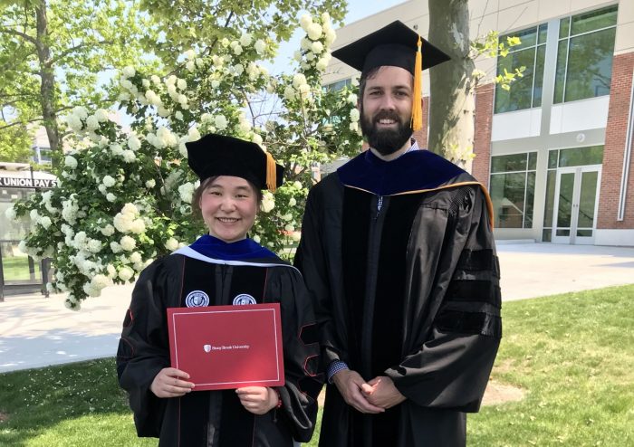
Xiaoning Wu at her recent PhD graduation with Kevin Reed. Photo by Gordon Taylor

By Daniel Dunaief

If they build it, they will understand the hurricanes that will come.

That’s the theory behind the climate model Kevin Reed, Associate Professor at the School of Marine and Atmospheric Sciences at Stony Brook University, and his graduate student Xiaoning Wu, recently created.

Working with Associate Professor Christopher Wolfe at Stony Brook and National Center for Atmospheric Research scientists, Reed and Wu developed an idealized computer model of the interaction between the oceans and the atmosphere that they hope will, before long, allow them to study weather events such as tropical cyclones, also known as hurricanes.

In his idealized program, Reed is trying to reduce the complexity of models to create a system that doesn’t require as much bandwidth and that can offer directional cues about coming climate change.

“When you’re trying to build a climate model that can accurately project the future, you’re trying to include every process you know is important in the Earth’s system,” Reed said. These programs “can’t be run” with university computers and have to tap into some of the biggest supercomputers in the world.

Reed’s work is designed to “peel back some of these advances that have happened in the field” which will allow him to focus on understanding the connections and processes, particularly between the ocean and the atmosphere. He uses fewer components in his model, reducing the number of equations he uses to represent variables like clouds.

“We see if we can understand the processes, as opposed to understanding the most accurate” representations possible, he said. In the last ten years or so, he took a million lines of code in a climate model and reduced it to 200 lines.

Another way to develop a simpler model is to reduce the complexity of the climate system itself. One way to reduce that is to scale back on the land in the model, making the world look much more like something out of the 1995 Kevin Costner film “Waterworld.”

About 30 percent of the world is covered by land, which has a variety of properties.

In one of the simulations, Reed reduced the complexity of the system by getting rid of the land completely, creating a covered aqua planet, explaining that they are trying to develop a tool that looks somewhat like the Earth.

“If we could understand and quantify that [idealized system], we could develop other ways to look at the real world,” he said.

The amount of energy from the sun remains the same, as do the processes of representing oceans, atmospheres and clouds.

In another version of the model, Reed and Wu represented continents as a single, north-south ribbon strip of land, which is enough to change the ocean flow and to create currents like the Gulf Stream.

The expectation and preliminary research shows that “we should have tropical cyclones popping up in these idealized models,” Reed said. By studying the hurricanes in this model, these Stony Brook scientists can understand how these storms affect the movement of heat from around the equator towards the poles.

The weather patterns in regions further from the poles, like Long Island, come from the flow of heat that starts at the equator and moves to colder regions.

Atlantic hurricanes, which pick up their energy from the warmer waters near Africa and the southern North Atlantic, transfer some of that heat. Over the course of decades, the cycling of that energy, which also reduces the temperature of the warmer oceans, affects models for future storm systems, according to previous studies.

Reed said the scientific community has a wide range of estimates for the effect of hurricanes on energy transport, with some researchers estimating that it’s negligible, while others believing it’s close to 50 percent, which would mean that hurricanes could “play an active role in defining” the climate.

Reed’s hypothesis is that a more rapid warming of the poles will create less of an energy imbalance, which will mean fewer hurricanes. This might differ in various ocean basins. He has been studying the factors that control the number of tropical cyclones.

Reed and Wu’s research was published in the Journal of Advances in Modeling Earth Systems in April.

Wu, who is completing her PhD this summer after five years at Stony Brook, described the model as a major part of her thesis work. She is pleased with the work, which addresses the changing ocean as the “elephant in the room.”

Oftentimes, she said, models focus on the atmosphere without including uncertainties that come from oceans, which provide feedback through hurricanes and larger scale climate events.

Wu started working on the model in the summer of 2019, which involved considerable coding work. She hopes the model will “be used more widely” by the scientific community, as other researchers explore a range of questions about the interaction among various systems.

Wu doesn’t see the model as a crystal ball so much as a magnifying glass that can help clarify what is happening and also might occur in the future.

“We can focus on particular players in the system,” she said.

A native of central China, Wu said the flooding of the Yangtze River in 1998 likely affected her interest in science and weather, as the factors that led to this phenomenon occurred thousands of miles away.

As for her future, Wu is intrigued by the potential to connect models like the one she helped develop with applications for decision making in risk management.

The range of work she has done has enabled her to look at the atmosphere and physical oceanography and computational and science communication, all of which have been “useful for developing my career.”

Kevin Reed. Photo from SBU

By Daniel Dunaief

At the beginning of this month, the North Atlantic started its annual hurricane season that will extend through the end of November.

Each year, the National Oceanic and Atmospheric Administration offers a forecast in May for the coming season. This year, NOAA’s Climate Prediction Center anticipates a 60 percent chance of an above-normal season. The Center anticipates 13 to 19 storms, although that number doesn’t indicate how many storms will make landfall.

These predictions have become the crystal ball through which forecasters and city planners prepare for a season that involves tracking disturbances that typically begin off the West coast of Africa and pick up energy and size as they travel west across the Atlantic towards Central America. While some storms travel back out to sea, others threaten landfall by moving up the Gulf Coast or along Atlantic Seaboard of the United States.

Kevin Reed, an Associate Professor at Stony Brook University’s School of Marine and Atmospheric Sciences, and Alyssa Stansfield, a graduate student in his lab, recently predicted the likely amount of rainfall from tropical cyclones.

Alyssa Stansfield at the 33rd Conference on Hurricanes and Tropical Meteorology in 2018. Photo by Arianna Varuolo-Clarke


Using climate change projection simulations, Reed and Stansfield came up with a good-news, bad-news scenario for the years 2070 through 2100. The good news in research they published in Geophysical Research Letters is they anticipate fewer hurricanes.

The bad news? The storms will likely have higher amounts of rain, with increased rain per hour.

“If you focus on storms that make landfall over the Eastern United States, they are more impactful from a rainfall standpoint,” Reed said. “The amount of rainfall per hour and the rainfall impact per year is expected to increase significantly in the future.”

In total, the amount of rainfall will be less because of the lower number of storms, although the intensity and overall precipitation will be sufficient to cause damaging rains and flooding.

Warmer oceans and the air above them will drive the increased rainfall, as these storms pass over higher sea surface temperatures where they can gain energy. Warmer, moist air gives the hurricanes more moisture to work with and therefore more potential rainfall.

“As the air gets warmer, it can hold more water in it,” Stansfield said. “There’s more potential rain in the air for the hurricanes before they make landfall.”

Stansfield said the predictions are consistent with what climatologists would expect, reflecting how the models line up with the theory behind them. She explored how climate change affects the size of storms in this paper, but she wants to do more research looking at hurricane size in the future.

“If hurricanes are larger, they will drop rainfall over a larger area,” which could increase the range of area over which policy makers might need to prepare for potential damage from flooding and high winds, Stansfield said.

While her models suggest that storms will be larger, she cautioned that the field hasn’t reached a consensus about the size of future storms. As for areas where there is greater consensus, such as the increased rainfall their models predict for storms at the end of the century, Stansfield suggested that the confidence in the community about their forecasts, which use different climate models, is becoming “more apparent as more modeling groups reach the same conclusion.”

Alyssa Stansfield at Sequoia National Park in 2018. Photo by Jess Stansfield

In explaining the expectations for higher rainfall in future storms, Reed said that even storms that had the same intensity as current hurricanes would have an increase in precipitation because of the availability of more moisture at the surface.

While storms in recent years, such as Hurricanes Harvey, Florence and Dorian dumped considerable rain in their path because they moved more slowly, effectively dumping rain over a longer period of time in any one area, it’s “unclear” whether future storms would move more slowly or stall over land.

Several factors might contribute to a decrease in the number of storms. For starters, an increase in wind sheer could disrupt the formation of some storms. Vertical wind sheer is caused when wind speed and direction changes with increasing altitude. Pre-hurricane conditions may also change due to internal variability and the randomness of the atmosphere, according to Reed.

Reed said the team chose to use climate models to make predictions for the end of the century because it is common in climate science for comparison to the recent historical record. They also used a 30 year period to limit some of the uncertainty due to internal variability of weather systems.

Stansfield, who is in her third year of graduate school and anticipates spending another two years at Stony Brook University before defending her graduate thesis, said she became interested in studying hurricanes in part because of the effects of Superstorm Sandy in 2012.

Alyssa Stansfield at Yosemite in 2019. Photo by Kathy Stansfield

When she was younger, she and her father Greg used to go to the beach when a hurricane passed hundreds of miles off the coast, where she would see the impact of the storm in larger waves. At some point, she would like to fly in a hurricane hunter plane, traveling directly into a storm to track its speed and direction.

Stansfield said one of the more common misconceptions about hurricanes is that the category somehow determines their destructive power. Indeed, Superstorm Sandy was a Category 1 hurricane when it hit New York and yet it caused $65 billion in damage, making it the 4th costliest hurricane in the United States, according to the NOAA.

After Stansfield earns her PhD, she said she wants to continue studying hurricanes. One question that she’d like to address at some point is why there are between 80 to 90 hurricanes around the world each year. This has been the case for about 50 years, since satellite records began.

“That’s consistent every year,” she said. “We don’t know why that’s the number. There’s no theory behind it.” She suggested that was a “central question” that is unanswered in her field. 

Understanding what controls the number of hurricanes will inform predictions about how that number will change in response to climate change.