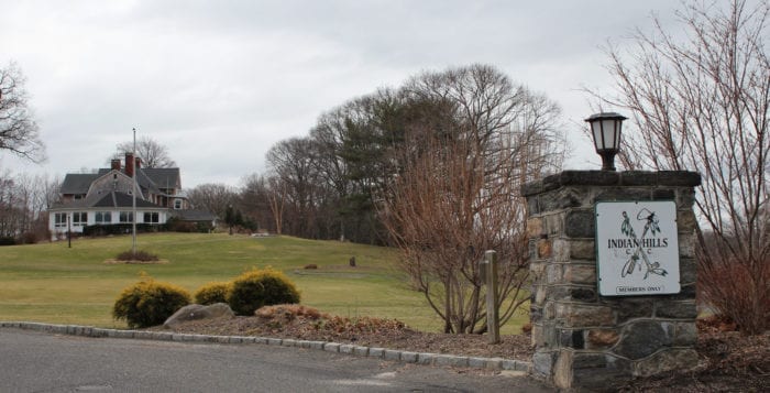
Northwind and Fort Salonga Property Owners Association clash over Preserve at Indian Hills project
By Chris Cumella
The Town of Huntington Planning Board will soon be releasing results from their research on the geographical region in their Final Environmental Impact Statement for The Preserve at Indian Hills project.
“In all of my communities, I reach out to area residents to gain their input to achieve the best results.”
— Jim Tsunis
Northwind Group CEO Jim Tsunis said he is determined to start construction on what he said would be one of the most extraordinary projects on the East Coast. The Preserve is a planned senior residential community through the construction of new units along the Indian Hills golf course and country club, giving residents views from what Tsunis describes as “one of the most beautiful country clubs on Long Island.”
The goal of Hauppauge-based developers Northwind and Nelson Pope Voorhis, land surveyors of Melville, is to respect the country club’s land while blending in a new community. They hope to see home values in the area soar over time. Tsunis’ development team said it has mitigated the environmental impacts from constructing these units through public input.
“In all of my communities, I reach out to area residents to gain their input to achieve the best results,” Tsunis said.
NPV submitted a response detailing specific comments that were addressed to them through the gathering of town input, such as the requests for marked pedestrian crosswalks and maintaining steady traffic of vehicles, pedestrians and golf carts, all of which have been claimed to be resolved.
The Draft Environmental Impact Statement was designed in 2019 to gather public feedback and utilize it to adjust the project to bridge compromises between the developers and residents. The Town Board presented a notice of completion for the FEIS in August 2020. However, some in the community thought the inquiries were anything but complete.
“The Town of Huntington now has to do what they call a findings statement,” said John Hayes, president of the Fort Salonga Property Owners Association. “They write down their recommendations for the developers and the proposed development.”
Hayes and the association have opposed much of the development’s progress since the draft became viewable in 2019. He expressed his surprise once he found out the FEIS was proposed to be completed from what he calls “an understatement” that he and several local community members highly contest.
Of the total 86 units expected to be built around the Indian Hills Country Club’s perimeter, 36 of them reside a few hundred feet from a labeled coastal erosion hazard area. This 2,500-foot bluff of land is nestled between the Long Island Sound and the country club, chiseled by the rising water levels every spring and summer, washed away and cleared by the passing of every fall and winter.
“The problem is not only that you have this 2,500-foot fault line, but if you are going to build 86 houses, the nitrogen level is governed by wastewater. That makes it even more unstable.”
— John Hayes
Hayes detailed how the nitrogen levels in the Sound could increase with the new units’ construction.
“The problem is not only that you have this 2,500-foot fault line, but if you are going to build 86 houses, the nitrogen level is governed by wastewater,” Hayes said. “That makes it even more unstable.”
Tsunis and his team will require a preliminary subdivision approval from the Town of Huntington in order to start work soon.
The rate of shore recession proves worrisome for environmental professionals concerned that winter storms will continue to remove sediment on the beach and tear away at the base of the bluffs.
“It’s dangerous,” said state Assemblyman Steve Englebright (D-Setauket), chair of the state’s Assembly Committee on Environmental Conservation. “There’s a very large body of clay that runs along the base of the bluff. The weight of water in the soil is enough to squeeze toothpaste-like clay onto the beach every winter.”
Englebright and his state Assembly committee colleagues were able to measure the rate of erosion in the Baiting Hollow area of Riverhead, where they found dune forms that ran north and south, more than a mile in length from top to bottom. Today, he says that what is left is no more than a few hundred yards of dunes, the rest of which has been eroded since sea levels increased in the Sound.
While reviews for the Indian Hills project are still currently underway to maintain and improve the development shortly, there is still a distance between the property owners association and Northwind.
“We have never turned down talking with the developers,” Hayes said. “We met with them more than three times, and yet we have never been anywhere near an agreement.”


