Tags Posts tagged with "Pavlos Kollias"

Pavlos Kollias

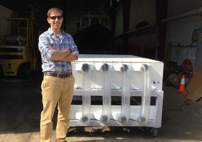
Michael French in front of a mobile radar antenna.

By Daniel Dunaief

Michael French


When he was in elementary school in Hamden, Connecticut, Michael French was several miles away from an event that would shape his life. A tornado touched down, causing extensive damage, knocking out power lines and injuring 40 people. The violent storm was traumatizing, causing him to hide in the closet during routine summer storms.

By the time French attended college at Cornell University, these powerful and potentially devastating storms had become an “interest and fascination,” he said, leading him to major in atmospheric sciences.

After graduating from college, he received an offer from Professor Howard Bluestein at the University of Oklahoma (OU) for a master’s program. A consultant for the movie Twister starring Helen Hunt and Bill Paxton, Bluestein was one of the first to put a weather radar on the back of a truck to collect data in severe storms and tornadoes. French also earned his PhD at OU.

These days, French, who is an Associate Professor in the School of Marine and Atmospheric Sciences at Stony Brook University, spends parts of his time traveling to places in the southeast in trucks with unique and emerging instrumentation, typically Doppler weather radar, gathering data about severe thunderstorms and tornadoes.

French has seen about 25 tornadoes. The closest he’s come to these violent storms is about a kilometer away, which occurred in 2004. When he’s conducting research, he is more concerned about lightning, which frequently occurs around thunderstorms that produce tornadoes.

When he’s collecting data, French has to get out of the truck to stow the antenna among other tasks. “Automatically, that means you’re in danger,” French said. “There’s nothing you can do about it, except try to minimize your time” outside. Two or three times when he was earning his PhD, lightning struck within a quarter of a mile of his location.

Better sampling

In his research, French described himself as a “pure observationalist.”

A main theme of his research is whether the nationwide network of fixed-site radar can be used by forecasters to predict whether a thunderstorm will produce a tornado and, if it does, how likely it is to be a significant or violent storm. 

French is also interested in exploring what leads to tornado dissipation and whether forecasters can use radar analysis to make dissipation predictions.

Looking at time scales of 30 seconds or fewer, he studies how tornadoes evolve, including how they tilt, how their intensity changes with height, and their motion. He can estimate these characteristics with phased-array radar technology, in which the beam of the radar is steered electronically.

Scientists like French can tap into archived data from a network of 160 radars stationed throughout the country. He would like to use information from the past 10 to 15 years to analyze hundreds of supercell thunderstorms to find commonalities among those that produce tornadoes and those that don’t.

“Ideally, in the future, such information, to the extent it exists, can be leveraged by forecasters to better assess the likelihood of a storm producing a tornado,” French explained.

Many of his ideas for research projects come from reading the results of papers from colleagues who use computer models to simulate storms and tornadoes. In a model, the scientists can control conditions like temperature and humidity. French thinks about ways to verify the findings using observational data.

Funded by the National Oceanic and Atmospheric Administration, French participates in the Propagation, Evolution and Rotation in Linear Storms field experiment (called PERiLS). 

Running from February through May in the southeast, the experiment studies tornadoes within a different type of storm, referred to as squall lines. The tornadoes that form in these storms persist or form overnight, often hitting while people are sleeping and are unprepared to protect themselves.

He is working with Stony Brook Professor Pavlos Kollias in using mobile phased array radar to collect data over short time scales of these squall lines when they’re producing tornadoes.

In areas where people live in mobile homes, these squall line tornadoes can lift the home, damaging homes and threatening the lives of people as they sleep.

Exciting findings

French uses a radar called dual polarization, which provides information about the size, shape, orientation and type of precipitation. He is interested in whether this technology can identify differences in storms to predict the formation of tornadoes.

In dual polarization, there are a few signatures of storms that hold some promise of differentiating between those that produce tornadoes and those that don’t.

Working with an algorithm to identify the ZDR column, which is a proxy for the size of the updraft, developed by Darrel Kingfield at the National Center for Atmospheric Research, French analyzed 200 supercell storms and found that the ZDR column was larger in storms that produce stronger tornadoes and was smaller or nonexistent in storms that did not.

Forecasters don’t have a way yet to automate the size of the ZDR column in real time.

In an email, Bluestein suggested that French’s studies, including on how tornadoes dissipate, can “contribute to improved short term forecasting.”

Bluestein, who has seen over 100 tornadoes, also suggested that two papers from French that related drop size distributions estimated from polarimetric radar data in supercells were “original and rather novel. This work has implications for estimating the intensity of pools of cool air in storms, which can be related to tornado formation.”

Dinner table conversations

A resident of Stony Brook, French lives with his wife Jennifer, who is a hydrometeorologist at Vieux & Co. The couple met when they were at the University of Oklahoma. 

French said his wife, who storm chased when she was in Oklahoma, knows the safety measures he uses to mitigate the risks. 

While French studies these storms because of their destructive power and the need to understand more about how and where they will form, he also has an appreciation for them.

At a distance, when these storms aren’t impacting people and when he can’t hear the roar of the wind, French describes tornadoes as a “wonder of nature” that have an “aesthetic element to them that is really astounding.”

As for his childhood concern about these storms, French feels that he “ultimately channeled [his fear] in a positive way.”

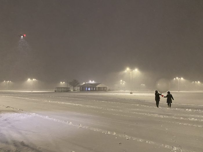
Weather balloons were launched to gather radar data. Photo by Brian Colle, Stony Brook University

By Daniel Dunaief

[email protected]

The hours a few meteorology professors and some of their students spent in driving snow and whipping wind this past weekend amid the nor’easter may improve the accuracy of future weather forecasts.

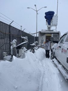
Samantha Lankowicz, above, a sophomore at SBU, takes a photo of the multi-angle snowflake camera, which is the equipment mounted on the black tripod. It captures photos of the snowflakes as they fall from three angles in real time. Photo by Brian Colle, Stony Brook University

Even as other Long Island residents were hunkered indoors, Stony Brook University Professors Brian Colle and Pavlos Kollias were teaming up with scientists from several institutions as a part of a three-year NASA-led study called IMPACTS, for The Investigation of Microphysics and Precipitation for Atlantic Coast-Threatening Snowstorms.

The researchers and a group of their students launched weather balloons and gathered radar data from last Friday evening through Saturday night, as the nor’easter named Kenan dumped well over two feet of snow through parts of Long Island.

Stony Brook students helped launch weather balloons every few hours, while NASA sent an ER-2 high altitude airborne plane and a Lockheed P-3 Orion plane into the storm.

“Everyone brings their tools to the sandbox with respect to looking at these storms,” said Colle, who collected data and managed students for over 24 hours.

At 4 a.m., Colle was driving on a road where the lanes and other traffic had disappeared.

“I kind of enjoyed it,” Colle admitted, as he maneuvered along the snow-covered roadway where the lanes completely disappeared.

Colle is in the second year of an IMPACT operation that started in 2020 and was put on pause last year amid the pandemic.

The purpose of the study is to improve forecasting in a one-to-two-day time horizon.

An improvement in the accuracy of localized forecasts over a shorter time can help municipal authorities determine when to send out plows.

“The models can hone in on those features and provide what we refer to as ‘nowcasting’ or short term forecasting,” Colle said. “There’s a big emphasis within the National Weather Service of providing decision support to emergency managers.”

Part of what makes forecasting these storms so challenging is the difficulty in predicting the timing and location of snow bands, which drop large amounts of snow in short periods of time.

In addition to information from the weather balloons, scientists throughout the area gathered temperature, wind and moisture data in places like Brookhaven and Albany.

Researchers ran a few different radar systems probing into the clouds to get more details about how these precipitation bands formed. 

During the storm, Colle said the wind shear or the change in wind speed at different altitudes was dramatic, with 10- to 20-knot winds near the ground and 50-knot winds only 500 meters above.

“I was surprised by how strong those winds were, right above our heads,” Colle said.

Colle suggested that the students who participated in gathering data amid a driving snowstorm had the opportunity to apply their textbook learning to a real-world situation.

“The students learn about these measurement approaches in class” but they truly understand it differently when they gather the data themselves, he said.

Student experience

A second-year student in the PhD program at Stony Brook, Erin Leghart, who lives in Farmingdale, worked from 6 p.m. to 2 a.m., which included launching six balloons in about six to eight hours.

Leghart said this was the first time she experienced winds like this in a winter storm.

She was well-dressed for the weather, as she invested in an ankle-length winter coat, snow boots, thermal long johns, Patagonia under armor and ski goggles.

Leghart said the excitement about the storm built about five days before it arrived, as it presented an opportunity to “do a live experiment.”

A sophomore at Stony Brook, Samantha Lankowicz, meanwhile, was excited to join her shift from 7 a.m. to 1 p.m.

“I got to do hands-on science with other students,” she said.

Lankowicz, who loves snow and was hoping for a chance to study a nor’easter this year, was pleased that one of the balloons made it all the way to the stratosphere.

Lankowicz has been to other balloon launches where a snow band turned into rain, which was “not as fun, standing in pouring rain when it’s 34 degrees.”

The only time she felt cold was when she had to take off her ski gloves and put on thinner gloves to handle the balloons.

Also a sophomore, John Tafe, who is from Salem, New York, was fascinated by weather early in life. When he was four years old, he saw clouds on the horizon and predicted a thunderstorm, which not only came later that day, but also knocked out power.

Tafe, whose hands also got cold from handling the balloons, was excited to contribute to the effort.

“To be in such a major storm that hopefully will provide valuable data is exciting,” Tafe said. “I hope that the data we collected will help advance the science.”

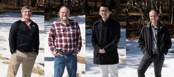
From left, atmospheric scientists Andrew Vogelmann, Edward Luke, Fan Yang, and Pavlos Kollias explored the origins of secondary ice — and snow. Photo from BNL

By Daniel Dunaief

Clouds are as confounding, challenging and riveting to researchers as they are magnificent, inviting and mood setting for artists and film makers.

A team of researchers at Brookhaven National Laboratory and Stony Brook University recently solved one of the many mysteries hovering overhead.

Some specific types of clouds, called mixed-phase clouds, produce considerably more ice particles than expected. For those clouds, it is as if someone took an empty field, put down enough seeds for a thin covering of grass and returned months later to find a fully green field.

Ed Luke, Atmospheric Scientist in the Environmental Sciences Department at Brookhaven National Laboratory, Andy Vogelmann, Atmospheric Scientist and Technical Co-manager of the BNL Cloud Processes Group, Fan Yang, a scientist at BNL, and Pavlos Kollias, a professor at Stony Brook University and Atmospheric Scientist at BNL, recently published a study of those clouds in the journal Proceedings of the National Academy of Sciences.

“There are times when the research aircraft found far more ice particles in the clouds than can be explained by the number of ice nucleating particles,” Vogelmann wrote in an email. “Our paper examines two common mechanisms by which the concentrations of ice particles can substantially increase and, for the first time, provides observational evidence quantifying that one is more common” over a polar site.

With a collection of theoretical, modeling and data collecting fire power, the team amassed over six years worth of data from millimeter-wavelength Doppler radar at the Department of Energy’s Atmospheric Radiation Measurement facility in the town of Utqiagvik, which was previously called Barrow, in the state of Alaska.

The researchers developed software to sort through the particles in the clouds, grouping them by size and shape and matching them with the data from weather balloons that went up at the same time. They studied the number of secondary ice needles produced under various conditions.

The scientists took about 100 million data points and had to trim them down to find the right conditions. “We culled the data set by many dimensions to get the ones that are right to capture the process,” Luke explained.

The dataset required supercooled conditions, in which liquid droplets at sub-freezing temperatures came in contact with a solid particle, in this case ice, that initiated the freezing process.

Indeed, shattering ice particles become the nuclei for additional ice, becoming the equivalent of the venture capitalist’s hoped for investment that produces returns that build on themselves.

“When an ice particle hits one of those drizzle drops, it triggers freezing, which first forms a solid ice shell around the drop,” Yang explained in a press release. “Then, as the freezing moves inward, the pressure starts to build because water expands as it freezes. That pressure causes the drizzle drop to shatter, generating more ice particles.”

Luke described Yang as the “theory wizard on the ice processes and nucleation” and appreciated the opportunity to solve the mechanism involved in this challenging problem.

“It’s like doing detective work,” said Luke. The pictures were general in the beginning and became more detailed as the group focused and continued to test them.

Cloud processes are the biggest cause for differences in future predictions of climate models, Vogelmann explained. After clouds release their precipitation, they can dissipate. Without clouds, the sunlight reaches the surface, where it is absorbed, particularly in darker surfaces like the ocean. This absorption causes surface heating that can affect the local environment.

Energy obtained from microscopic or submicroscopic processes, such as the absorption of sunlight at the molecular level or the energy released or removed through the phase changes of water during condensation, evaporation or freezing, drive the climate.

“While something at microscales (or less) might not sound important, they ultimately power the heat engine that drives our climate,” said Vogelmann.

To gather and analyze data, the group had to modify some processes to measure particles of the size that were relevant to their hypothesis and, ultimately, to the process.

“We had to overcome a very serious limitation of radar,” Kollias said. They “started developing a new measurement strategy.”

When the cost of collecting large amounts of data came down, this study, which involved collecting 500 times more data points than previous, conventional measures, became feasible.

Luke “came up with a very bright, interesting technique of how to quantitatively figure out, not if these particles are there or how often, but how many,” Kollias said.

Luke found a way to separate noise from signal and come up with aggregated statistics.

Kollias said everyone in the group played a role at different times. He and Luke worked on measuring the microphysical properties of clouds and snow. Yang, who joined over two and a half years ago and was most recently a post doctoral research associate, provided a talented theoretical underpinning, while Vogelmann helped refine the study and methodology and helped write up the ideas.

Kollias said the process begins with a liquid at temperatures somewhere between 0 and 10 degrees below zero Celsius. As soon as that liquid touches ice, it explodes, making it a hundred times more efficient at removing liquid from the cloud.

Kollias described the work as a “breakthrough” because it provided real measurements, which they can use to test their hypotheses.

In the next few months, Kollias said the group would make sure the climate modeling community sees this work.

Luke was hoping the collaboration would lead to an equation that provided the volume of secondary ice particles based on specific parameters, like temperature and humidity.

From the data they collected, “you can almost see the equation,” Luke said. “We wanted to publish the equation. That’s on the to-do list. If we had such an equation, a modeler could plug that right in.”

Even though they don’t yet have an equation, Luke said that explicit descriptions of the dataset, in the form of probability density functions, are of value to the modeling community.

The group would like to see how broadly this phenomenon occurs throughout the world. According to Kollias, this work is the “first step” and the team is working on expanding the technique to at least three more sites.