Tags Posts tagged with "Hurricane Lee"

Hurricane Lee

Public domain photo

Long Island’s fishing industry may have dodged a bullet this hurricane season, although the official season for the Atlantic Basin does not end until Nov. 30. Yet stormier seas may be brewing for the years ahead.

Local fishermen sounded an upbeat tune after a sequence of intense tropical cyclones did not make landfall. While precipitation disrupted some local events in recent weeks, fishing operations have gone along without interruption.

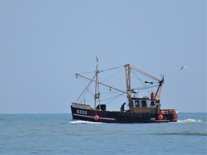
Eric Huner owns and operates Captain Fish Port Jefferson, a fishing charter boat based in Port Jefferson that transports tourists and locals for fishing charters.

“For me personally, it didn’t affect me at all,” he told TBR News Media. “I can’t say there’s any real loss, probably for any private fishing boat like myself.”

On the commercial fishing side, the experience was relatively similar, according to Bonnie Brady, executive director of the Long Island Commercial Fishing Association.

“As far as those guys that were fishing, most guys were out fishing the next day” after Hurricane Lee brushed past the Northeast, she said. “There wasn’t really much of an impact, thank goodness.”

Difficult past, uncertain future

Those interviewed suggested the Long Island fishing industry had averted a major threat with these storms avoiding landfall.

Reflecting upon the commercial impacts of Hurricane Sandy in 2012, Brady remembered it as “particularly vicious” for the shoreline, with consequences for the fishing industry as well.

However, Huner said that irregular winds and tidal patterns are increasingly commonplace, complicating matters for his business. With projections for more frequent and intense storms, Huner said his line of work is becoming less predictable, noting the increasing difficulties in deciding which days to fish and selecting departure times.

“This year was the first time I took notice of the weather patterns being very difficult to predict,” he said. There was “a lot of volatility in the wind patterns, difficult to find windows of opportunity to go out,” adding, “It was not a normal, stable summer.”

More broadly, Brady expressed reservations about the regional trend toward offshore wind, saying this infrastructure could disrupt the local fishing industry.

“Offshore wind is going to, from our perspective, industrialize the ocean beyond any kind of repair,” she said. “It’s a very frightening time for our ocean, and that’s why we’re fighting so hard against it.”

Optimistic outlook

Huner said that the fisheries remain well populated despite the climactic challenges, a positive indicator that conservation efforts are working.

He also stated that the nature of the trade requires frequent adaptation to changing conditions. “The local fisherman is a pretty experienced person on the water,” he said. “I’m constantly reviewing what the weather forecasts are, what the wind forecasts are — and that’s a big part of my job.”

He added, “It takes a little more work, and if this is going to be what we call our ‘new normal,’ then we’re just going to have to be really on top of it.”

Adding to these sentiments, Brady said local fishermen are used to adapting “to changes in the water every day.”

“Those who are good at this trade tend to be experiential learners,” she said. “Every day, the ocean can change. The tides change. The moon changes. So they learn to adapt based on living it.”

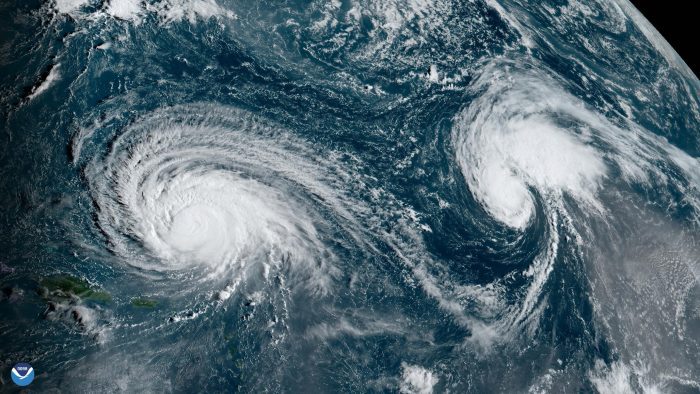
Hurricane Lee, left, and Hurricane Margot churn over the Atlantic. Satellite photo from NOAA

City planners all along the eastern seaboard, meteorologists and people living in flood plains are all hoping the current projections for Hurricane Lee prove correct.

As of earlier this week, the hurricane, which became the fastest system to transition from a tropical storm into a Category 5 hurricane, was not expected to make direct landfall.

That, however, may only be a temporary reprieve, as the conditions that made such a rapid intensification of this monster storm, which, at one point, had wind speeds of 165 miles per hour, continue to exist during the rest of this hurricane season and will likely continue in future years.

Earlier this summer, a sensor off the coast of Florida recorded an ocean temperature of 101.1 degrees Fahrenheit, the highest ever recorded. That creates conditions that threaten marine life and provides the energy that fuels the growth and intensity of hurricanes.

“We know that the warmer the sea surface temperatures are that a storm interacts with, the increased likelihood that a storm will undergo rapid intensification,” said Kevin Reed, associate professor at the School of Marine and Atmospheric Sciences at Stony Brook University. As the Earth continues to warm, Reed added, he expects those conditions to persist.

The exact timing of when a storm will intensify “remains a significant challenge to the weather community,” Reed added. “These types of events continually remind us that we have some way to go in forecasting the intensity of storms, even over a couple of days’ time scale.”

While most of the models predict the storm will head north before tracking toward a potentially dangerous landfall, Reed added that “there remains a possibility that the storm could take a track that interacts with New York or New England” and that the hurricane is still multiple days away from the region.

At this point, Reed believes such a landfall is not impossible but is unlikely.

Even without a landfall nearby, forecasters warn that the storm could produce dangerous rip currents and rough waters around the middle Atlantic states toward the latter part of this week.

NOAA forecast

One of the first things Reed does each morning and the last thing he does in the evening is check the National Hurricane Center site, among others.

A month ago, the hurricane season, which runs from June 1 through Nov. 30, was relatively quiet.

At that point, the National Oceanic and Atmospheric Association updated its seasonal projection to suggest that the hurricane season would be above normal.

“Here we are, in the thick of things,” with multiple storms out there and high activity levels, Reed said. “It’s important to keep an eye on those storms. All it takes is one to make landfall in our region to have a lasting impact.”

Hurricane Lee is the fourth hurricane of the season and the 14th named storm, six ahead as of Sept. 9 of the average over the last 30 years, according to the National Hurricane Center data.

A Category 1 storm, Hurricane Margot, is moving northward in the Atlantic, where it is not expected to make landfall. Another two disturbances may also combine and form a tropical storm. If they do, the disturbance would be named Nigel.

Reed is currently working on a few projects in which he hopes to use climate information to help inform potential impacts of future storms in the local area and coastal regions.

He is looking back retrospectively at various storms to determine how those hurricanes might differ in a warmer world. Those projects, he said, are still in the early stages.

Well aware of the potential for strong storms to hit the area, Reed has looked at a flood map around his house to know where flood waters would go amid different conditions.

He has also talked with his family about what they would do during a storm and where they would get information in the event of an evacuation from New York.

“I try to practice what I preach,” Reed said.