Tags Posts tagged with "Shawn Serbin"

Shawn Serbin

From left, Shawn Serbin, Scott Giangrande and Chongai Kuang. Photo from Brookhaven National Laboratory

By Daniel Dunaief

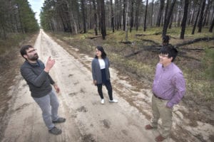
Chongai Kuang is doing considerably more than standing in the middle of various fields throughout the southeast, looking up into the sky, sticking his finger in the air and taking notes on the potential appeal of the area.

Entrusted with finding the right spot for the third ARM Mobile Facility, or AMF3, Kuang, who is an Atmospheric Scientist in the Environmental & Climate Sciences Department at Brookhaven National Laboratory, is gathering considerable amounts of information about different areas in the southeast.

In March of 2023, the ARM3 mobile facility, which has been operating in Oliktok Point, Alaska, will have a new home, where it can gather information about atmospheric convection, land-atmosphere interactions and aerosol processes.

In addition to finding the right location for this facility, Kuang will coordinate with the larger science community to make recommendations to ARM for observations, measurements, instruments and sampling strategies. Observations from these fixed and mobile facilities will improve and inform earth system models.

Kuang would like to find a strategic place for the AMF3 that is “climactically relevant to provide important observations on clouds, aerosols, and land atmosphere interactions that are needed to answer science drivers” important in the southeastern United States, Kuang said. These facilities will help researchers understand how all these atmospheric phenomena interact with solar radiation and the Earth’s surface.

The AMF3 should provide information that informs climate, regional and weather models.

In 2018, the Department of Energy, which funds BNL and 16 other national laboratories, held a mobile facility workshop to determine where to move the AMF3. The group chose the Southeastern United States because it has atmospheric convection, high vegetative-driven emissions and strong coupling of the land surface with the atmosphere. This area also experiences severe weather including tornadoes and hurricanes, which have significant human and socioeconomic impacts, said Kuang.

The most violent weather in the area often “tests the existing infrastructure,” Kuang said. “This deployment can provide critical observations and data sets,” in conjunction with regional operational observational networks.

Atmospheric phenomena as a whole in the southeastern United States includes processes and interactions that span spatial scales ranging from nanometers to hundreds of kilometers and time scales spanning seconds to days.

Kuang’s primary research interests over the past decade has focused on aerosol processes at nanometer scales, as he has studied the kinds of miniature aerosol particles that form the nuclei for cloud formation. These aerosols affect cloud lifetime and spatial distribution.

“Our research is challenged by disparate scales relevant to phenomena we’re trying to characterize, from nanometers to the length scale of convective systems, which are tens of kilometers or even larger,” Kuang said. These scales also present opportunities to study coupled science with convection, aerosol and land-atmosphere interactions.

The ARM observatories around the world provide atmospheric observations of aerosols, clouds, precipitation and radiation to inform and improve Earth system models.

“We are going to leverage as much as we can of the existing networks,” Kuang said. The ARM has a fixed site in Oklahoma, which provides data for the Southern Great Plains Site, or SGP. The Southeastern site, wherever it winds up, will provide a context for large-scale atmospheric phenomena.

The way aerosols, clouds and weather systems form and change presents a challenge and an opportunity for research stations like AMF3, which will seek to connect phenomenon at spatial and time scales that affect where Kuang and his team hope to locate the site.

Kuang is also staying abreast of the latest technology and is also contributing to the development of these capabilities. The technology the AMF3 may use could be developed between now and when the site starts gathering data.

“We have the opportunity now to start thinking about what the next generation measurement capabilities and emerging technologies are that could be operational in 2023,” he said. “We are in conversations with the broader community and with different vendors and with a number of different investigators who are developing new technologies.”

Researchers hope to understand the coupling between the land surface and atmospheric phenomenon. “That will have feedback on radiation and precipitation and the impact on land-surface interactions,” Kuang explained. The current plan is for the new facility to operate for about five years.

While Kuang is focused on the scientific drivers for the site selection, he has also been exploring the dynamic with potential research partners, including universities, seeking ways to add educational partners.

“We have hopes and plans for this kind of deliberate, targeted outreach within the region,” Kuang said. “We want to organize activities like summer school, to provide young scientists with primers and an introduction about how observations are made within their backyard.”

The work he’s trying to do now is “setting the table and preparing the soil for the eventual siting” of the station.

Kuang will measure his success if the new site improves poorly represented model processes.

Once the DOE chooses a site, Kuang plans to develop and execute an initial science plan that uses AMF3 observations. As an ARM instrument mentor, he will also be responsible for a set of instruments that measure aerosol size and concentration.

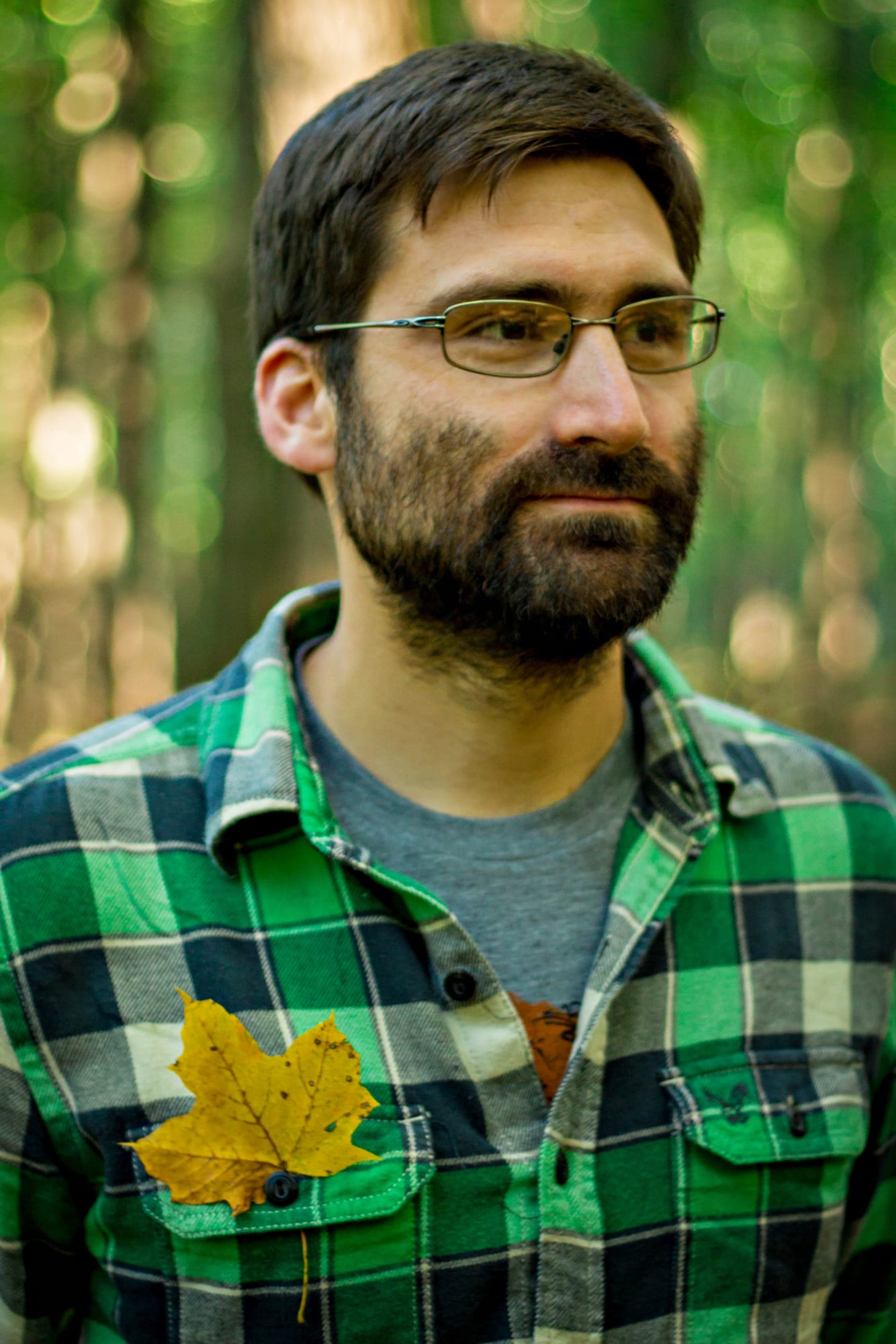
A resident of Wading River, Kuang started working at BNL in 2009 as a postdoctoral researcher. When he’s not working, he describes cooking as “therapeutic,” as he and his wife, Anyi Hsueh, who is a psychiatric nurse practitioner, have explored Southeastern Asian and Middle Eastern cuisines.

Kuang is working with Associate Ecologist Shawn Serbin and Meteorologist Scott Giangrande, in site selection. The work presents an “important responsibility and our site science team envisions the AMF3 southeastern united States [site] to enable transformational science,” he said.

From left, Shawn Serbin, University of Maryland collaborator Feng Zhao and Ran Meng. Photo by Roger R. Stoutenburgh

By Daniel Dunaief

Not all greenery is the same. From above the Earth, forests recovering after a fire often look the same, depending on the sensing system. An area with bushes and shrubs can appear to have the same characteristics as one with a canopy.

From left, Shawn Serbin, University of Maryland collaborator Feng Zhao and Ran Meng. Photo by Roger R. Stoutenburgh

Working in associate ecologist Shawn Serbin’s laboratory at Brookhaven National Laboratory, Ran Meng, a postdoctoral researcher, recently figured out a way to improve the level of information gained from these remote images, enabling them to distinguish among the different types of growth after a forest fire.

Examining the growth in a pine forest on Long Island after a fire near BNL in 2012, Meng used various spectral properties to get a more accurate idea of how the forest was recovering. Meng and Serbin recently published their results in the journal Remote Sensing of Environment.

“Using our remote sensing analysis, we were able to link detailed ground measurements from [BNL’s Kathy Schwager and Tim Green] and others to better understand how different burn severities can change the recovery patterns of oak and pine species,” Serbin explained in an email. The information Meng and Serbin collected and analyzed can map canopy moisture content and health as well as fuels below the canopy to identify wildfire risk.

The imagery can be used to map the water content or moisture stored in the leaves and vegetation canopies, Serbin explained. LiDAR data can see through the canopy and measure the downed trees and other fuels on the forest floor. This type of analysis can help differentiate the type of growth after a fire without requiring extensive surveys from the ground.  “One of the issues on the ground is that it’s time consuming and expensive,” Serbin said. Remote sensing can “cover a much larger area.”

Assisted by Meng’s background in machine learning, these researchers were able to see a higher resolution signal that provides a more detailed and accurate picture of the vegetation down below. One of the purposes of this work is to help inform forest managers’ decision-making, Serbin added. A forest with a canopy will likely capture and retain more water than one dominated by bushes and shrubs. A canopied forest acts “more like a sponge” in response to precipitation.

A canopied forest can “hold water,” Meng said. If the canopy disappears and changes to shrubs or grass, the forest’s capacity to store water will be damaged. Altering the trees in a forest after a fire can start a “reaction chain.” Without a nearby canopied forest, the water cycle can change, causing more erosion, which could add more sediment to streams.

Serbin recently met with the Central Pine Barrens Commission, the Department of Environmental Conservation and SUNY College of Environmental Science and Forestry, which is based in Syracuse.

Serbin had planned to meet with these groups several years ago to try to build a better relationship between the information the lab was collecting and the pine barrens and ESF to “use the lab as a field research site.”

They discussed ways to use the science to inform management to keep the pine barrens healthy. The timing of the meeting, so soon after the publication of the recent results related to fire damage surveys, was fortuitous.

“It just happens that this work with [Meng] comes out and is highly relevant,” Serbin said. “This is a happy coincidence.” He said he hopes these groups can use this information to feed into a larger model of research collaboration. This work not only provides a clearer picture of how a forest recovers, but also might suggest areas where a controlled burn might benefit the area, minimizing the effect of a more intense fire later on.

“These forests used to burn more often but with less intensity due to the lower fuel loads from more frequent fire,” Serbin explained. Fire suppression efforts, however, have meant that when fires do burn, they occur with higher intensities. “It could be harder to maintain the pine barrens because the fires burn more strongly, which can reduce or destroy the soil seed stock or alter the recovery trajectory in other ways,” he said.

The remote sensing analysis of trees uses shapes, sizes, leaf color and chemistry to explore the fingerprints of specific trees. This could offer researchers and conservationists an opportunity to monitor endangered species or protected habitats.

“We can do even better using platforms like NASA G-LiHT because we can use both the spectral fingerprint as well as unique structural characteristics of different plants” to keep track of protected areas, Serbin explained.

As for what’s next, Serbin said he would like to scale this study up to study larger areas in other fire-prone systems, such as boreal forests in Alaska and Canada. He plans to apply these approaches to develop new forest recovery products that can be used in conjunction with other remote sensing data and field studies to understand forest disturbances, recovery and carbon cycling.

Meng plans to move on in August to work directly with the NASA G-LiHT team. He said he believes this kind of work can also track infestations from beetles or other pests that attack trees or damage forests, adding, “There are some slight changes in spectral patterns following beetle outbreaks.”

A final goal of this project, which admittedly requires considerably more work according to Meng, is to monitor those changes early to enable forest managers to intervene, potentially creating the equivalent of an insect break if they can act soon enough.

Serbin appreciated the work his postdoc contributed to this project, describing Meng as a “dedicated researcher” who had to “sort out what approaches and computational techniques to use in order to effectively characterize” the images.

“[He] persevered and was able to figure out how to analyze these very detailed remote sensing data sets to come up with a new and novel pattern that hadn’t really been seen before,” said Serbin.

Shawn Serbin. Photo by Bethany Helzer

While judging a book by its cover may be misleading, judging a forest by looking at the top of the canopy can be informative. What’s more, that can be true even from satellite images.

An expert in a field called “remote sensing,” Shawn Serbin, an assistant scientist at Brookhaven National Laboratory, takes a close look at the spectral qualities of trees, gathering information that generates a better understanding of how an area responds to different precipitation, temperature and atmospheric carbon dioxide.

Serbin is “on the cutting edge” of this kind of analysis, said Alistair Rogers, a scientist at BNL who collaborates with and supervises Serbin. “He’s taking this to a new level.” Serbin and Rogers are a part of the BNL team working on a new, decade-long project funded by the Department of Energy called Next Generation Ecosystem Experiments — Tropics.

The multinational study will develop a forest ecosystem model that goes from the bedrock to the top of the forest canopy and aims to include soil and vegetation processes at a considerably stronger resolution than current models.

The NGEE Tropics study follows a similar decade-long, DOE-funded effort called NGEE-Arctic, which is another important biological area. Serbin is also working on that arctic study and ventured to Barrow, Alaska, last summer to collect field data.

Shawn Serbin. Photo by Bethany Helzer

Working with Rogers, Serbin, who joined BNL last March, said his group will try to understand the controls on tropical photosynthesis, respiration and allocation of carbon.

Serbin uses field spectrometers and a range of airborne and satellite sensors that measure nitrogen, water, pigment content and the structural compound of leaves to get at a chemical fingerprint. The spectroscopic data works on the idea that the biochemistry, shape and other properties of leaves and plant canopies determine how light energy is absorbed, transmitted and reflected. As the energies and biochemistry of leaves changes, so do their optical properties, Serbin explained.

“Our work is showing that spectroscopic data can detect and quantify the metabolic properties of plants and help us to understand the photosynthetic functioning of plants, remotely, with the ultimate goal to be able to monitor photosynthesis directly from space,” Serbin said.

NGEE-Tropics, which received $100 million in funding from the DOE, brings together an international team of researchers. This project appealed to Serbin when he was seeking an appointment as a postdoctoral student at the University of Wisconsin, Madison. “It’s one of the reasons I was happy to come to BNL,” Serbin said. “To have the opportunity to collaborate closely with so many top-notch researchers on a common goal is incredibly rare.”

The tropics study includes scientists from the Lawrence Berkeley National Laboratory, Los Alamos, Oak Ridge and Pacific Northwest national laboratories and also includes researchers from the Smithsonian Tropical Research Institute, the U.S. Forest Service, the National Center for Atmospheric Research, NASA and numerous groups from other countries.

In the first phase of this 10-year study, scientists will design pilot studies to couple improvements in computer modeling with observations in the tropics. These early experiments will include work in Manaus, Brazil, to see how forests react to less precipitation. In Puerto Rico, researchers will see how soil fertility impacts the regrowth of forests on abandoned agricultural land.

Serbin expects to work in all three regions. He plans to do some pilot work early on to identify how to deal with the logistics of the experiments.

“These are designed to ‘shake out the bugs’ and figure out exactly how we can do what we need to do,” he said.

Serbin lives in Sound Beach with his partner Bethany Helzer, a freelance photographer whose work includes book covers and who has been featured in Elle Girl Korea and Brava Magazine. The couple has two cats, Bear and Rocky, whom they rescued in Wisconsin. Helzer has joined Serbin on his field expeditions and has been a “trooper,” contributing to work in California in which the couple endured 130-degree heat in the Coachella Valley.

“Having her along has indeed shown that when you are in the field and focused on the work, you can miss some of the beauty that surrounds you,” Serbin said.

Serbin said the NGEE-Tropics work, which has involved regular contact through Skype, email and workshops, will offer a better understanding of a biome that is instrumental in the carbon cycle. “Our work will directly impact future global climate modeling projections,” he said.