Environment & Nature

The North Shore Rail Trail from Mount Sinai to Wading River has leveled the land where the path is expected to go. Photo by Kyle Barr

The North Shore Rail Trail, formerly known as the Rails to Trails Recreational Path, is an approximately 10-mile recreational path and is currently under construction on the former Long Island Rail Road right of way, owned by the Long Island Power Authority. The trail runs from Crystal Brook Hollow Road in Mount Sinai to Wading River Manor Road in Wading River and parallels Route 25A. 

The North Shore Rail Trail from Mount Sinai to Wading River has leveled the land where the path is expected to go. Photo by Kyle Barr

In a release, Suffolk County Leg. Sarah Anker’s (D-Mount Sinai) office said that Suffolk County Department of Public Works and DF Stone Contracting have removed the topsoil from west to east along the trail path and will continue to grade the area and lay down the subbase within the upcoming months. DPW anticipates that it will begin laying down asphalt from west to east after April 15, weather permitting. Shrubbery has been removed to clear a handicap-accessible path at the Town of Brookhaven Rose Caracappa Senior Center in Mount Sinai. The trail is estimated to be completed in the fall of 2021.

The project was first suggested over 50 years ago by local civic members and was reintroduced in 2001 by advocates of bicycle organizations, the Setauket-Port Jefferson Station Greenway Trail and some community residents. The path is being funded by federal and state grants totaling close to $10 million, with a $500,000 match from Suffolk County. Suffolk County entered into a licensing agreement with LIPA to utilize the right of way for the trail. The engineering group NV5 was chosen by DPW to plan and design the trail.

In 2019, DPW approved DF Stone Contracting to construct the trail, reducing the cost of construction by approximately $2 million through the request-for-proposal process. The release said the county will work with the Town of Brookhaven Highway Department and New York State Department of Transportation for trail signage and lighting installation at road intersections. Maintenance of the trail will involve a partnership with not-for-profit organizations and Suffolk County Department of Parks. Suffolk County police and SCDP will provide law enforcement oversight for the trail.

People looking for more information can contact Anker’s office at 631-854-1600.

Cole Swensen, a Boy Scout in Miller Place Troop 204. created a bench and concrete pads along the Setauket-Port Jefferson Station Greenway Trail. Photo by Kyle Barr

With the weather warming, and with more people available to take walks while home from work and school (maintaining social distancing, of course), one local Boy Scout’s Eagle Scout Service Project has made a lasting impact.

Port Jefferson resident Cole Swensen, a member of Miller Place Boy Scout Troop 204, installed a bench, along with concrete pads on the Setauket-Port Jefferson Station Greenway Trail earlier this month. 

“I’m happy with the finished product,” Swensen said.

Swensen, a senior at Earl L. Vandermeulen High School in Port Jefferson, said he and his dad use the trail often for running and biking and saw there was a need for a new bench, made from wood composite, at the top of the hill just after the westernmost trail entrance in Setauket. The young man also installed three concrete pads on the trail, one at his new bench and two more at existing benches.

“These pads not only clean up the look of the benches and trail, but they also prevent the area in front of the benches from getting muddy,” Swensen said. “It also is a place for strollers to easily get off the main trail.”

Charlie McAteer, the chair of the Friends of the Greenway, said Troop 204 has been a huge boon to the trail, having done five projects with the Greenway, with one more still in the planning phase. This new project comes just as the Greenway is getting increased usage thanks to more people looking to spend time outdoors while maintaining a distance from others.

“This is a remarkable commitment to the Setauket to Port Jeff Station Greenway Trail,” McAteer said. “The community will be enjoying these for decades.”

The high school senior said he had been working on the project since before last summer but had to put it on pause after a severe bike accident led to a concussion. He conducted his fundraising last month, just as things with the coronavirus crisis were starting to close in. Still, he managed to raise about $1,000 toward the project. The build was over a three-day period with the bulk of the work centered on installing the new bench and making sure the concrete pads were leveled against the slope of the hill.

Swensen said he is still waiting on the finalized paperwork for his Eagle Scout application, since all offices are closed everything now has to be mailed.

After graduating high school, Swensen expects to attend SUNY Maritime to study naval architecture, involved in designing the hulls of boats and ships. 

Swensen’s father, Eric, said his son has been interested in boats and sailing since he was young.

By Daniel Dunaief

Two researchers from Brookhaven National Laboratory were stuck on a ship trapped in ice near the North Pole — and they couldn’t have been happier.

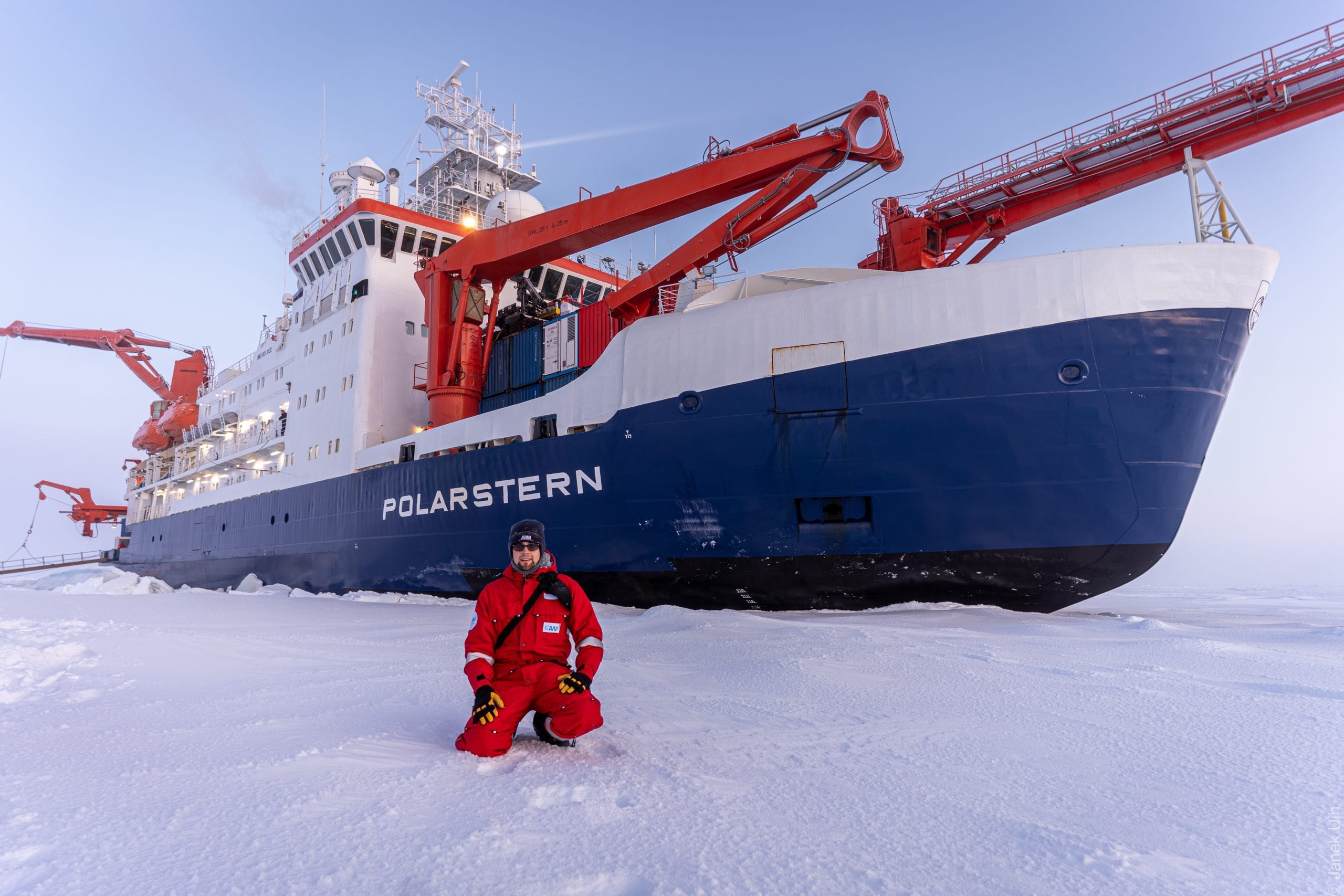
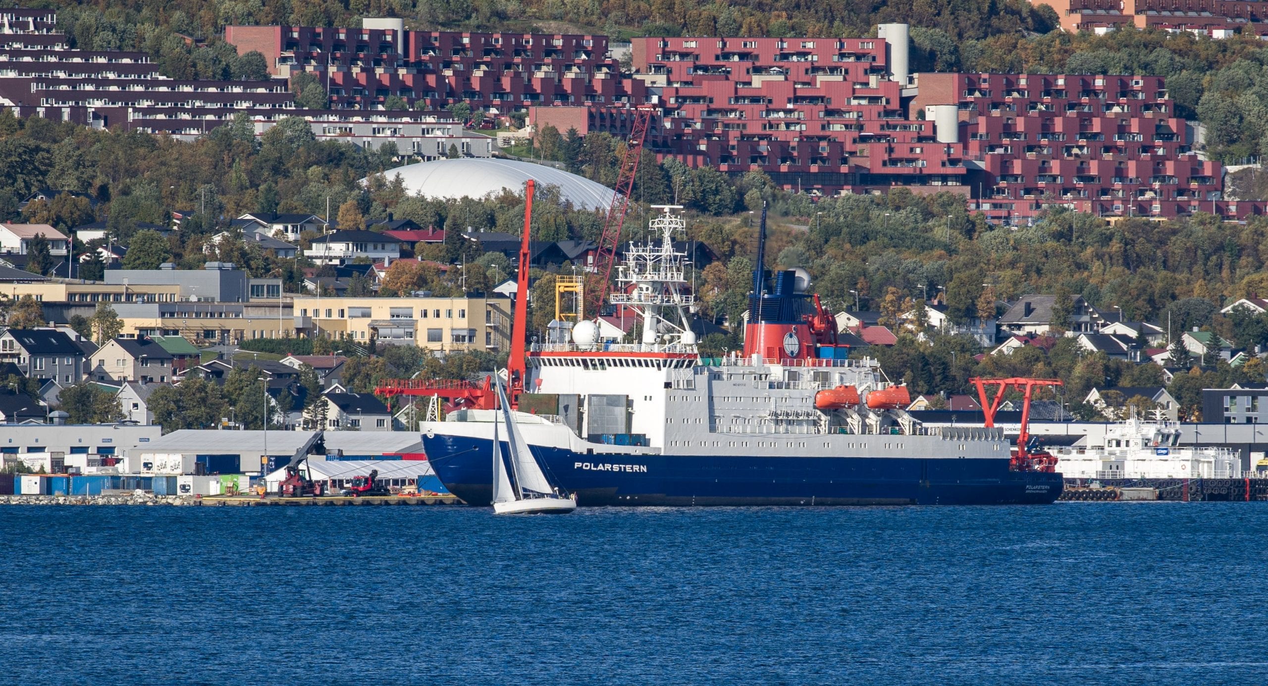
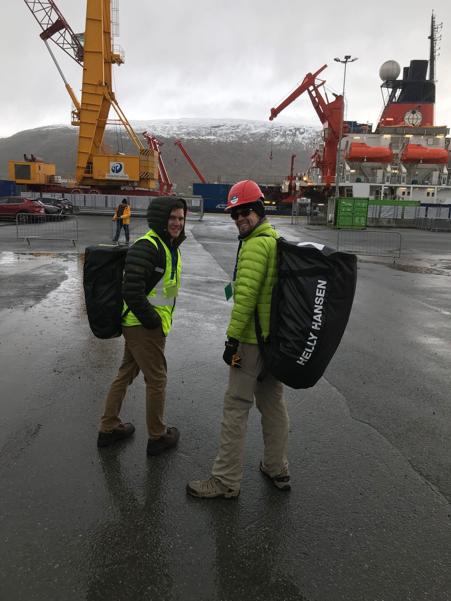
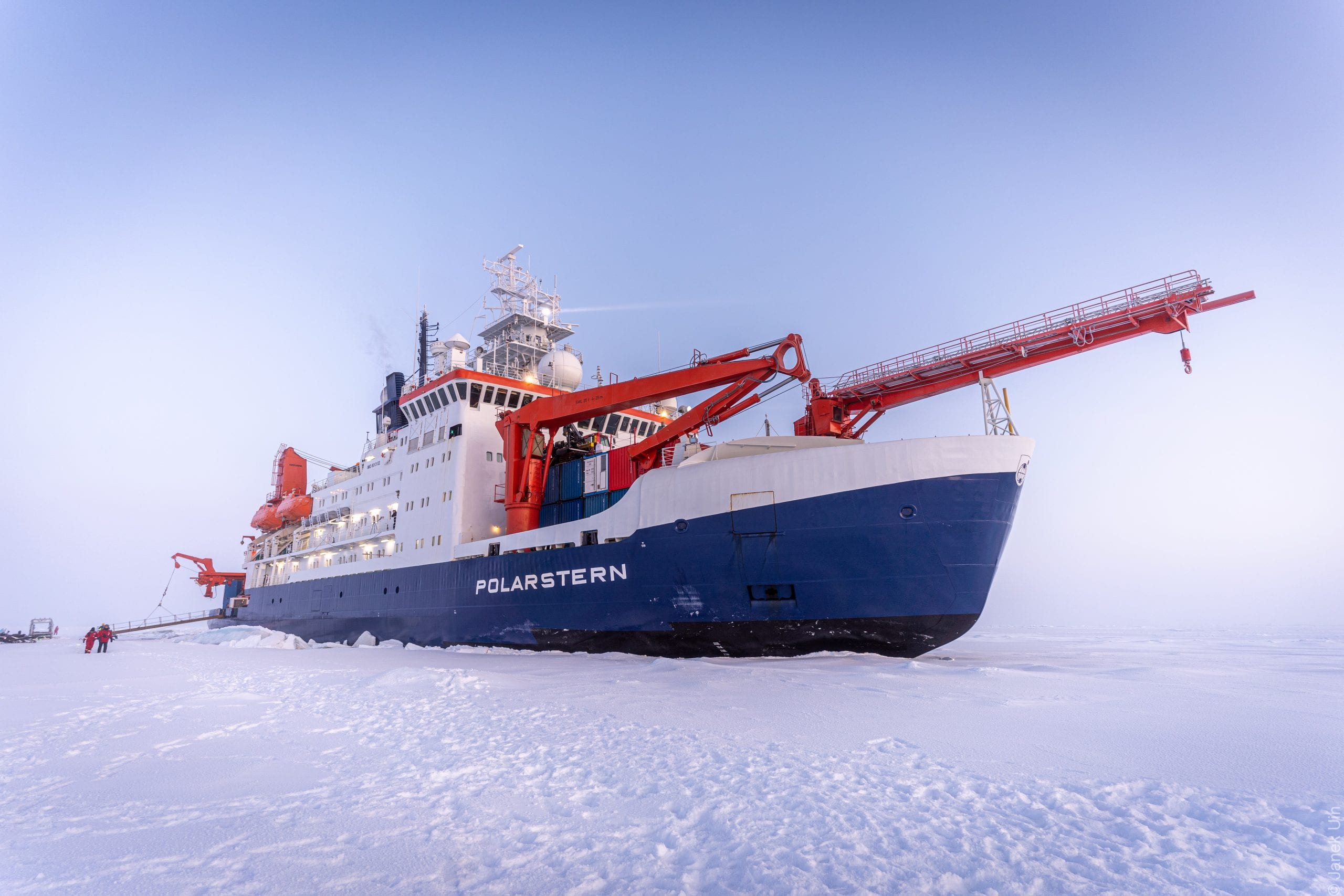
In fact, one of them, Matt Boyer, an Atmospheric Scientist at BNL, is returning to the German ship Polarstern for six of the next seven months. The Polarstern is part of a 20-nation effort that will gather information about the Arctic to understand climate change. The scientific collaboration, called MOSAiC (Multidisciplinary Drifting Observatory for the Study of Arctic Climate), started in September and will involve collecting data for a full year.

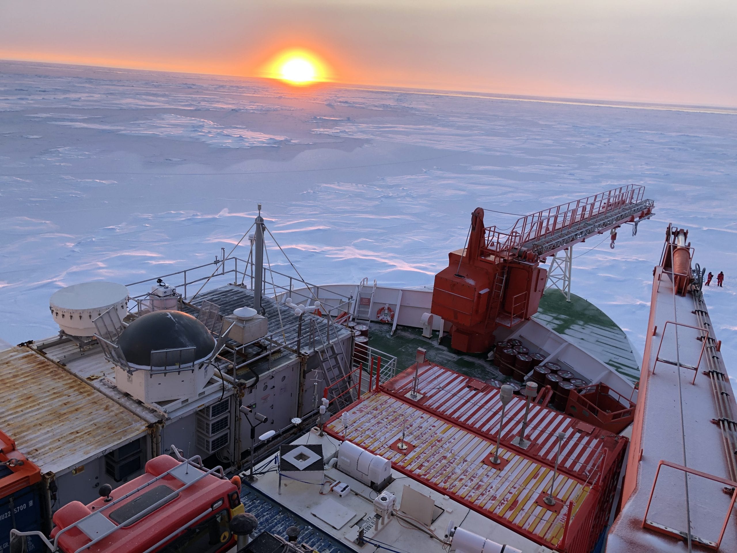
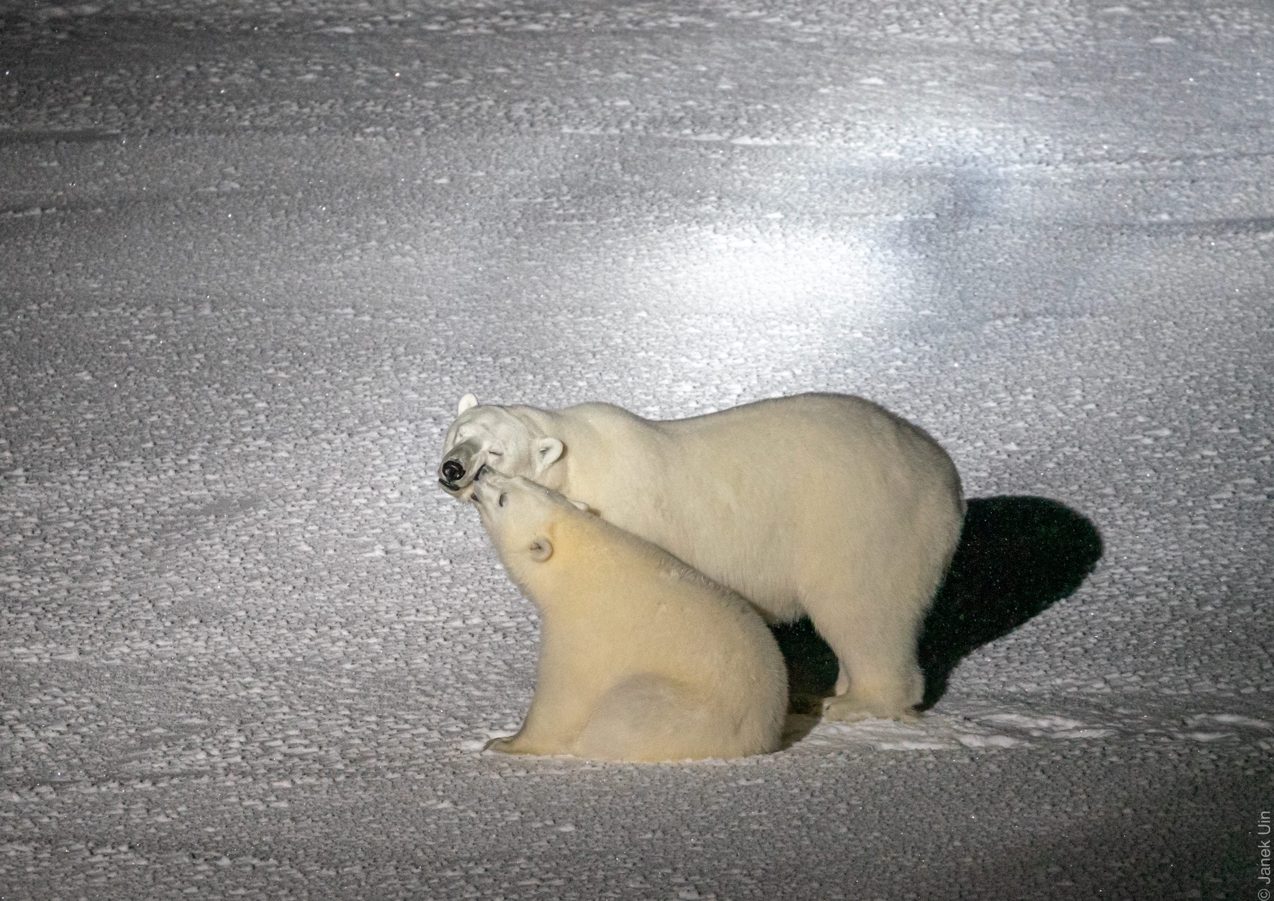
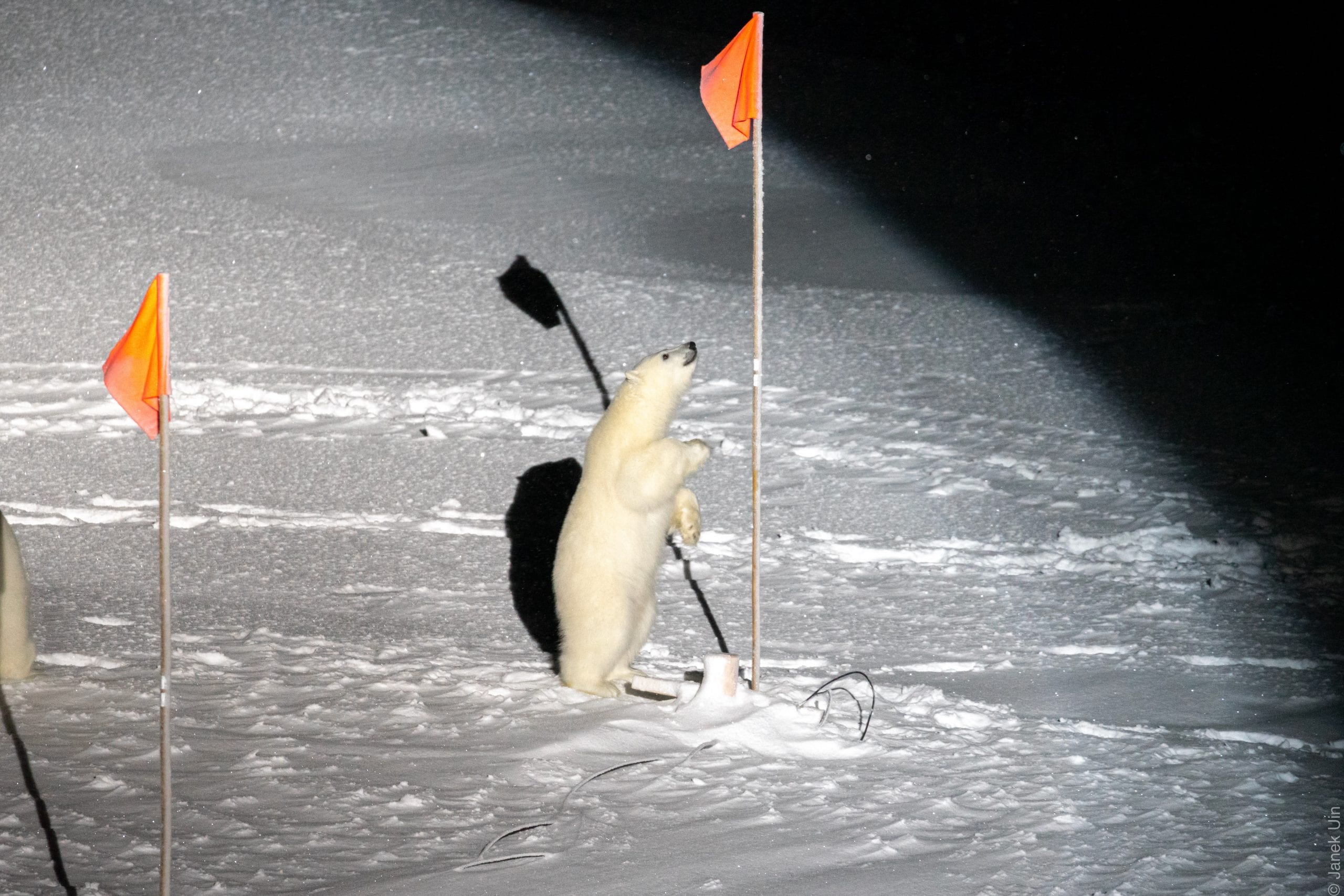
The scientists are measuring aerosols, cloud particles, and other data through conditions that are among the most challenging on the planet. Researchers aboard the Polarstern regularly endure cold temperatures, fierce winds, minimal to no sunlight and the threat of polar bears unafraid of humans.

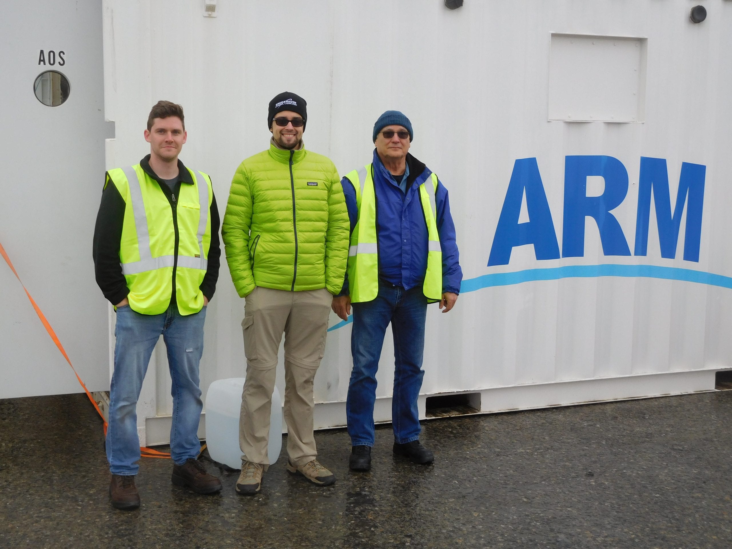
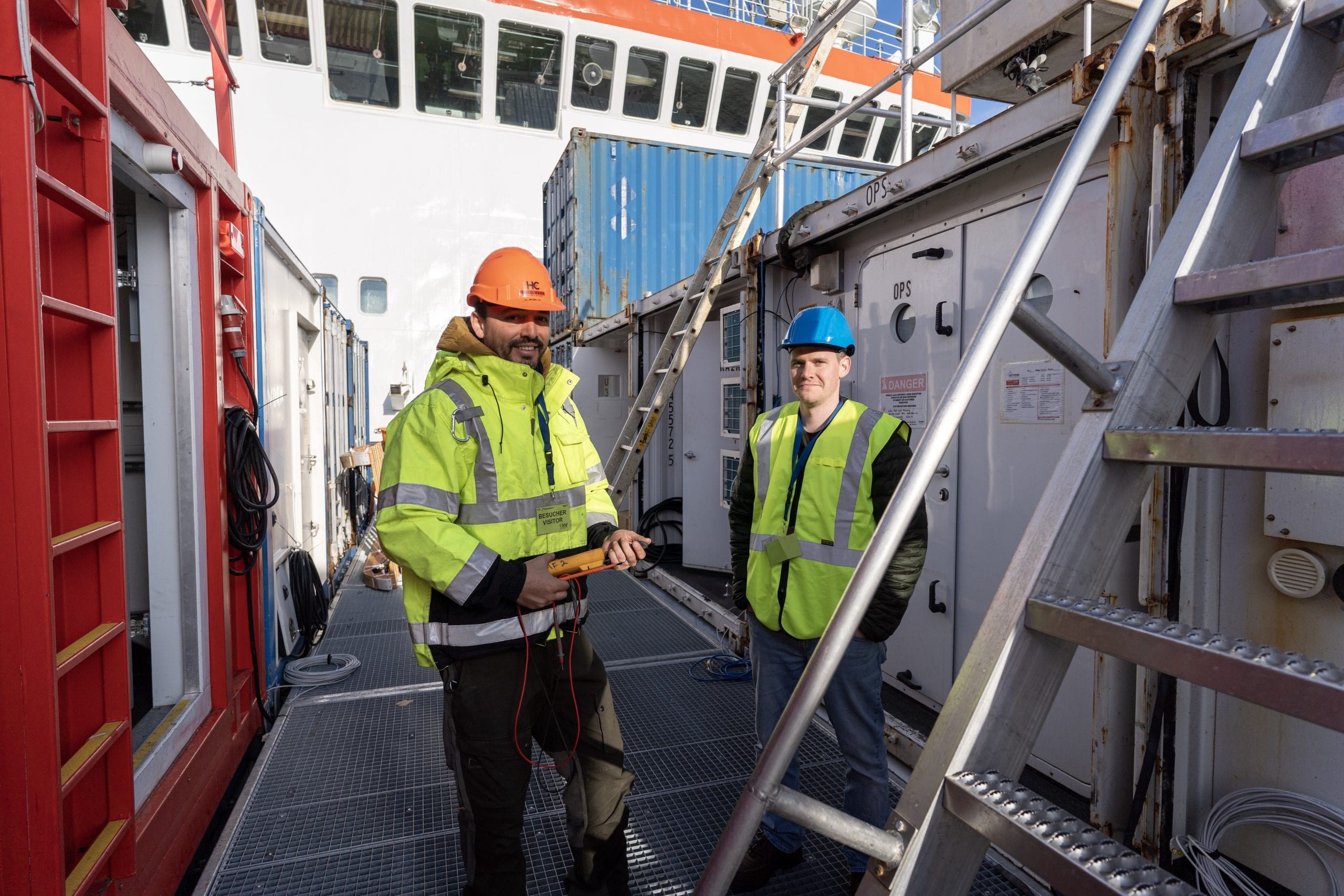
Janek Uin, an Associate Atmospheric Scientist at BNL, is working with instruments that measure properties of atmospheric aerosol particles such as their size, the concentration of particles per unit volume of air, how the particles are affected by water vapor and how much light the particles scatter, which affects the sunlight that reaches the Earth’s surface.

Arthur Sedlacek, an atmospheric chemist with the Environmental & Climate Sciences Department at BNL, is one of a host of scientists collecting data from the Polarstern. Indeed, Sedlacek traveled to Tromsø Norway when the ship departed, where he prepared to measure the accumulation of black carbon in the Arctic. 

Caused by burning fossil fuels, emissions from distant wildfires, among other things, black carbon can cause polar ice to melt. When there is sun, the black carbon prevents the reflection of the light, which further darkens the white surface, either through exposure of the underlying ground or previously deposited black carbon.

Sedlacek, who did not travel aboard the Polarstern, said scientists around the world are “itching to see the data” from this ambitious mission. The data collection is “so unique and so important that it will not only help us better understand the current (pristine) state of the cryosphere, but it will also [allow scientists] to better understand (and quantify) how the Arctic is responding to climate change.”

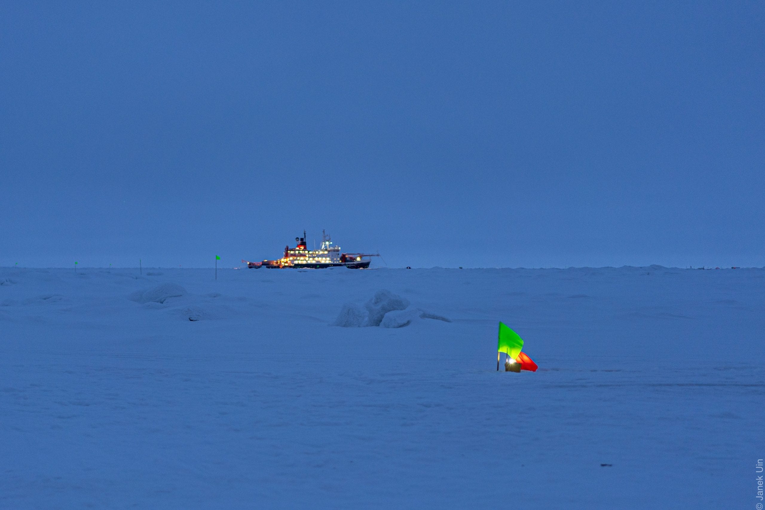
Uin, who is an instrument mentor for about 30 instruments worldwide, recalled how he went out for a fire drill. Following his designated path and waiting for the signal to return, Uin decided to snap some pictures of a frozen and uneven landscape that appeared blue during much of the day, when the faint rays of the sun barely made it over the horizon. Unable to maneuver the camera to his satisfaction, Uin took off his gloves. His exposed fingers became numb in the wind. After he put his gloves back on, it took about 10 minutes for the feeling to return to his hands.

Boyer, meanwhile, who spent more of his time working outside than Uin, helped set up the meteorological site about 1 kilometer away from the ship and is monitoring the size and concentration of organic and inorganic aerosol particles.

The size and concentration of the particles determines how they behave in atmospheric processes, Boyer explained. The size of the particle influences its light scattering ability, how long it stays in the atmosphere, the human health impact and its ability to form clouds, among other properties.

The process of working near the North Pole requires a high level of patience. A task that might take two hours in a lab, for example, might require as long as four days to complete in Arctic conditions.

Boyer described how the moisture from his own breath sometimes froze in his face. “I prefer not to wear goggles” because they fog up, he explained. When he exhaled, the water vapor in his breath caused his eyelids to freeze shut. “You have to constantly close your eyes and pull the ice off your eyelids.”

Boyer had to hold onto a piece of metal when it was well below 0 degrees Fahrenheit and windy. Placing the bolts, nuts and screws into a hole with a glove on is “almost impossible,” Boyer said, although once those items are in place, holding a wrench with gloves on is manageable

Each time people work outside, polar bear guards constantly watch the horizon to make sure the carnivorous creatures don’t approach scientists. While the ship is not a cruise vessel, it offers pleasant amenities, including a small pool, a sauna, an exercise room and nourishment Uin and Boyer, who were roommates aboard the Polarstern, appreciated.

“The food was excellent,” Uin said. “Working long hours in extreme conditions in close quarters, the food has to be good. If it’s bad, morale plummets.” The scientist has been on three ice breakers and the food has always been high quality. 

Uin appreciated the opportunity to take the journey and to conduct the scientific research. “I am reminded how lucky I am that people trust me to do this,” he said.

Uin enjoys the opportunity to look at the ice, which appears blue because of the low light. “People think it’s all white,” he said. “There’s a constant twilight and an all-encompassing blue.” He is excited to look at the information the instruments collect and is “certain that the data will help to bring new insights into the very complex processes governing Earth’s climate and help better predict future trends.”

Boyer, who plans to leave BNL this month to pursue his PhD at the University of Helsinki, said he appreciated the opportunity to be a part of a multi-national team. “I’m one of the luckier people on the planet,” Boyer said. “Not many people will see the Arctic and the Antarctic and I’ve seen both,” adding that there is a satisfaction at being involved with something that is “much larger than myself. I’m a part of a community that works together towards a common goal. It’s nice to be a part of an international team working with people from places and countries who put aside their differences.”

All photos from Janek Uin

Winners have been announced for the first Friends of Caleb Smith Preserve photography contest, which began on Aug. 1, 2019 and ran through January of this year. There were 37 participants in the six-month-long contest, which focused on The Beauty of Caleb Smith State Park Preserve located at 581 W. Jericho Turnpike in Smithtown. Judges included three members of the friends group and a park official.

The contest was divided into two age groups: youth and adult (ages 18 or over). There were 22 contestants in the adult division and 15 in the youth division, most of whom were from Commack High School. 

In the adult division Elizabeth Milward of Smithtown captured first place for “Reflection.” Second place was awarded to Katelynd Hill of East Meadow for “Goose Stretch” and third place went to Gerta Polgardy of Kings Park for “Barn.” Honorable mentions went to Tom Caruso of Smithtown for “Deer in Snow Storm,” and Sid Lorber of Smithtown for “A December Day at Caleb.”

Michela DiStefano of Commack High School won first place in the youth division for “Frozen Pond.” Second place was awarded to Miranda Gonzalez of Commack High School for “Emergence,” and Travis Maffei of Kings Park grabbed third place for “Ageless Beauty.” Russell Korn, of Commack High School, received an honorable mention for “Reflection.” 

“The contest was an enjoyable experience as all the beautiful photos came in, and we’re looking forward to holding it again next year,” said Friends President Chris Duffner. Cash prizes of $100 will be awarded to each of the first-place winners, $50 to the second-place winners and $25 to the third-place winners.

A reception that was to be held at the park’s museum on March 15 has been canceled.

The winning photos will be on display throughout the month of March. For more information, call 631-265-1054 or email [email protected].

Long-tailed duck. Photo by Luke Ormand

By John L. Turner

In the early afternoon of Super Bowl Sunday I decided to explore McAllister County Park in the northwestern corner of the Village of Belle Terre with the goal of enjoying the stark winter landscape and seeing some winter birds, and secretly hoping to spy a Snowy Owl or Northern Shrike, winter visitors occasionally seen here, although none had been recently reported. 

This not-well-known county park is on the east side of Port Jefferson Harbor and consists of a mined out section of the Harbor Hill Terminal Moraine and a sand spit that extends west to the jetty connecting the harbor with Long Island Sound. This spit and the western one connected to Old Field embrace and enclose the Harbor, containing low-lying coastal dunes which are smaller versions typical of the south shore barrier islands, and are clad in characteristic dune vegetation carpeted in beach grass. But this article isn’t about plants and vegetation; rather it’s about ducks and one species in particular that I enjoyed watching that day — the Long-tailed Duck.

Long-tailed Ducks, so named because of their distinctive and elongated central tail streamers, are a winter visitor from Arctic breeding grounds to Long Island’s coastal waters, frequenting sheltered bays and harbors and near shore areas of the open ocean. They are one of nearly three dozen species of waterfowl (duck, swans, and geese) you can see on Long Island during the winter inhabiting the Island’s freshwater ponds, lakes and streams and the salty water bodies surrounding the Island.

As I walked along the jetty a skein of eight fast but low-flying ducks, which I immediately realized were Long-tailed Ducks, shot past and landed in the Harbor about 200 yards away. I was delighted to realize my walk along the coastline would take me past them and pass them I did. And it was serendipity that as I neared the small flock the ducks began to actively feed by diving, disappearing, and reappearing in a rather rhythmic pattern — feathered apparitions on wavelet waters.

In our waters Long-tailed ducks feed on clams, mussels, and crabs located on the harbor bottom; in general, they are well-known for their diving exploits and, in fact, this species is thought to be the deepest diving duck in the world. Being adept at diving so deeply has its risks, though, as Long-tails have been found drowned in fishing nets resting at a water depth of 180 feet.  

While it’s no longer a major ongoing source of mortality for the species, thousands of Long-tail ducks, overwintering in the Great Lakes, once routinely drowned in gill nets, according to reports published half a century ago.  Staggeringly, there are reports of hundreds of ducks drowning in a single gill net designed to catch whitefish, which on purpose remain suspended in the water column for several days.  In fact, in the winter of 1952-1953 19,562 ducks died from drowning in Lake Michigan alone!!! The same number had perished the year before.  

Long-tailed ducks breed throughout the Arctic region including North America and the broad swath of Siberia. The ducks take advantage of the tremendous hatch of insects and growth of freshwater plants during the short breeding season the Arctic provides. 

As summer melds into fall individual ducks head to open water with many coming south to Long Island and beyond. The birds here probably come from northern Quebec which may be fitting because the very vocal male ducks repeatedly make a call that sounds to me like the French phrase “ah alhoutte,” “ah alhoutte,” “ah alhoutte.” 

Indeed, Long-tailed ducks are among the most vocal of all ducks and is the reason the species was once called Old Squaw, a derogatory reference to talkative native American women. Even their Latin or scientific name references this garrulous nature as their generic name Clangula means “sound” or “noise.” I was not to be disappointed as the birds repeatedly called this “ah alhoutte” phrase after bobbing to the surface following their many-second submergent searches for sustenance.

Long-tailed ducks are both graceful and beautiful and if any duck can qualify as elegant it’s this species. Their winter plumage, which in an unusual occurrence is actually their breeding plumage, is like a photograph negative, being composed of varying shades of black, gray, and white: black back with graceful white scapular plumes arching over their shoulder, white sides, white top of the head, black side of the neck, black breast, white on the base and back of the neck and grey face with white eye arcs. Their pink bubble gum-colored bill, bracketed by black at the base and tip, provides the only bright color.

Like all birds, Long-tailed ducks molt their feathers, replacing worn out feathers with new, fresh ones. Unlike most waterfowl though, which molt twice yearly, Long-tails undergo a highly complicated molt and plumage sequence three times in a year involving a basic, alternate, and supplemental plumage; why this duck is unique among its waterfowl brethren in evolving this intricate feather replacement strategy- among the most complicated of the world’s many thousands of bird species — is not clear.

The experience with these lovely Longtails came to an end as they burst from the water, although I don’t know why they flushed, and took off together, rushing west toward the setting sun, with one bird “ah alhouetting” as it went. I’ll long remember this scene of the late afternoon sky and winter sun, reflecting off a wonderful slice of briny water, with trees lining the west edge of the harbor framing the scene, as these noisy Arctic visitors, gracing the harbor and my day,headed out into the open waters of Long Island Sound.

A resident of Setauket, John Turner is conservation chair of the Four Harbors Audubon Society, author of “Exploring the Other Island: A Seasonal Nature Guide to Long Island” and president of Alula Birding & Natural History Tours.

By 2020, the courts at the Port Jefferson Country Club are nearly at the edge of the bluff. Photo by Royce Perera

I have spent my lifetime fighting to protect our land, water and the air we breathe in every few seconds of our lives. So, it was especially meaningful to meet Sapphire Perera, a young person in our community whose deep caring for and connection with our environment has propelled her to play a role in its protection.  

One of Sapphire’s talents is writing, and she uses this skill to spread awareness and inspire others to action. Our local newspaper, TBR News Media, has given Sapphire Perera an opportunity to use the platform of a column in the paper to inform us about environmental issues. This is a good thing because young people can introduce fresh ideas and outlook to environment-related issues and breathe new life into our motivation to protect and improve the environment that sustains us.

— State Assemblyman Steve Englebright (D-Setauket)

By Sapphire Perera

The beauty of the Port Jeff shoreline should not blind us to the growing problem of land erosion. Similar to the fact that the majestic stone figures of Easter Island should not hide the ecological disaster that overcame their island. All over the shores of Port Jeff and Long Island, there are eroding bluffs. While people just see these eroding bluffs as being steep cliffs of sand that can be climbed on, they pose a much greater threat to our environment and to the buildings that line the top of the land. 

In 2012, satellite images show much more room left between the Port Jefferson Country Club’s tennis courts and the bluff.

Ever since 2012, the residents of Port Jeff have been trying to solve the issue of the eroding bluffs. The lack of vegetation and increasing deforestation have only made the erosion worse. To combat this problem, the village has planned on constructing seawalls and barriers and are still waiting for permits from the New York State Department of Environmental Conservation. They also hope for Suffolk County to dredge the area surrounding Mount Sinai harbor and return sand to the beaches. Currently, the Town of Brookhaven is in the midst of reconstruction of the jetties at the mouth of Mount Sinai Harbor. The jetties had been worn down over time, leaving them not as effective as they used to be, with holes and submerged rocks allowing sand to run over and through. Previous Port Times Record editor Alex Petroski wrote about the eroding bluffs in Port Jeff [“Eroding Port Jeff beach causing concern for village,” June 1, 2017], and his article included pictures of the bluffs of Port Jeff and Belle Terre. In February, my brother Royce Perera captured the image of these bluffs from a similar angle with his drone. If you compare the two pictures and examine the bluffs near the country club, the worsening erosion of the bluffs is clear. Bluff erosion has only gotten worse and without any deterrents or solutions, more land continues to end up on our sandy beaches.

Most recognize the problem but are ignorant of how the erosion of these bluffs has continually gotten worse and how human interaction can increase the rate at which erosion occurs. Many factors contribute to erosion but in recent years, there have been intense storms, strong winds and frequent human interference. While erosion is a natural process, coastal erosion on Long Island’s North Shore has been designated “critical” by the U.S. Army Corps of Engineers. As sand is continually sliding down the bluff to the beach, it is taking away land from the Island. Currently, the Port Jefferson Country Club tennis court is facing this problem because erosion of the bluff has come dangerously close to it. As more and more land disappears from the bluff, there is more of a chance for erosion to occur less stability. 

Sapphire Perera

Personally, when I have visited the beach, I have witnessed young kids and young adults walking up and down the bluffs. While this is perceived as a harmless act, these people are actually acting as catalysts to the process of erosion. The weight of that person pushes down more sand and destroys plants that hold the sand together. Sometimes there is garbage thrown down onto these bluffs which ends up destroying vegetation. Vegetation is one thing that helps maintain the structure of the bluff since it is holding particles together through the roots.

In order to protect the land and preserve the tennis courts at the country club, the Town is inching closer to finalizing reconstructing the jetties with hopes that it will be a barrier against erosion from tides, currents and waves. Other ways that would prevent erosion include the diversion of surface runoff away from the bluff, minimized paved areas that increase runoff and a decrease in additional weight on the bluff edge, such as pools, buildings or storage sheds.

Anthropologists now say that the grandeur of the Easter Island statues exists at a huge cost, namely the permanent destruction of the Island. We in Port Jefferson must learn from others’ mistakes and curb human activity in order to conserve Port Jeff’s beaches, water and land. 

Sapphire Perera is a junior at Port Jefferson high school. This is the first of a planned column series by her called “Turtle Island,” which refers to the Native American mythology about North America existing on the back of a great turtle that bears every living being on its spine.

A sign inside Wild by Nature in East Setauket warns customers they will no longer supply plastic bags starting March 1. The store will also collect 5 cents for paper bags used. Photo by Heidi Sutton

Beginning March 1, Long Islander shoppers will have one less option when packing their groceries, as a New York State ban on single-use plastic bags goes into effect. 

The ban would prohibit retailers from giving out plastic carryout bags to customers. State lawmakers hope that this will lead to more residents deciding to bring their own reusable bags and a decrease of plastic waste. 

The legislation is a step toward reducing the 23 billion plastic bags used by New Yorkers every year, reducing litter and helping the fight against climate change. 

According to a Siena College Research Institute poll conducted after the bill was passed, 62 percent of New Yorkers support the ban compared to 33 percent who don’t. 

“We are expecting a successful implementation.”

-Adrienne Esposito

While plastic bags will no longer be handed out at retailers, paper bags will still be available. In Suffolk County, consumers will be charged 5 cents for each paper carryout bag provided at a checkout. In areas that have the opted into the 5 cent charge, the fee does not apply for SNAP and WIC food benefit recipients. 

Adrienne Esposito, executive director of the Citizens Campaign for the Environment, said the ban will have a positive impact in curbing plastic pollution. 

“This is a significant accomplishment — Suffolk County needs to be commended for implementing the 5 cent bag fee,” she said. “The state noticed the success of it and it led to this ban.”

Some environmentalists are concerned about some final tweaks in the legislation by the DEC that would allow usage of bags which are thicker and heavier. Esposito said they aren’t concerned about it as it won’t be widely distributed as regular bags and will only be used for packaging of certain foods. 

“If for some reason it needs to be tweaked further, we will be a part of those discussions,” she said. 

State lawmakers are hoping the ban will increase usage in reusable bags. Earlier this month, Gov. Andrew Cuomo (D) announced a campaign, dubbed BYOBagNY, which has been spearheaded by the state Department of Environmental Conservation. 

The agency has been running ads on the ban on TV, radio and social media. In addition, the DEC provided educational materials to its nine regional offices to use for outreach events and will be distributing more than 270,000 reusable bags to low- and moderate-income communities. 

Stop & Shop branches throughout the county began offering free reusable bags to customers who bring in one or more carryout plastic bags for recycling. 

Similarly, in the county, a plastic straw ban took effect this January, which required businesses to switch biodegradable alternatives. A Styrofoam ban was also implemented, prohibiting businesses from using items such as cups, trays and containers that are made from polystyrene. 

“We are expecting a successful implementation — we as a society can learn to bring a reusable bag when we go out shopping,” Esposito said. “Most people have already made the change, some have lagged behind, but this is one thing they can do to reduce plastic waste.”