Tags Posts tagged with "Route 25A Citizen Advisory Committee"

Route 25A Citizen Advisory Committee

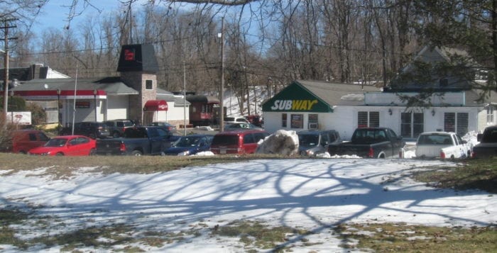
Community leaders still await land use codes for Route 25A in Setauket after a visioning report was approved by the town in 2017. File photo by Rita J. Egan

In 2016, the Route 25A Citizen Advisory Committee, consisting of community leaders and elected officials, was formed to envision a better Route 25A in the Three Village area.

At the end of 2017, the Brookhaven Town Board adopted the visioning report, resulting from those meetings. The report included recommendations to create a safer roadway with quality buildings, improve pedestrian and bicycle-friendly activities and preserve historic and natural open spaces along the corridor. The next step was for the town to begin developing land use codes based on the findings in the report. The land use planning phase would be the most significant as the new zoning codes developed would help guide the future development of businesses and affect the community for years to come.

George Hoffman, president of the Three Village Civic Association who co-chaired the advisory committee, said there have been hurdles along the way. These obstacles have included the pandemic shutdowns, members of the town Planning Board retiring and former town Councilwoman Valerie Cartright (D-Port Jefferson Station) running for and winning her bid as New York State Supreme Court justice. Cartright also had difficulties securing funds for a planning consultant to help write the codes, which would have cost $200,000, according to Hoffman, while she was in office.

Hoffman said there is new hope that the land use planning process will begin as he and Councilmember Jonathan Kornreich (D-Stony Brook) will meet with the new planning commissioner at the beginning of March.

Hoffman said the earlier community meetings included the town hiring a planning company to help organize the focus groups and to write the report that was a result of the meetings. The members discussed a variety of subjects, including whether to allow mixed-use development, which many felt wouldn’t be the right  fit for the area.

The civic president said it has been a frustrating journey, especially as a similar process has been conducted in Councilman Dan Panico’s (R-Manorville) district and has been completed.

Hoffman said community leaders and elected officials had a consensus over what was needed. 

“I don’t think it was a radical change, but there were areas we were concerned about, “ he said.

Among those areas are the southeast corner of Nicolls Road and Route 25A where buildings have different architecture and signage and the area around East Setauket Pond Park, which lies on the western side of Se-Port Delicatessen on Route 25A. Many also expressed concern regarding the former Baptist church in Stony Brook, west of Stony Brook Road.

“Right now developers are driving what the development will be on 25A and not the community and the town,” he said. “That’s why you want the land use plan.”

Kornreich said he believes there are opportunities “to add amenities that are of the quality that people would expect in a community like this.”

He added in addition to taking the recommendations made by the visioning committee and adapting to land use codes, there are other strategies, too.

He said one opportunity is talking to property owners along 25A in the Three Village area.

“I started sitting down with the property owners in that corridor to see if we can find ways to bring them together to see if we can work together, maybe by them combining their properties and looking at things in a more imaginative way,” he said, adding it may lead to more dramatic and impactful solutions.

“Part of it is just simply using the existing rules that we have now to try to encourage people to redevelop their properties,” the councilmember said.

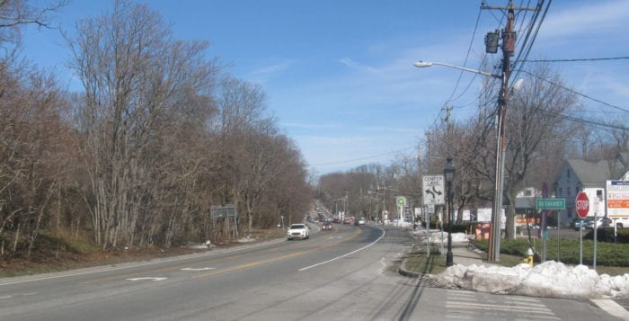
Among the suggested improvements for Route 25A is making signs more consistent, especially at Woods Corner east of Nicolls Road. File photo by Rita J. Egan

The next phase of the 25A corridor study is set to begin. Late last month, the Route 25A Citizen Advisory Committee, town officials and community leaders met to begin discussing a land use code for the corridor. This code would regulate future development and architecture styles among other things in the area.

“This is where we can take a vision and be able to actually make an impact.”

— George Hoffman

The land use phase is one of the most significant land use initiatives affecting the community in years.

George Hoffman, co-chair of the CAC, said he is excited for this next phase and to be working with this group of individuals.

“This is where we can take a vision and be able to actually make an impact,” he said.

The corridor study dates back to 2016 when the town appointed the CAC to assist them in the study and land use plan in the future development of the area. In 2017, the town came out with its Route 25A /Three Village Area Visioning Report.

The report covered the hamlets of Stony Brook, Setauket and East Setauket. Its goal was to use the report as a tool to help achieve a corridor that has a well-functioning road, quality building, site design, improved pedestrian- and bicycle-friendly facilities and preserve historic and natural open spaces.

Hoffman said 25A is an important and historical road that he believes should
be protected.

“The community has seen what has happened to Route 25 after it was turned into a highway,” he said. “They don’t want 25A to turn into Jericho Turnpike.”

Councilwoman Valerie Cartright (D-Port Jefferson Station) said the 25A corridor study is an important tool for land use planning in the community.

“We have just entered into the second phase of this project and I look forward to working with the Citizens Advisory Committee and the community toward implementation of the community vision,” she said in a statement. “I am proactively advocating for this project to proceed as quickly as the process allows, and I will continue to look for public input and participation as we move forward.”

“I am proactively advocating for this project to proceed as quickly as the process allows, and I will continue to look for public input and participation as we move forward.”

— Valerie Cartright

Hoffman said with the land use phase they can apply what they learned in the vision report and decide if there needs to be any changes in zone codes.

One option they are considering is a design manual for future development in the corridor.

“We want to slowly over time make the architecture more consistent,” Hoffman said.

He said residents have expressed they would like the historical nature of the area to be preserved and be a kind of colonial rural community.

The committee will look at all the available parcels in the corridor that could be developed to make sure they are appropriately zoned.

Hoffman also mentioned areas of opportunity the committee and others will look at. One of them is Woods Corner, which is a commercial area east of Nicolls Road. He said he has gotten a sense from the community that there could be improvements to the signage of the commercial buildings.

Another area is the East Setauket commercial corridor near Gnarled Hollow Road and East Setauket Pond Park.

“The boarded-up building on the corner has been an eyesore for quite some time,” Hoffman said. “The county is attempting to purchasing it.”

The first step is to get an appraisal on the land and then the owner of the property will be made an offer. Hoffman said the area is environmentally sensitive due to a stream flowing under the property into nearby waterways. The building’s basement was known to flood because of the running water.

“Because there are no sewers in the area there are limitations on how large a building can be,” he said.

The co-chair of the committee said they hope to take about six months on the land use plan process, and when completed, they will look to write an updated town zone code. If approved, it will be adopted by the town board.