Tags Posts tagged with "Michael Jensen"

Michael Jensen

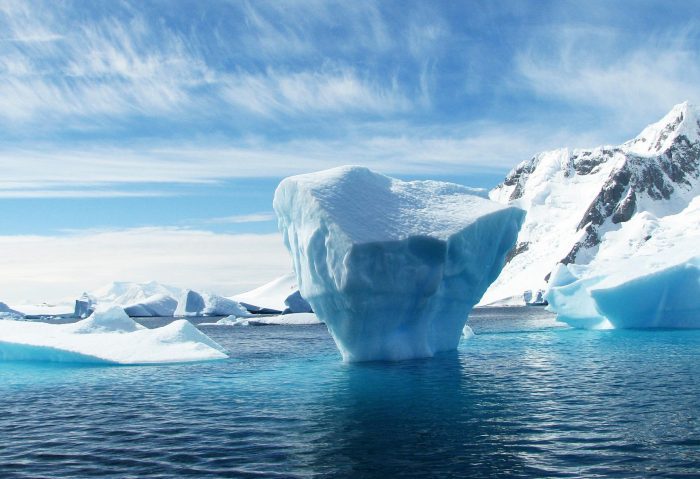
The temperatures at the poles are heating up more rapidly than those at the equator. Pixabay photo

By Daniel Dunaief

On any given day, heat waves can bring record-breaking temperatures, while winter storms can include below average cold temperatures or snow.
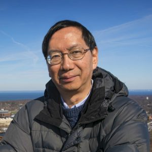
Edmund Chang. Photo from SBU

Weather and climate experts don’t generally make too much of a single day or even a few days amid an otherwise normal trend. But, then, enough of these exceptional days over the course of years can skew models of the climate, which refers to average temperature and atmospheric conditions for a region.

If the climate is steady, “we should see approximately the same number of hot and cold records being broken,” said Edmund Chang, Professor at the School of Marine and Atmospheric Sciences at Stony Brook University. “Over the past few decades, we have seen many more hot records being broken than cold records, indicating the climate is getting hotter.”

Recent heat

Indeed, just last week, before a heatwave hit the northeastern United States, the United Kingdom reported the hottest day on record, with the temperature at Heathrow Airport reaching above 104 degrees.

Erinna Bowman, who grew up in Stony Brook and has lived in London since 2009, said the temperature felt “like a desert,” with hot, dry heat radiating up in the urban setting. Most homes in London don’t have air conditioning, although public spaces like supermarkets and retail stores do.

“I’m accustomed to the summer getting quite hot, so I was able to cope,” said Bowman. Indeed, London is usually considerably cooler during the summer, with average temperatures around 73 degrees.
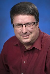
Michael Jensen. Photo from BNL

News coverage of the two extraordinarily hot days in London “was very much framed in the context of a changing climate,” Bowman said. The discussion of a hotter temperature doesn’t typically use the words “climate change,” but, instead, describes the phenomenon as “global heating.”

For climate researchers in the area, the weather this summer has also presented unusual challenges.

Brookhaven National Laboratory meteorologist Michael Jensen spent four years planning for an extensive study of convective clouds in Houston, in a study called Tracking Aerosol Convection Interactions, or Tracer.

“Our expectation is that we would be overwhelmed” with data from storms produced in the city, he said. “That’s not what we’re experiencing.”

The weather, which has been “extremely hot and extremely dry,” has been more typical of late August or early September. “This makes us wonder what August is going to look like,” he said.

Jensen, however, is optimistic that his extensive preparation and numerous pieces of equipment to gather meteorological data will enable him to collect considerable information.

Warming at the poles

Broadly speaking, heat waves have extended for longer periods of time in part because the temperatures at the poles are heating up more rapidly than those at the equator. The temperature difference between the tropics and the poles causes a background flow from west to east that pushes storms along, Chang explained.

The North Pole, however, has been warming faster than the tropics. A paper by his research group showed that the lower temperature gradient led to a weakening of the storm track.

When summer Atlantic storms pass by, they provide relief from the heat and can induce more clouds that can lead to cooler temperatures. Weakening these storms can lead to fewer clouds and less cooler air to relieve the heat, Chang added.

Rising sea levels
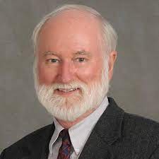
Malcolm Bowman. Photo from SBU

Malcolm Bowman, who is Erinna Bowman’s father and is Distinguished Service Professor at the School of Marine and Atmospheric Sciences at Stony Brook University, believes the recent ice melting in Greenland, which has been about 10 degrees above normal, could lead to a rise in sea levels of about one inch this summer. “It will slowly return to near normal as the fresh water melt spreads slowly over all the world’s oceans,” he added.

Bowman, who has studied sea level rises and is working on mitigation plans for the New York area in the event of a future major storm, is concerned about the rest of the hurricane season after the level of warming in the oceans this summer. 

“Those hurricanes which follow a path over the ocean, especially following the Gulf Stream, will remain strong and may gather additional strength from the heat of the underlying water,” he explained in an email.

Bowman is the principal investigator on a project titled “Long Island South Shore Sea Gates Study.”

He is studying the potential benefit of six possible sea gates that would be located across inlets along Nassau and Suffolk County. He also suggests that south shore sand dunes would need to be built up to a height of 14 feet above normal high tide.

Meanwhile, the Army Corps of Engineers has come up with a tentatively selected plan for New York Harbor that it will release some time in the fall. Bowman anticipates the study will be controversial as the struggle between green and grey infrastructure — using natural processes to manage the water as opposed to sending it somewhere else — heats up.

As for the current heat waves, Bowman believes they are a consistent and validating extension of climate change.

Model simulations

In his lab, Chang has been looking at model simulations and is trying to understand what physical processes are involved. He is comparing these simulations with observations to determine the effectiveness of these projections.

To be sure, one of the many challenges of understanding the weather and climate is that numerous factors can influence specific conditions.

“Chaos in the atmosphere could give rise to large variations in weather” and to occasional extremes, Chang said. 

Before coming to any conclusions about longer term patterns or changes in climate, Chang said he and other climate modelers examine collections of models of the atmosphere to assess how likely specific conditions may occur due to chaos even without climate change.

“We have to rule out” climate variability to understand and appreciate the mechanisms involved in any short term changes in the weather, he added.

Still, Chang said he and other researchers are certain that high levels of summer heat will be a part of future climate patterns. 

“We are confident that the increase in temperature will result in more episodes of heat waves,” he said.

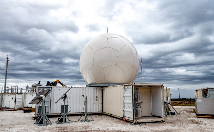
A TRACER site similar to this one in Argentina is being constructed in Pearland, Texas. Photo courtesy of ARM

By Daniel Dunaief

Before they could look to the skies to figure out how aerosols affected rainclouds and storms around Houston, they had to be sure of the safety of the environment on the ground.

Researchers from several institutions, including Brookhaven National Laboratory, originally planned to begin collecting data that could one day improve weather and even climate models on April 15th of this year.

The pandemic, however, altered that plan twice, with the new start date for the one-year, intensive cloud, study called TRACER, for Tracking Aerosol Convection Interactions, beginning on Oct. 1st.

The delay meant that the “intensive observational period was moved from summer 2021 to summer 2022,” Michael Jensen, the Principal Investigator on Tracer and a meteorologist at Brookhaven National Laboratory, explained in an email.

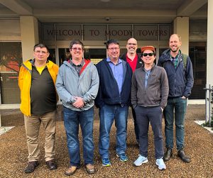
Scientists and ARM staff pose during planning for TRACER (left to right): Iosif “Andrei” Lindenmaier, ARM’s radar systems engineering lead; James Flynn, University of Houston; Michael Jensen, TRACER’s principal investigator from Brookhaven National Laboratory; Stephen Springston, ARM’s Aerosol Observing System lead mentor (formerly Brookhaven Lab, now retired); Chongai Kuang, Brookhaven Lab; and Heath Powers, site manager for the ARM Mobile Facility that will collect measurements during TRACER. (Courtesy of ARM)

At the same time, the extension enabled a broader scientific scope, adding more measurements for the description of aerosol lifecycle and aerosol regional variability. It also allowed the researchers to include air quality data, funded by the National Aeronautics and Space Administration and urban meteorology, funded by the National Science Foundation.

The primary motivation for the project is to “understand how aerosols impact storms,” Jensen explained in a presentation designed to introduce the TRACER project to the public.

Some scientists believe aerosols, which are tiny particles that can occur naturally from trees, dust and other sources or from man-made activities like the burning of fossil fuels, can make storms stronger and larger, causing more rain.

“There’s a lot of debate in the literature” about the link between aerosols and storms, Jensen said.

Indeed, there may be a “sweet spot” in which a certain number or concentration of aerosols causes an invigoration of rainstorms, while a super abundance beyond that number reverses the trend, Jensen added.

“We don’t know the answers to those questions,” the BNL scientist said. “That’s why we need to go out there and take detailed measurements of what’s going on inside clouds, how precipitation particles are freezing or melting.”

Even though aerosols are invisible to the naked eye, they could have significant impacts on how mass and energy are distributed in clouds, as well as on broader atmospheric processes that affect weather patterns.

The TRACER study, which is a part of the Department of Energy’s Atmospheric Radiation Measurement, or ARM, user facility, could “help forecast heavy rains that can cause flash flooding,’ said Chongai Kuang, atmospheric scientist and TRACER co-investigator at BNL.

The TRACER study will explore the way sea and bay breeze circulations affect the evolution of deep convective storms as well as examining the influence of urban environments on clouds and precipitation.

Several additional funding agencies have stepped in to address basic scientific questions, including the National Aeronautics and Space Administration’s efforts to address air quality issues in Houston and the Texas Commission on Environmental Quality, which funded a study on ozone and low-level atmospheric mixing.

“Our original TRACER field campaign provided a seed for what is now a major, multi-agency field campaign with a significantly expanded scientific scope,” Jensen explained in an email.

A joint team from BNL and Stony Brook University is developing new software to scan the precipitation radar system to select and track storm clouds to observe the rapid development of these storms. Additionally, aerosol instrumentation will help provide updated information on the precursor gases and the smallest aerosol particles at the earliest stages of the aerosol cycle, Jensen explained.

Ultimately, the data that these scientists gather could improve the ability to forecast storms in a range of areas, including on Long Island.

“Understanding sea breezes and the coastal environment is a very important aspect of TRACER,” Jensen said. “Even though it’s not the preliminary focus, there’s an opportunity to learn new science, to improve weather forecasting and storm forecasting for those coastal environments.”

Researchers chose Houston because of their desire to study a more densely populated urban area and to understand the way numerous factors influence developing clouds, weather patterns and, ultimately, the climate.

“We know the urban environment is where most people live,” Jensen said. “This is taking us in new directions, with new opportunities to influence the science” in these cities.

Researchers plan to collect information about clouds, aerosols and storms everywhere from ground-based instruments stationed at four fixed sites, as well as through mobile facilities, to satellite images.

The program operates a tethered balloon which is “like a big blimp that goes up half a mile into the atmosphere,” said Heath Powers, the Atmospheric Radiation Measurement facility site manager for Tracer from Los Alamos National Laboratory.

The tethered balloon is located at Smith Point, Texas, on the eastern shore of Galveston Bay and will do low-level profiling of aerosols, winds, thermodynamics and ozone as it is influenced by bay breeze circulation, Jensen explained.

The National Science Foundation is planning to bring a C-130 plane to conduct overflights, while the group will also likely use drones, Powers added.

The TRACER study will launch around 1,500 weather balloons to gather information at different altitudes. The research will use over four dozen instruments to analyze meteorology, the amount of energy in the atmosphere and the air chemistry.

“Clouds are the big question,” Powers said. “Where they form, why they form … do they rain or not rain. We are well-positioned to get at the core of a lot of this” through the information these scientists gather.

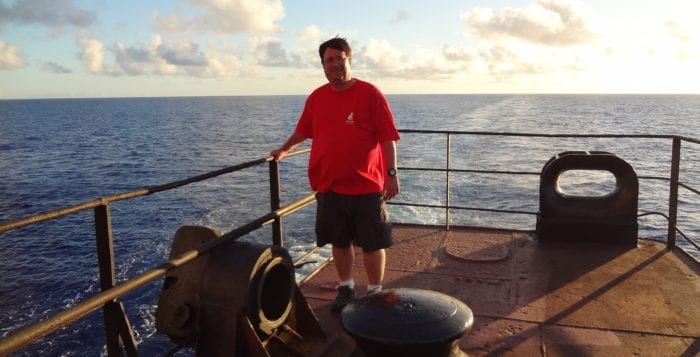
Michael Jensen on a container ship in the Pacific Ocean, where he was measuring marine clouds. Photo from M. Jensen

By Daniel Dunaief

They often seem to arrive at the worst possible time, when someone has planned a picnic, a wedding or an important baseball game. In addition to turning the sky darker, convective clouds can bring heavy rains and lightning.

For scientists like Michael Jensen, a meteorologist at Brookhaven National Laboratory, these convective clouds present numerous mysteries, including one he hopes to help solve.

Aerosols, which come from natural sources like trees or from man-made contributors, like cars or energy plants, play an important role in cloud formation. The feedbacks that occur in a cloud system make it difficult to understand how changes in aerosol concentrations, sizes or composition impact the properties of the cloud.

“One of the big controversies in our field is how aerosols impact convection,” Jensen explained in an email. “A lot of people believe that when a storm ingests aerosols, it makes it stronger, because there are changes to precipitation and particles in the clouds.”

This process is called convective invigoration, which could make it rain more.

Another group of scientists, however, believes that the aerosols have a relatively small effect that is masked by other storm processes, such as vertical winds. 

Strong vertical motions that carry air, water and heat through the atmosphere are a signature of convective storms.

Jensen will lead an effort called Tracking Aerosol Convection Interactions Experiment, or TRACER, starting in April of 2021 in Houston that will measure the effect of these aerosols through a region where he expects to see hundreds of convective storm clouds in a year. 

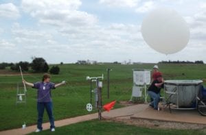
From left, Donna Holdridge, from Argonne National Laboratory; Michael Jensen, kneeling; and Petteri Survo, from Vaisal Oyj in Helsinki, Finland during a campaign in Oklahoma to study convective storms. The team is testing new radiosondes, which are instruments sent on weather balloons. Photo from M. Jensen

The TRACER team, which includes domestic and international collaborators, will measure the clouds, precipitation, aerosol, lighting and atmospheric thermodynamics in considerable detail. The goal of the campaign is to develop a better understanding of the processes that drive convective cloud life cycle and convective-aerosol interactions.

Andrew Vogelmann, a technical co-manager of the Cloud Properties and Processes Group at BNL with Jensen, indicated in an email that the TRACER experiment is “generating a buzz within the community.” 

While other studies have looked at the impact of cities and other aerosol sources on rainfall, the TRACER experiment is different in the details it collects. In addition to collecting data on the total rainfall, researchers will track the storms in real time and will focus on strong updrafts in convection, which should provide specific information about the physics.

Jensen is exploring potential sites to collect data on the amount of water in a cloud, the size of the drops, the phase of the water and the shapes of the particles. He will use radar to provide information on the air velocities within the storm.

He hopes to monitor the differences in cloud characteristics under a variety of aerosol conditions, including those created by industrial, manufacturing and transportation activities.

Even a perfect storm, which starts in an area with few aerosols and travels directly through a region with many, couldn’t and wouldn’t create perfect data.

“In the real atmosphere, there are always complicating factors that make it difficult to isolate specific processes,” Jensen said. To determine the effect of aerosols, he is combining the observations with modeling studies.

Existing models struggle with the timing and strength of convective clouds.

Jensen performed a study in 2011 in Oklahoma that was focused on understanding convective processes, but that didn’t hone in on the aerosol-cloud interactions.

Vogelmann explained that Jensen is “well-respected within the community and is best known for his leadership” of this project, which was a “tremendous success.”

Since that study, measurement capabilities have improved, as has modeling, due to enhanced computing power. During the summer, Long Island has convective clouds that are similar to those Jensen expects to observe in Houston. Weather patterns from the Atlantic Ocean for Long Island and from the Gulf of Mexico for Houston enhance convective development.

“We experience sea breeze circulation,” Jensen said. Aerosols are also coming in from New York City, so many of the same physical processes in Houston occur on Long Island and in the New York area.

As the principal investigator, Jensen will travel to Houston for site selection. The instruments will collect data every day. During the summer, they will have an intensive operational period, where Jensen and other members of the TRACER team will forecast the convective conditions and choose the best days to add cloud tracking and extra observations.

Jensen expects the aerosol impact to be the greatest during the intermediate strength storms. 

The BNL meteorologist described his career as jumping back and forth between deep convective clouds and marine boundary layer clouds.

Jensen is a resident of Centerport and lives with his wife Jacqui a few blocks from where he grew up. Jacqui is a banker for American Community Bank in Commack. The couple has a 22-year-old son Mack, who is a substitute teacher at the Harborfields school district.

Jensen describes his family as “big music people,” adding that he plays euphonium in a few community band groups, including the North Shore Community Band of Longwood and the Riverhead Community Band.

As an undergraduate at SUNY Stony Brook, Jensen was broadly interested in science, including engineering. In flipping through a course catalog, he found a class on atmospheric science and thought he’d try it.

Taught by Robert Cess, who is now a professor emeritus at SBU, the class “hooked” him.

Jensen has been at BNL for almost 15 years. Over that time, he said the team has “more influence in the field,” as the cloud processing group has gone from six to 18 members. The researchers have “expanded our impact in the study of different cloud regimes and developed a wide network of collaborations and connections throughout the globe.”

As for his work in the TRACER study, Jensen hopes to “solve this ongoing debate, or at least provide new insights into the relative role of aerosols and dynamics.”